- Home
- :
- All Communities
- :
- Products
- :
- ArcGIS Spatial Analyst
- :
- ArcGIS Spatial Analyst Questions
- :
- Why do I lose the display of "Not Visible" cells w...
- Subscribe to RSS Feed
- Mark Topic as New
- Mark Topic as Read
- Float this Topic for Current User
- Bookmark
- Subscribe
- Mute
- Printer Friendly Page
Why do I lose the display of "Not Visible" cells when clipping a Viewshed raster?
- Mark as New
- Bookmark
- Subscribe
- Mute
- Subscribe to RSS Feed
- Permalink
I ran a viewshed analysis of visibility from a road. I clipped that analysis to the polygon of the 2.5 mi buffer around the road. It has clipped to the right shape, but won't display the "Not Visible" data. The attribute table contains zeros (not visible).
I checked the "Use Input Features for Clipping Geometry" box and set the NoData Value to 0. I also imported the original, correctly displaying symbology into my new clipped layer.
- Mark as New
- Bookmark
- Subscribe
- Mute
- Subscribe to RSS Feed
- Permalink
because visible is classed as 1 and not visible is classed as 0 and you made the not visible, nodata
- Mark as New
- Bookmark
- Subscribe
- Mute
- Subscribe to RSS Feed
- Permalink
So I changed the NoData Value to 0 to fix the fact that when I clipped the data, all cells outside the clipped extent were displayed in the new layer as Not Visible. When I zoom in, the display of outlying data disappears, but reappears when I zoom out to view the full extent.
Any ideas of how I can address both problems, and be left with a raster showing visible and not visible only within the desired boundary?
- Mark as New
- Bookmark
- Subscribe
- Mute
- Subscribe to RSS Feed
- Permalink
When you clip, you need to set the raster extent to the smallest extent you want to view. If you have a clipping polygon, then use that polygon as the extent of processing, but use the cell size of the raster you are clipping and use the raster you are clipping as the snap raster.
If you have a screen grab of the dataframe it would help
- Mark as New
- Bookmark
- Subscribe
- Mute
- Subscribe to RSS Feed
- Permalink
Dan,
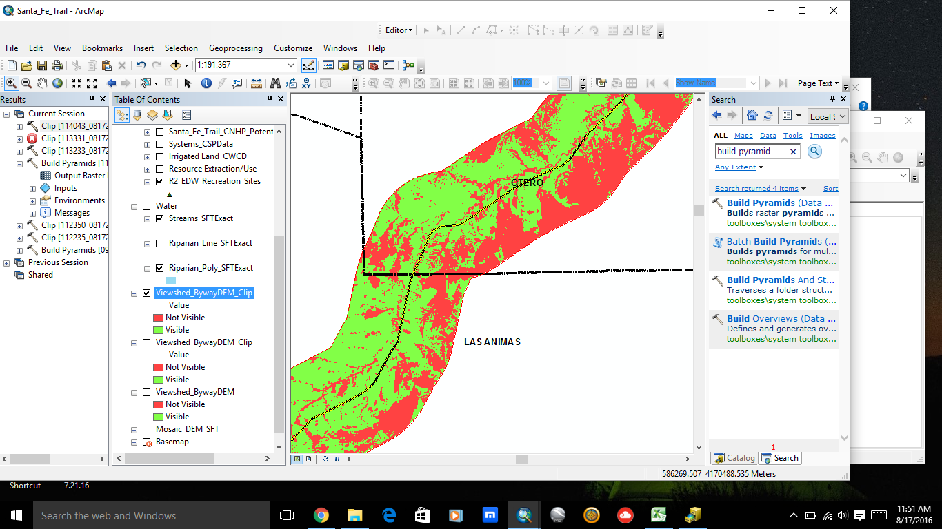
I changed the snap raster and cell size to match the original raster, and left the NoData Value blank. I've tried it with clicking "Maintain Clipping Extent" and without. The display behind the clip tool screen shows my issue remains. Is there a simple display feature I need to change to get the red rectangle to disappear at wider views? When zoomed in, everything looks great (see second screenshot). Thanks again and sorry for the previous duplicate message. 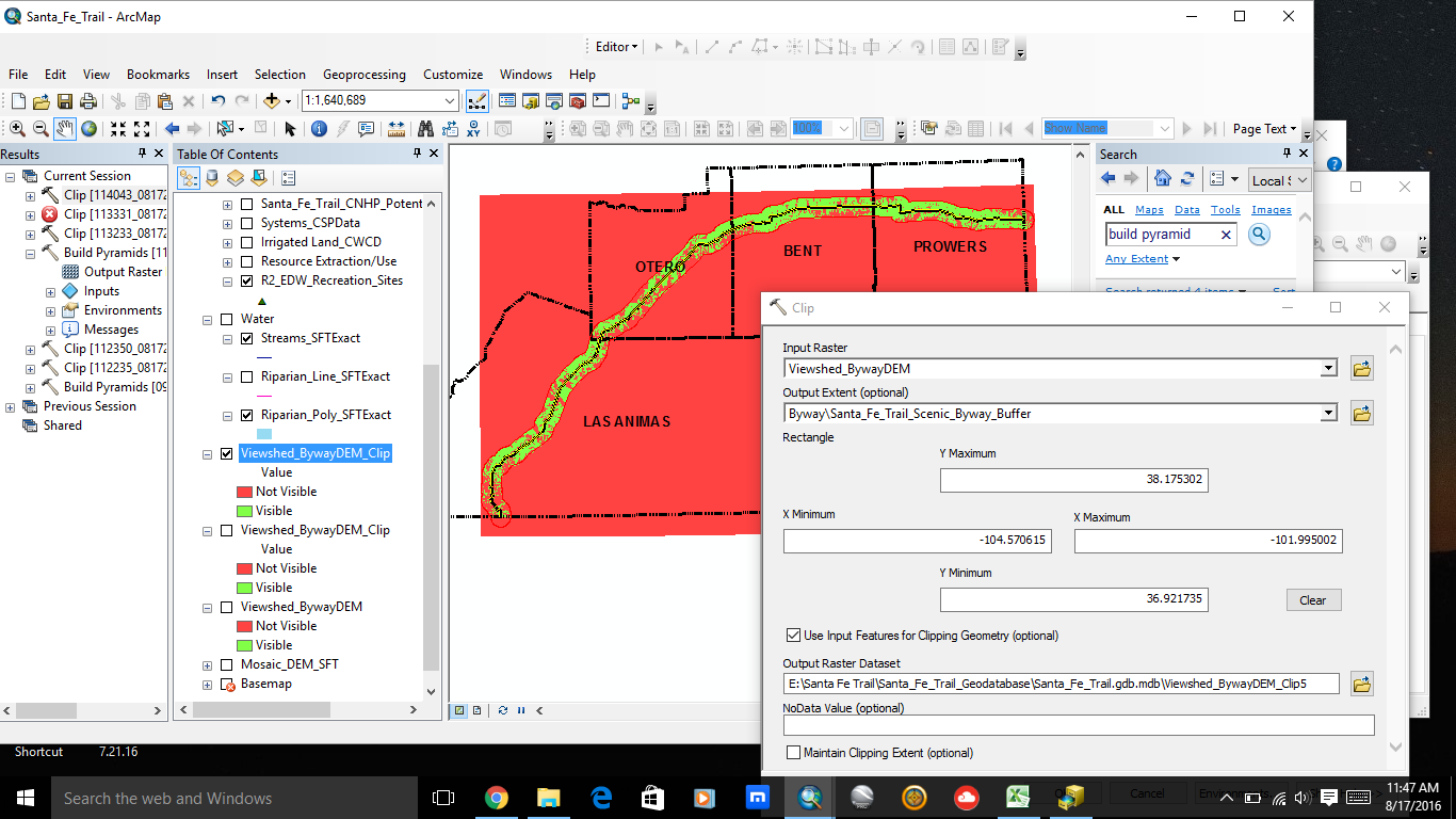
- Mark as New
- Bookmark
- Subscribe
- Mute
- Subscribe to RSS Feed
- Permalink
So I changed the NoData Value to 0 to fix the fact that when I clipped the data, all cells outside the clipped extent were displayed in the new layer as Not Visible. When I zoom in, the display of outlying data disappears, but reappears when I zoom out to view the full extent.
Any ideas of how I can address both problems, and be left with a raster showing visible and not visible only within the desired boundary?
- Mark as New
- Bookmark
- Subscribe
- Mute
- Subscribe to RSS Feed
- Permalink
as per my comment... this response seems to be a duplicate