- Home
- :
- All Communities
- :
- Products
- :
- ArcGIS Spatial Analyst
- :
- ArcGIS Spatial Analyst Questions
- :
- Reclassify a raster error
- Subscribe to RSS Feed
- Mark Topic as New
- Mark Topic as Read
- Float this Topic for Current User
- Bookmark
- Subscribe
- Mute
- Printer Friendly Page
- Mark as New
- Bookmark
- Subscribe
- Mute
- Subscribe to RSS Feed
- Permalink
I have a DEM that won’t reclassify correctly. When I run the reclassify tool, only a fraction of the image displays like it should when a reclass operation is performed, (the rest of the image maintains its DEM imagery without the reclass). I have ran statistics on this DEM and cannot figure out what the problem is, any help would be greatly appreciated.
Solved! Go to Solution.
Accepted Solutions
- Mark as New
- Bookmark
- Subscribe
- Mute
- Subscribe to RSS Feed
- Permalink
Reclassifying continuous rasters is problematic as there is no raster table to operate on. For best results, I suggest converting the DEM to integer first - or try Slice or Rescale By Function tools instead.
- Mark as New
- Bookmark
- Subscribe
- Mute
- Subscribe to RSS Feed
- Permalink
Is there any chance that the DEM has not been merged together but consists of two adjacent tiles? or is the lack of reclassification random through out the area (a picture would help). See this link also
- Mark as New
- Bookmark
- Subscribe
- Mute
- Subscribe to RSS Feed
- Permalink
Reclassifying continuous rasters is problematic as there is no raster table to operate on. For best results, I suggest converting the DEM to integer first - or try Slice or Rescale By Function tools instead.
- Mark as New
- Bookmark
- Subscribe
- Mute
- Subscribe to RSS Feed
- Permalink
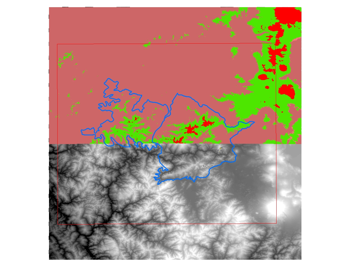
Thank you for your replies, actually I have ran statistics, I have converted to integer, and I put the 4 raster together using the mosaic function, (image above). When I did this, only the top half of the combined raster reclassed properly. When this did not work properly, I converted to interger, running stats, etc, for each separate raster. Then I tried to reclassify the original rasters separately, and the top 2 rasters reclassed correctly and the bottom 2 rasters did not.
- Mark as New
- Bookmark
- Subscribe
- Mute
- Subscribe to RSS Feed
- Permalink
Make sure the geoprocessing extents include your whole project area. It seems the software will reset them to a wrong limit w/o me knowing about it and then I get confusing results. You can reset them under Geoprocessing>Environments. I use the DEM limits when I reset them.
It could also be a projection issue with your data so make sure the projections are all the same.
Last idea is that the process bombs for some reason and only processes part of the data. You'd think you would get an error message if this happened. A guess would be that the raster has some "null" value and the tool can't handle. In that case you could use the CON() function to make sure that there are not grids in the DEM that are null. This is a wild guess.
Please post the solution if you find one!
- Mark as New
- Bookmark
- Subscribe
- Mute
- Subscribe to RSS Feed
- Permalink
Many thanks to all of the help! I used the Rescale By Function tool and it worked! I will be using this tool in the future to build my habitat suitability models. Have a great day!