- Home
- :
- All Communities
- :
- Products
- :
- ArcGIS Spatial Analyst
- :
- ArcGIS Spatial Analyst Questions
- :
- Raster to Polygon fails with empty input
- Subscribe to RSS Feed
- Mark Topic as New
- Mark Topic as Read
- Float this Topic for Current User
- Bookmark
- Subscribe
- Mute
- Printer Friendly Page
Raster to Polygon fails with empty input
- Mark as New
- Bookmark
- Subscribe
- Mute
- Subscribe to RSS Feed
- Permalink
ERROR 010067: Error in executing grid expression.
Failed to execute (RasterToPolygon).
This is an issue because I'm trying to batch process a large number of watershed rasters (some of which are empty) using a Python script (832 tiles), and the script is interrupted when it encounters the first empty raster. Is there any known workaround for this issue? Alternately, is there any way to programmatically check for these invalid inputs?
- Mark as New
- Bookmark
- Subscribe
- Mute
- Subscribe to RSS Feed
- Permalink
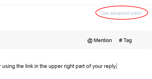
When you reply to this thread you can use the advanced editor using the link in the upper right part of your reply:
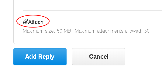
In the advanced editor you will find in the lower left corner a link that enables you to attach your data (if it is smaller than 50MB):
It would be best to use the format you are using, since converting to another format might have a different result when we run the code on it.
- Mark as New
- Bookmark
- Subscribe
- Mute
- Subscribe to RSS Feed
- Permalink
Hi again,
I contacted the ESRI support.
Meanwhile, how can I share the tif file with you?
I share some screenshots and echo lines:
PRIOR TO EXTRACT BY MASK (SOURCE RASTER)
Get raster properties shows:
MINIMUM: -107dem_EU8.tifMAXIMUM: 5112dem_EU8.tifMEAN: 701.50966808932dem_EU8.tifSTD: 613.36991449625dem_EU8.tifALLNODATA: 1dem_EU8.tifANYNODATA: 0dem_EU8.tifUNIQUEVALUECOUNT: 5209dem_EU8.tif
AFTER PROCESSING, EXAMINING WITH GET RASTER PROPERTIES:
MINIMUM: 0slope_cr.tifMAXIMUM: 81.714889526367slope_cr.tifMEAN: 7.7882586697231slope_cr.tifSTD: 7.6317294646923slope_cr.tifALLNODATA: 1slope_cr.tifANYNODATA: 0slope_cr.tifUNIQUEVALUECOUNT: ERROR 000864: Property type: The input is not within the defined domain.
MINIMUM: 0slope_fr.tifMAXIMUM: 87.347358703613slope_fr.tifMEAN: 6.697570111711slope_fr.tifSTD: 8.029112308876slope_fr.tifALLNODATA: 1slope_fr.tifANYNODATA: 0slope_fr.tifUNIQUEVALUECOUNT: ERROR 000864: Property type: The input is not within the defined domain.
MINIMUM: 0slope_gr.tifMAXIMUM: 86.183372497559slope_gr.tifMEAN: 13.185961209459slope_gr.tifSTD: 10.142107658809slope_gr.tifALLNODATA: 1slope_gr.tifANYNODATA: 0slope_gr.tifUNIQUEVALUECOUNT: ERROR 000864: Property type: The input is not within the defined domain.
MINIMUM: 0slope_it.tifMAXIMUM: 88.314254760742slope_it.tifMEAN: 12.155243931512slope_it.tifSTD: 11.308642649386slope_it.tifALLNODATA: 1slope_it.tifANYNODATA: 0slope_it.tifUNIQUEVALUECOUNT: ERROR 000864: Property type: The input is not within the defined domain.
MINIMUM: 0slope_pt.tifMAXIMUM: 86.680160522461slope_pt.tifMEAN: 7.9297302374002slope_pt.tifSTD: 6.9735340036504slope_pt.tifALLNODATA: 1slope_pt.tifANYNODATA: 0slope_pt.tifUNIQUEVALUECOUNT: ERROR 000864: Property type: The input is not within the defined domain.ERROR 000800: The value is not a member of MAXIMUM | MINIMUM | MEAN | STD | TOP | LEFT | RIGHT | BOTTOM | CELLSIZEX | CELLSIZEY | VALUETYPE | COLUMNCOUNT | ROWCOUNT | BANDCOUNT | ALLNODATA | ANYNODATA | SENSORNAME | PRODUCTNAME | ACQUISITIONDATE | SOURCETYPE | CLOUDCOVER | SUNAZIMUTH | SUNELEVATION | SENSORAZIMUTH | SENSORELEVATION | OFFNADIR | WAVELENGTH.slope_pt.tif baaadMINIMUM: 0slope_sl.tifMAXIMUM: 83.555519104004slope_sl.tifMEAN: 13.833553877048slope_sl.tifSTD: 10.842502128808slope_sl.tifALLNODATA: 0slope_sl.tifANYNODATA: 1slope_sl.tifUNIQUEVALUECOUNT: ERROR 000864: Property type: The input is not within the defined domain.
Any insight?
Thank you
Eva
Enviado desde Yahoo Mail con Android
El jue., jul. 26, 2018 a 22:00, Xander Bakker<[email protected]> escribió:
|
GeoNet |
|
Re: Raster to Polygon fails with empty input
reply from Xander Bakker in Spatial Analyst - View the full discussion
When you reply to this thread you can use the advanced editor using the link in the upper right part of your reply:
https://community.esri.com/servlet/JiveServlet/downloadImage/2-787828-415222/300-156/pastedImage_1.png
In the advanced editor you will find in the lower left corner a link that enables you to attach your data (if it is smaller than 50MB):
https://community.esri.com/servlet/JiveServlet/downloadImage/2-787828-415259/360-154/pastedImage_1.png
It would be best to use the format you are using, since converting to another format might have a different result when we run the code on it.
Reply to this message by replying to this email, or go to the message on GeoNet |
Start a new discussion in Spatial Analyst by email or at GeoNet |
Following Re: Raster to Polygon fails with empty input in these streams: Inbox |
This email was sent by GeoNet because you are a registered user.
You may unsubscribe instantly from GeoNet, or adjust email frequency in your email preferences
- Mark as New
- Bookmark
- Subscribe
- Mute
- Subscribe to RSS Feed
- Permalink
Hi Eva Sevillano ,
From the screenshot I notice that you have a Digital Elevation Model in TIF format which uncompressed is over 28GB. That might be a "little" big to attach to the thread, since 50MB is the limit. Due to the size there might be problems with the statistics not being calculated correctly. You could try and force calculating the statistics using Calculate Statistics—Help | ArcGIS Desktop and see if the results change. As an alternative you could extract a window of your data and send that instead of the entire raster (possibly after extracting due to the reduced size the problem may not occur).
- Mark as New
- Bookmark
- Subscribe
- Mute
- Subscribe to RSS Feed
- Permalink
Hi again,
I subset the raster into a 17Mb one.
Running the tool with this one it is ok:
MINIMUM: 0 MAXIMUM: 65.707992553711MEAN: 9.1686641569023STD: 6.9617968344174ALLNODATA: 0ANYNODATA: 1
In the big one(s), calculating statistics throws the same results: same statistics as the getrasterproperties.
So it's only the allnodata = 1 that wonders me.
Is there anything I can change in the big(s) ones before running other processes like spatial join or merge that throw empty feature error because I don't know exactly why (but was the reason of my checking on the allnodata property)?
Thanks a lot for your suggestions and support (waiting for the ESRI support feedback).
Keep on trying to figure out and processing!
Eva
Eva Sevillano Marco
C/Castillo sn 42108 Dévanos (Soria) Spain
Posdoutorado Engenharia Florestal FURBIFFSC Inventário Florístico Florestal de Santa CatarinaMonitoramento com Sensoriamento Remoto
Campus 2. Fundação Universidade Regional de BlumenauRua São Paulo, 3250 Itoupava Seca 89030-000 Blumenau SC Brasil
34 666 02 87 6755 47 9741 5794 https://es.linkedin.com/in/eva-sevillano-marco-0813872b
En viernes, 27 de julio de 2018 14:31:45 CEST, Xander Bakker <[email protected]> escribió:
#yiv8715547539 * #yiv8715547539 a #yiv8715547539 body {font-family:Helvetica, Arial, sans-serif;}#yiv8715547539 #yiv8715547539 h1, #yiv8715547539 h2, #yiv8715547539 h3, #yiv8715547539 h4, #yiv8715547539 h5, #yiv8715547539 h6, #yiv8715547539 p, #yiv8715547539 hr {}#yiv8715547539 .yiv8715547539button td {}
|
GeoNet |
|
Re: Raster to Polygon fails with empty input
reply from Xander Bakker in Spatial Analyst - View the full discussion
Hi Eva Sevillano ,
From the screenshot I notice that you have a Digital Elevation Model in TIF format which uncompressed is over 28GB. That might be a "little" big to attach to the thread, since 50MB is the limit. Due to the size there might be problems with the statistics not being calculated correctly. You could try and force calculating the statistics using Calculate Statistics—Help | ArcGIS Desktop and see if the results change. As an alternative you could extract a window of your data and send that instead of the entire raster (possibly after extracting due to the reduced size the problem may not occur).
Reply to this message by replying to this email, or go to the message on GeoNet |
Start a new discussion in Spatial Analyst by email or at GeoNet |
Following Re: Raster to Polygon fails with empty input in these streams: Inbox |
This email was sent by GeoNet because you are a registered user.
You may unsubscribe instantly from GeoNet, or adjust email frequency in your email preferences
- Mark as New
- Bookmark
- Subscribe
- Mute
- Subscribe to RSS Feed
- Permalink
From what you describe it looks like something is not being processed correctly and the resulting ALLNODATA value is incorrect. There are different alternatives you could follow:
- Doing something similar to what Neil suggested earlier (using the IsNull operator)
- You could also create an integer and use a cursor (using the old cursor which supports the RAT and nor the da cursor) and check how many rows there are (0 means that the raster had all NoData)
- Or continue the process and use the try except to catch any error
- Mark as New
- Bookmark
- Subscribe
- Mute
- Subscribe to RSS Feed
- Permalink
The ESRI support confirmed it is an already reported bug of the Get Raster Properties tool that happens with large rasters. Feedback welcome for debuging
I'm checking nodata values with the IsNull tool and continue processing and see if any other error appears (in split rasters)
So thanks to everyone. Really useful tips.
Eva
Eva Sevillano Marco
C/Castillo sn 42108 Dévanos (Soria) Spain
Posdoutorado Engenharia Florestal FURBIFFSC Inventário Florístico Florestal de Santa CatarinaMonitoramento com Sensoriamento Remoto
Campus 2. Fundação Universidade Regional de BlumenauRua São Paulo, 3250 Itoupava Seca 89030-000 Blumenau SC Brasil
34 666 02 87 6755 47 9741 5794 https://es.linkedin.com/in/eva-sevillano-marco-0813872b
En lunes, 30 de julio de 2018 15:56:11 CEST, Xander Bakker <[email protected]> escribió:
#yiv2374495829 * #yiv2374495829 a #yiv2374495829 body {font-family:Helvetica, Arial, sans-serif;}#yiv2374495829 #yiv2374495829 h1, #yiv2374495829 h2, #yiv2374495829 h3, #yiv2374495829 h4, #yiv2374495829 h5, #yiv2374495829 h6, #yiv2374495829 p, #yiv2374495829 hr {}#yiv2374495829 .yiv2374495829button td {}
|
GeoNet |
|
Re: Raster to Polygon fails with empty input
reply from Xander Bakker in Spatial Analyst - View the full discussion
From what you describe it looks like something is not being processed correctly and the resulting ALLNODATA value is incorrect. There are different alternatives you could follow:
- Doing something similar to what Neil suggested earlier (using the IsNull operator)
- You could also create an integer and use a cursor (using the old cursor which supports the RAT and nor the da cursor) and check how many rows there are (0 means that the raster had all NoData)
- Or continue the process and use the try except to catch any error
Reply to this message by replying to this email, or go to the message on GeoNet |
Start a new discussion in Spatial Analyst by email or at GeoNet |
Following Re: Raster to Polygon fails with empty input in these streams: Inbox |
This email was sent by GeoNet because you are a registered user.
You may unsubscribe instantly from GeoNet, or adjust email frequency in your email preferences
- « Previous
-
- 1
- 2
- Next »
- « Previous
-
- 1
- 2
- Next »