- Home
- :
- All Communities
- :
- Products
- :
- ArcGIS Spatial Analyst
- :
- ArcGIS Spatial Analyst Questions
- :
- Re: Point density - Errors
- Subscribe to RSS Feed
- Mark Topic as New
- Mark Topic as Read
- Float this Topic for Current User
- Bookmark
- Subscribe
- Mute
- Printer Friendly Page
Point density - Errors
- Mark as New
- Bookmark
- Subscribe
- Mute
- Subscribe to RSS Feed
- Permalink
Hello Esri Community,
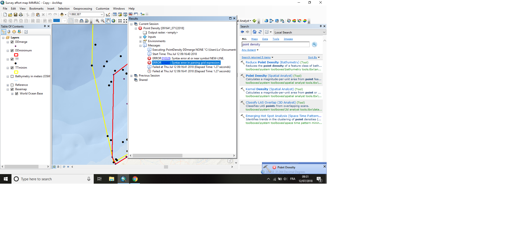
I would like to do a Density population map for my thesis but I had 2 errors when I tried :
1. ERROR 01038 Syntax error at or near symbol NEW-LINE
I precised that DDminimum does come from a polygone but convex hull (Minimum geometry boundary tool).
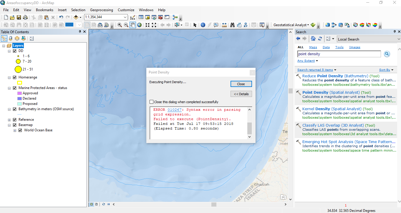
2. ERROR 010267 Syntax error in parsing grid expression
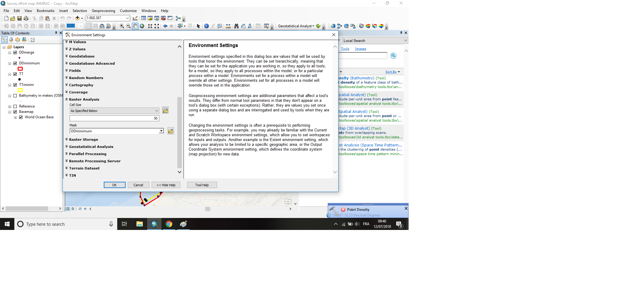
I did the Environment setting (attached). Environments > Raster analysis
Looking forward to hearing your feedbacks !
Thank you,
Loren
- Mark as New
- Bookmark
- Subscribe
- Mute
- Subscribe to RSS Feed
- Permalink
Is anybody could help please ? 
- Mark as New
- Bookmark
- Subscribe
- Mute
- Subscribe to RSS Feed
- Permalink
The tool inputs would be more useful.
It looks like you may have a file path that has a space, international characters, or punctuation or the filename itself.
- Mark as New
- Bookmark
- Subscribe
- Mute
- Subscribe to RSS Feed
- Permalink
Dear Dan,
Thanks for replying. I started to desperate!
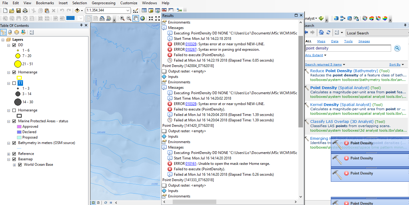
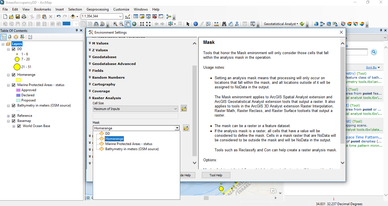
I removed the space from output raster destination, but another error appeared : "unable to open the mask raster ".
"Home range" (previsously called DDminimum) is a file from Minimum geometry boundary tool.
Do you have an idea ?
- Mark as New
- Bookmark
- Subscribe
- Mute
- Subscribe to RSS Feed
- Permalink
c:\Users\Lo'\Documents\MSc WCM\Msc….
punctuation after Lo and space after MSc can't see the rest.
Try moving everything out of the Users folder... maybe C:\GIS
- Mark as New
- Bookmark
- Subscribe
- Mute
- Subscribe to RSS Feed
- Permalink
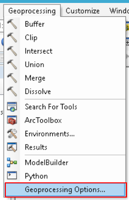
It also seems that you have background processing switched on. If the process still does not work with the suggestions provided by Dan, you should try and switch off the background processing:
and
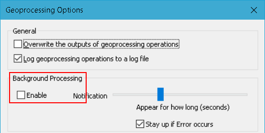
- Mark as New
- Bookmark
- Subscribe
- Mute
- Subscribe to RSS Feed
- Permalink
Thank you Dan and Xander for answering !
I changed my folder emplacement and switch off the tick in Background processing 
However the error "parsing grid expression" appeared ?
We will success soon I am sure !
- Mark as New
- Bookmark
- Subscribe
- Mute
- Subscribe to RSS Feed
- Permalink
Can you show the actual tool dialog input Loren, not where you searched for Point Density.
Point Density—Help | ArcGIS Desktop
ie. the input file, the population field and any other optional parameters.
You do have the Spatial Analyst extension enabled as well?
- Mark as New
- Bookmark
- Subscribe
- Mute
- Subscribe to RSS Feed
- Permalink
I have the Spatial analyst extension.
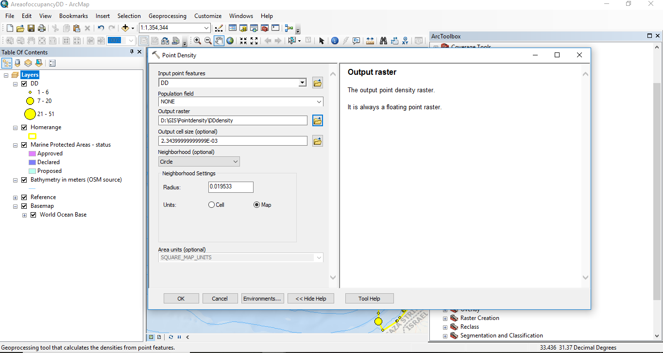
From Point density toolbox :
- Mark as New
- Bookmark
- Subscribe
- Mute
- Subscribe to RSS Feed
- Permalink
You aren't working with projected data.
The cell size and circle radius units suggest this.
I would use projected data for the inputs.
As for the mask, for now, drop the mask to see if it works without the mask.
Simply use Select by Attributes to select the points that fall within the convex hull and save those as a new (projected) point file.
As for the output... make it a *.tif file avoid an esri grid... simply add tif to the end of the file name once you have chosen your saving location.
I think it is a combination of not using projected data for the inputs and perhaps the mask