- Home
- :
- All Communities
- :
- Products
- :
- ArcGIS Spatial Analyst
- :
- ArcGIS Spatial Analyst Questions
- :
- Mosaic Raster Calculator data to base map incomple...
- Subscribe to RSS Feed
- Mark Topic as New
- Mark Topic as Read
- Float this Topic for Current User
- Bookmark
- Subscribe
- Mute
- Printer Friendly Page
Mosaic Raster Calculator data to base map incomplete
- Mark as New
- Bookmark
- Subscribe
- Mute
- Subscribe to RSS Feed
- Permalink
Hi everyone
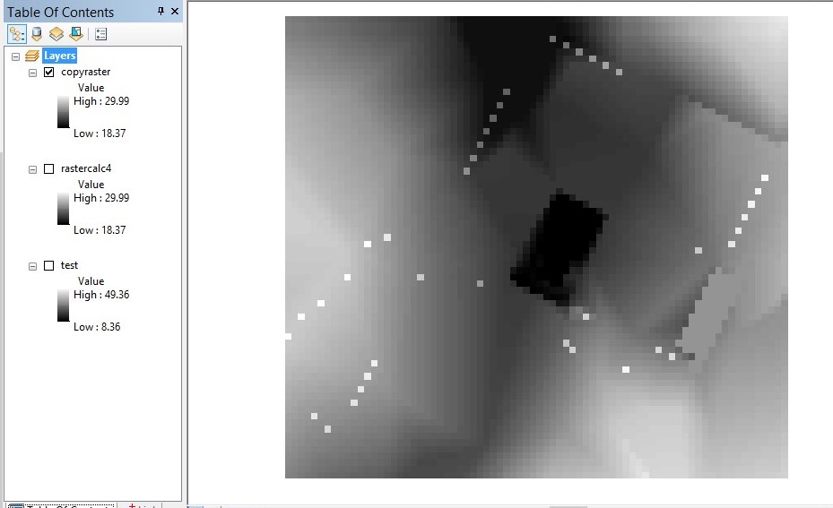
What I want to achieve is adding features of different sizes to a base map. The base map I have is cell size 5 so the problem I have is that feature that are thinner than 5metres come up patchy. I managed to get this far and completed a raster calculation to add height data to the existing base map with the desired effect (see 'minimum test'). I would like to add this to my base map but once added using the Mosaic tool, all my data returns to the original cell size which is 5 (see 'overallresult'). Has anyone had experience with this? I may be resigned to the fact that the cell size of my base map will act as default otherwise, but it is not ideal especially for viewshed analysis purposes. Any information or ideas would be much appreciated.
Many thanks
Lizzie
- Mark as New
- Bookmark
- Subscribe
- Mute
- Subscribe to RSS Feed
- Permalink
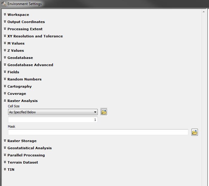
You can specify the output Cell Size in the Geoprocessing Tools. The Copy Raster has a default of 'Maximum of Inputs' which in turn will convert back to cell size 5, in your case. Just change the drop down and specify your desired cell size.
Hopefully that helps.