Turn on suggestions
Auto-suggest helps you quickly narrow down your search results by suggesting possible matches as you type.
Cancel
- Home
- :
- All Communities
- :
- Products
- :
- ArcGIS Spatial Analyst
- :
- ArcGIS Spatial Analyst Questions
- :
- Majority function raster simplification
Options
- Subscribe to RSS Feed
- Mark Topic as New
- Mark Topic as Read
- Float this Topic for Current User
- Bookmark
- Subscribe
- Mute
- Printer Friendly Page
Majority function raster simplification
Subscribe
3031
1
10-20-2014 09:14 PM
10-20-2014
09:14 PM
- Mark as New
- Bookmark
- Subscribe
- Mute
- Subscribe to RSS Feed
- Permalink
When running the majority function on a raster image to simplify and clean up the file, the resulting raster is ending up distorted. What were straight roads or other boundaries are now at somewhat of an angle. Is this normal for the majority function, and if it is, is there another raster simplification tool that can be used that won't do that?
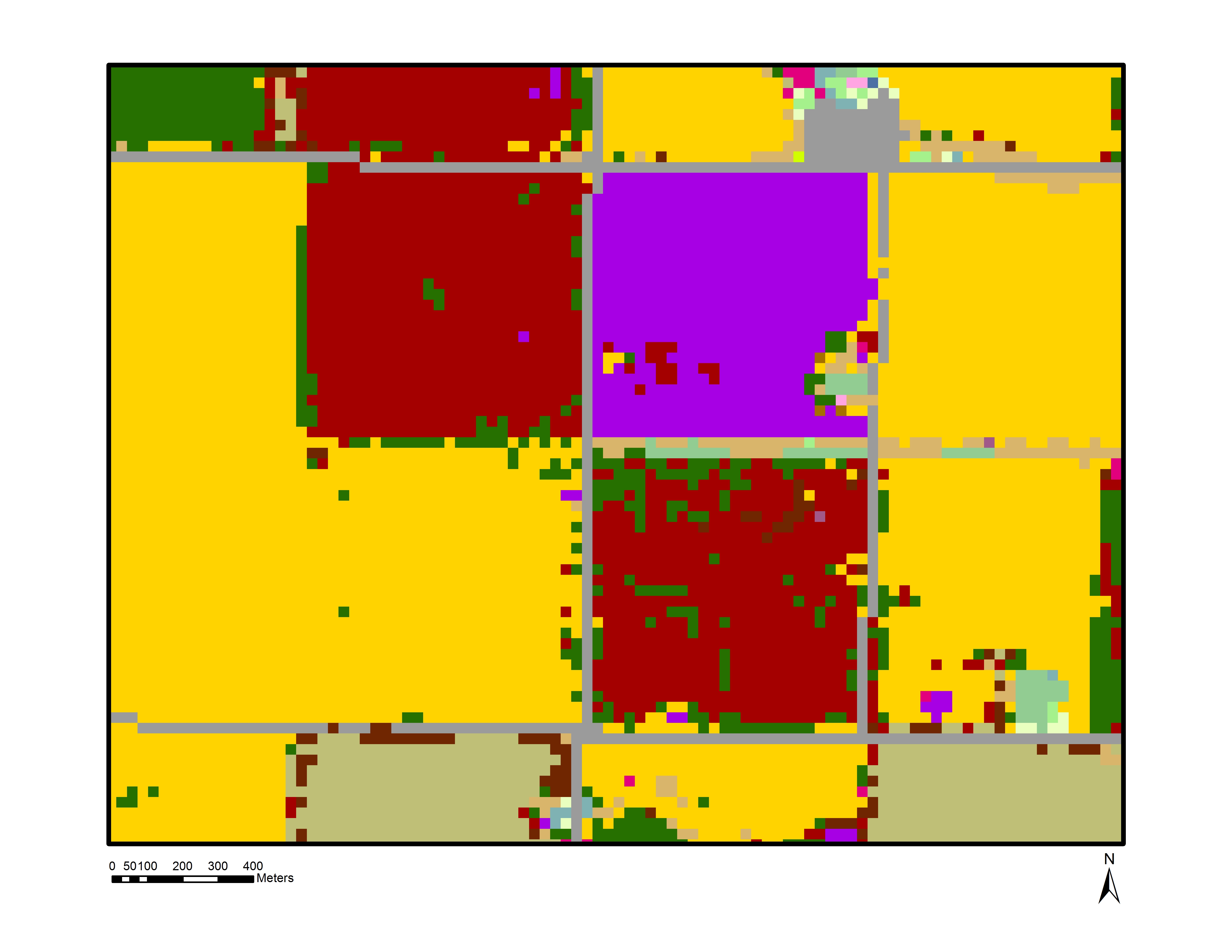
Original Raster
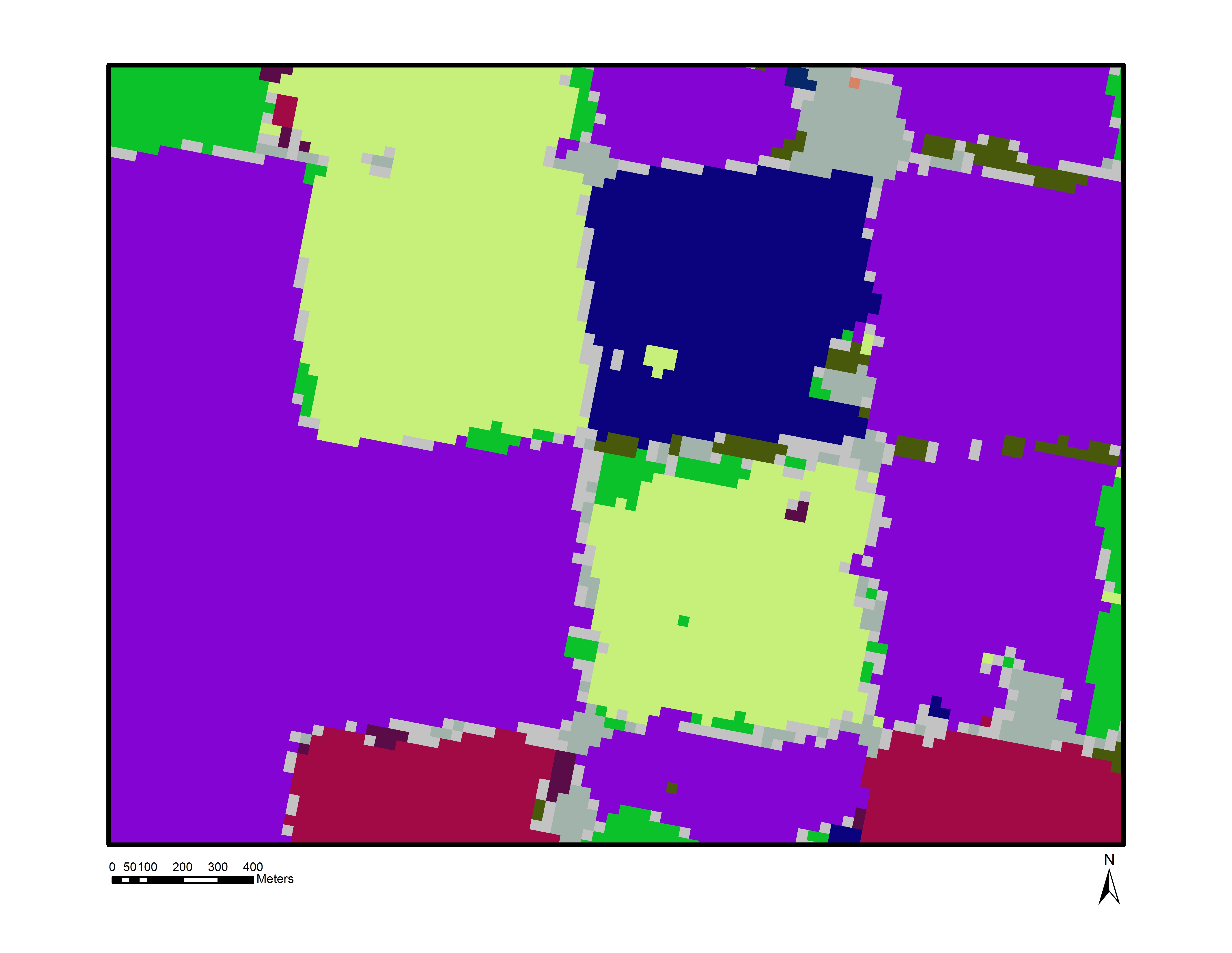
Simplified Raster with slanted borders.
1 Reply
10-22-2014
07:40 PM
- Mark as New
- Bookmark
- Subscribe
- Mute
- Subscribe to RSS Feed
- Permalink
Looks to me like the processing is happening in another coordinate system then the one you are using in ArcMap. The cells indeed stored as square cells but are being projected on the fly onto the map.
The fix is to select the Environments button when you open the tool to run and set the coordinate system to the same as the map.