- Home
- :
- All Communities
- :
- Products
- :
- ArcGIS Spatial Analyst
- :
- ArcGIS Spatial Analyst Questions
- :
- Re: Intersecting a flood raster with a population ...
- Subscribe to RSS Feed
- Mark Topic as New
- Mark Topic as Read
- Float this Topic for Current User
- Bookmark
- Subscribe
- Mute
- Printer Friendly Page
Intersecting a flood raster with a population grid
- Mark as New
- Bookmark
- Subscribe
- Mute
- Subscribe to RSS Feed
- Permalink
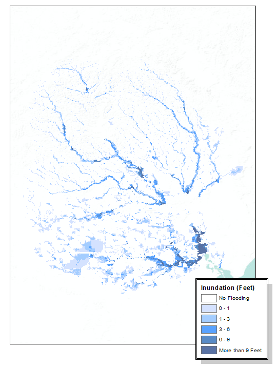
I have two rasters: a flood inundation raster (depth grid) and a census grid. I would like to know how many people are affected at 0-1 feet, 1-3 feet, 3-6 feet, 6-9 feet, and more than 9 feet. I need to figure out how many are effected in each class (a count). What tool(s) do I need to use? Do I need to convert one (or both) rasters to a polygon? Thanks in advance!
- Mark as New
- Bookmark
- Subscribe
- Mute
- Subscribe to RSS Feed
- Permalink
will give you all the combinations. You have integer rasters and they are classified..
If your population isn't in classes, then
Zonal Statistics as Table—Help | ArcGIS Desktop
might do it
You should do the conversion to raster explicitly because you will need to establish the cell size, processing extent and set your snap raster (to the existing raster extent)
- Mark as New
- Bookmark
- Subscribe
- Mute
- Subscribe to RSS Feed
- Permalink
In addition to what Dan mentions, if your population is expressed as density you will need to convert the density to number of people using the area of overlap. If they are absolute values, use the fraction of overlap to get the correct number of people.
- Mark as New
- Bookmark
- Subscribe
- Mute
- Subscribe to RSS Feed
- Permalink
Wouldn't I need to convert my flood inundation raster to polygon so I had a "zone" to refer to?
My census grid is number of # people/cell
- Mark as New
- Bookmark
- Subscribe
- Mute
- Subscribe to RSS Feed
- Permalink
zonal statistics as table will convert a polygon back to a raster in any event... check the link I posted