- Home
- :
- All Communities
- :
- Products
- :
- ArcGIS Spatial Analyst
- :
- ArcGIS Spatial Analyst Questions
- :
- How to interpret the results of the Corridor tool
- Subscribe to RSS Feed
- Mark Topic as New
- Mark Topic as Read
- Float this Topic for Current User
- Bookmark
- Subscribe
- Mute
- Printer Friendly Page
How to interpret the results of the Corridor tool
- Mark as New
- Bookmark
- Subscribe
- Mute
- Subscribe to RSS Feed
- Permalink
Hello everyone,
sorry, I feel like I'm flooding this forum with questions lately, but I am always getting such excellent help, which is great!
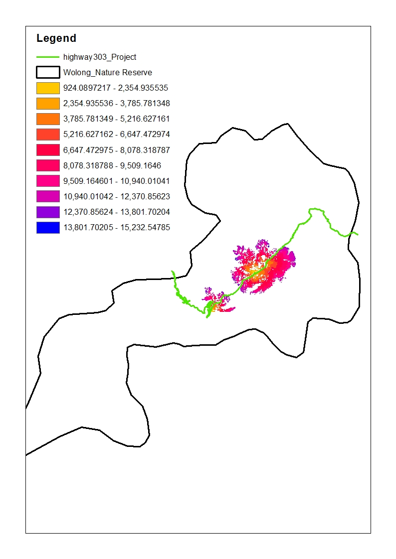
My question now concerns the output of the Corridor tool (see picture below). It is created using two inputs of the Cost Distance tool for two different sources - in this case habitat for giant pandas North of Highway 303 and habitat South of the highway. Now I was wondering:
1.) Why do I get so many NoData cells? Is that because the cost there to connect the two sources would be too great? (but too great compared to what? The maximum dispersal limit that I specified when using Cost Distance?) --> I am actually quite happy that there is so much NoData, because IF it really means travel for pandas is too "costly" there, then I have the area for possible corridor establishment narrowed down pretty neatly. I just want to make sure I am not drawing incorrect conclusions.
2.) The higher the value of a cell the higher the cost for a panda to travel through this cell from one habitat to the next. Is that correct?

Many thanks in advance!
Carina
Solved! Go to Solution.
- Mark as New
- Bookmark
- Subscribe
- Mute
- Subscribe to RSS Feed
- Permalink
Yes, that is due to the underlying resistance values, which where input for the cost distance and based on suitability of habitat for pandas (they only cross where highly suitable habitat is close on both sides of the highway). Actually the weight for the highway is high, but it seems the corridor tool still concludes that they can cross at certain points ... I hope there is no mistake anywhere. 😕
- Mark as New
- Bookmark
- Subscribe
- Mute
- Subscribe to RSS Feed
- Permalink
If the highway should not be crossed, you should make you highway "thick" enough and assign it NoData in the resistance value raster. If there are parts where a pixel can cross to the other side (even diagonally) than the cost distance will cross the highway.
- « Previous
-
- 1
- 2
- Next »
- « Previous
-
- 1
- 2
- Next »