Turn on suggestions
Auto-suggest helps you quickly narrow down your search results by suggesting possible matches as you type.
Cancel
- Home
- :
- All Communities
- :
- Products
- :
- ArcGIS Spatial Analyst
- :
- ArcGIS Spatial Analyst Questions
- :
- How to extract data from raster map to polygon sha...
Options
- Subscribe to RSS Feed
- Mark Topic as New
- Mark Topic as Read
- Float this Topic for Current User
- Bookmark
- Subscribe
- Mute
- Printer Friendly Page
How to extract data from raster map to polygon shapefile attribute table
Subscribe
4656
2
08-21-2013 07:30 AM
08-21-2013
07:30 AM
- Mark as New
- Bookmark
- Subscribe
- Mute
- Subscribe to RSS Feed
- Permalink
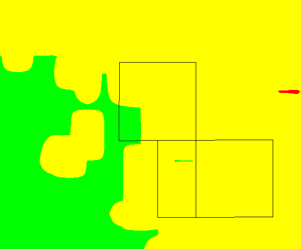
Just as the title says - how do I extract the (average) data from a raster image onto a polygon overlay?
In the attached image, the black square polygons belong to one shapefile. I want to extract the averaged data from the colored raster underlay and apply that average value into a new field in the polygon attribute table.
Anyone with suggestions on how to do this?
[ATTACH=CONFIG]26855[/ATTACH]
In the attached image, the black square polygons belong to one shapefile. I want to extract the averaged data from the colored raster underlay and apply that average value into a new field in the polygon attribute table.
Anyone with suggestions on how to do this?
[ATTACH=CONFIG]26855[/ATTACH]
2 Replies
08-21-2013
07:45 AM
- Mark as New
- Bookmark
- Subscribe
- Mute
- Subscribe to RSS Feed
- Permalink
Have a look at the zonal toolbox, specifically the zonal statistics tools.
Regards,
Jim
Regards,
Jim
08-21-2013
07:52 AM
- Mark as New
- Bookmark
- Subscribe
- Mute
- Subscribe to RSS Feed
- Permalink
Have a look at the zonal toolbox, specifically the zonal statistics tools.
Regards,
Jim
thanks, will look into it.