Turn on suggestions
Auto-suggest helps you quickly narrow down your search results by suggesting possible matches as you type.
Cancel
- Home
- :
- All Communities
- :
- Products
- :
- ArcGIS Spatial Analyst
- :
- ArcGIS Spatial Analyst Questions
- :
- Re: How to combine these three rasters according t...
Options
- Subscribe to RSS Feed
- Mark Topic as New
- Mark Topic as Read
- Float this Topic for Current User
- Bookmark
- Subscribe
- Mute
- Printer Friendly Page
How to combine these three rasters according to this logic?
Subscribe
1507
3
05-25-2011 12:25 AM
by
Anonymous User
Not applicable
05-25-2011
12:25 AM
- Mark as New
- Bookmark
- Subscribe
- Mute
- Subscribe to RSS Feed
- Permalink
Original User: Jamal432@gmail.com
How to combine these three rasters according to this logic?
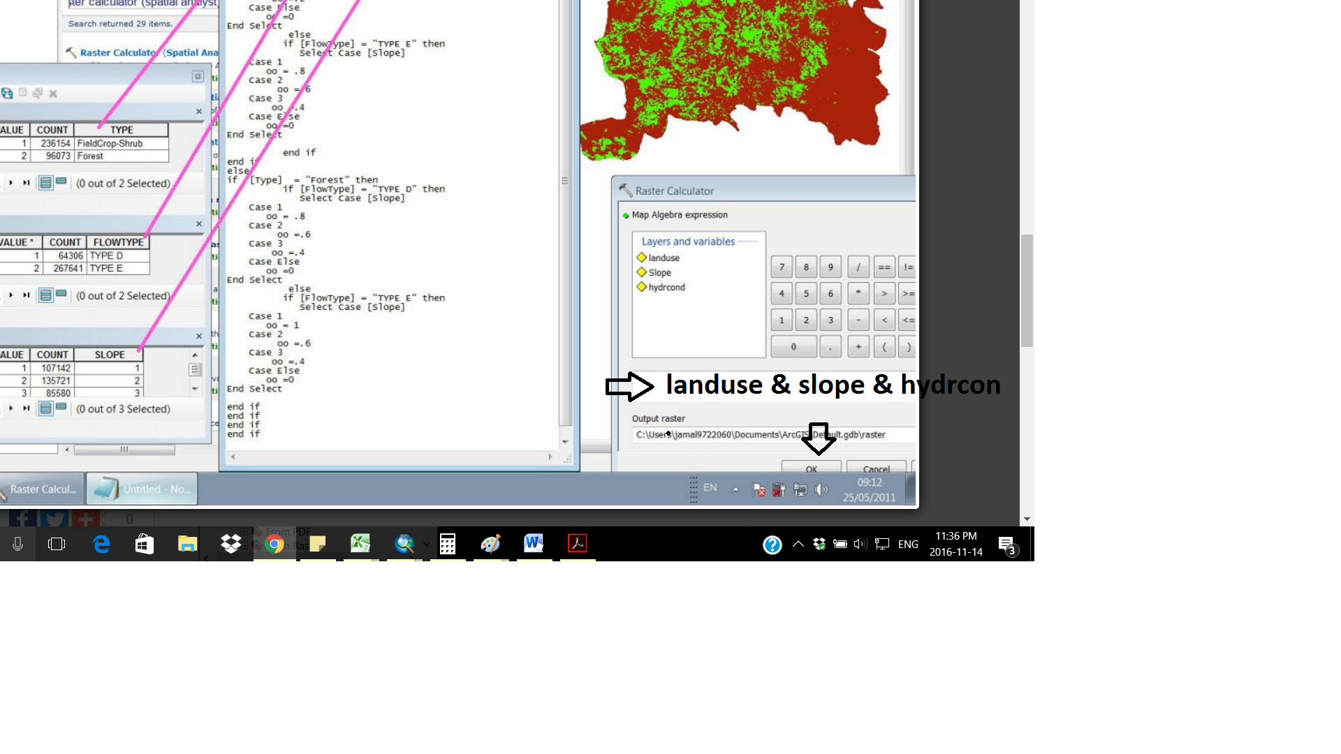
please, see the attached images that show my question
explanation:
I've three rasters: slope, landuse and hydraulic conductivity. i need to combine them according the relation shown in the table (second attachment)
i convert the table shown in the second attachment to the following code:
-----------------------------------------------------------
if [Type] = "FieldCrop-Shrub" then
if [FlowType] = "TYPE D" then
Select Case [Slope]
Case 1
oo = .6
Case 2
oo =.4
Case 3
oo =.2
Case Else
oo =0
End Select
else
if [FlowType] = "TYPE E" then
Select Case [Slope]
Case 1
oo = .8
Case 2
oo =.6
Case 3
oo =.4
Case Else
oo =0
End Select
end if
end if
else
if [Type] = "Forest" then
if [FlowType] = "TYPE D" then
Select Case [Slope]
Case 1
oo = .8
Case 2
oo =.6
Case 3
oo =.4
Case Else
oo =0
End Select
else
if [FlowType] = "TYPE E" then
Select Case [Slope]
Case 1
oo = 1
Case 2
oo =.6
Case 3
oo =.4
Case Else
oo =0
End Select
end if
end if
end if
end if
---------------------------------------------------------------------------
Now, how can i include this code to combine these three rasters?
thank you
regards
Jamal
3 Replies
11-08-2016
01:33 PM
- Mark as New
- Bookmark
- Subscribe
- Mute
- Subscribe to RSS Feed
- Permalink
I know this is an old thread, but it popped up to the top, so here's a quick answer. The equivalent of if/then/else logic for rasters is the Con tool/statement.
Con(condition,do this if true, do this if false)
11-15-2016
09:11 AM
- Mark as New
- Bookmark
- Subscribe
- Mute
- Subscribe to RSS Feed
- Permalink
As an alternative one could use the Combine—Help | ArcGIS for Desktop tool to combine the rasters (have to be integer) and perform the analysis in the attribute table (create a new field with the result) and use the Lookup—Help | ArcGIS for Desktop tool to create the output raster based on the generated field.
