- Home
- :
- All Communities
- :
- Products
- :
- ArcGIS Spatial Analyst
- :
- ArcGIS Spatial Analyst Questions
- :
- how generate missing contour lines from existing c...
- Subscribe to RSS Feed
- Mark Topic as New
- Mark Topic as Read
- Float this Topic for Current User
- Bookmark
- Subscribe
- Mute
- Printer Friendly Page
how generate missing contour lines from existing contour lines?
- Mark as New
- Bookmark
- Subscribe
- Mute
- Subscribe to RSS Feed
- Permalink
I have some elevation data as contour lines but there are places where the contours just stop. I've been reading about interpolation but they all start with points, is there any interpolation method that I can do using the existing contour lines? Thanks!

- Mark as New
- Bookmark
- Subscribe
- Mute
- Subscribe to RSS Feed
- Permalink
You could interpolate the existing contours, using Topo to raster (Topo to Raster—Help | ArcGIS for Desktop , and then derive new contours, but you will loose precision.
- Mark as New
- Bookmark
- Subscribe
- Mute
- Subscribe to RSS Feed
- Permalink
If the incomplete contour lines cause undesired artifacts at the ends you could consider excluding them from the interpolation.
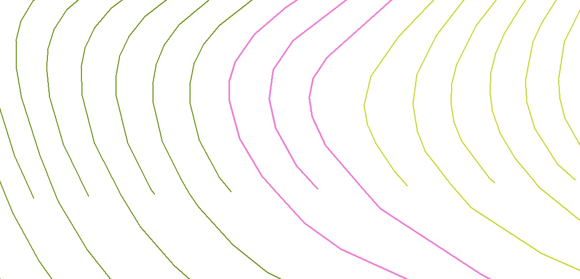
Question: how were these contour lines generated? It seems a little strange that every second line stops at a similar Y (lat) value.
- Mark as New
- Bookmark
- Subscribe
- Mute
- Subscribe to RSS Feed
- Permalink
The contour lines are USGS 24k. We need areas above 2500ft (middle pink line in image) but the 2500 contour is missing at certain areas. After reading about interpolation I was hoping that we could create a complete 2500 ft contour.
- Mark as New
- Bookmark
- Subscribe
- Mute
- Subscribe to RSS Feed
- Permalink
you can't produce a new contour or extend an existing without re-interpolating
- Mark as New
- Bookmark
- Subscribe
- Mute
- Subscribe to RSS Feed
- Permalink
resolved?
- Mark as New
- Bookmark
- Subscribe
- Mute
- Subscribe to RSS Feed
- Permalink
Sorry, got pulled to do another project. Haven't had a chance to do the interpolation for the contours yet.
- Mark as New
- Bookmark
- Subscribe
- Mute
- Subscribe to RSS Feed
- Permalink
I wonder if maybe a more complete contour data set is available, which would save having to interpolate. Here's some links that may be of help:
topotools.cr.usgs.gov/contour_data.php
nationalmap.gov/viewer.html
The National Map: Viewer and Download Platform
Chris Donohue, GISP
- Mark as New
- Bookmark
- Subscribe
- Mute
- Subscribe to RSS Feed
- Permalink
An other way with the extension 3D Analyst is:
1. Make a TIN with the contour lines. The contours are hard break lines in the TIN and every line must have an elevation.
2. From the TIN you can generate contour lines in several Intervalls.