- Home
- :
- All Communities
- :
- Products
- :
- ArcGIS Spatial Analyst
- :
- ArcGIS Spatial Analyst Questions
- :
- calculate zonal statistics using overlapping polyg...
- Subscribe to RSS Feed
- Mark Topic as New
- Mark Topic as Read
- Float this Topic for Current User
- Bookmark
- Subscribe
- Mute
- Printer Friendly Page
calculate zonal statistics using overlapping polygons
- Mark as New
- Bookmark
- Subscribe
- Mute
- Subscribe to RSS Feed
- Permalink
Hello! I'm trying to calculate zonal statistics with a grid as input and overlapping circles in a feature class as areas. As I understud the software is converting the feature class with the polygons in a raster file in the background and clips the polygons. Can I avoid this somehow or is there an other possibility to extract this spatial information from the grid? What I would need is the number of cells with specific values within a 2000m radius around points. Thanks!
Solved! Go to Solution.
- Mark as New
- Bookmark
- Subscribe
- Mute
- Subscribe to RSS Feed
- Permalink
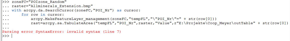
A ok, now I sow there is a ) missed at the end.
solved this error
got a new one 🙂
- Mark as New
- Bookmark
- Subscribe
- Mute
- Subscribe to RSS Feed
- Permalink
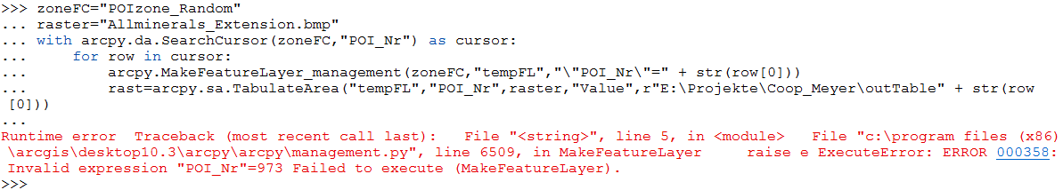
What type of feature class are you working with? Where clauses are data-specific (see the help for Make Feature Layer, where clause section). My example used a shapefile - fields are enclosed by double quotes. File GDB fields have no quotes. Personal GDB fields are enclosed by []. A nice way to figure it out is to run Make Feature Layer once through the normal tool dialog to figure out the syntax. Once you get it to work once, you can export the result from the results window to a Python snippet and inspect the syntax more fully in a text editor or IDE
- Mark as New
- Bookmark
- Subscribe
- Mute
- Subscribe to RSS Feed
- Permalink
Another reason to eschew mdb.
You can generate the correct delimeters with arcpy.AddFieldDelimeters. The code below would return "[POI_Nr]" if ZoneFC was in a pGDB.
arcpy.AddFieldDelimeters(
    os.path.dirname(arcpy.Describe("ZoneFC").catalogPath),
    "POI_Nr")
- Mark as New
- Bookmark
- Subscribe
- Mute
- Subscribe to RSS Feed
- Permalink
Hi!
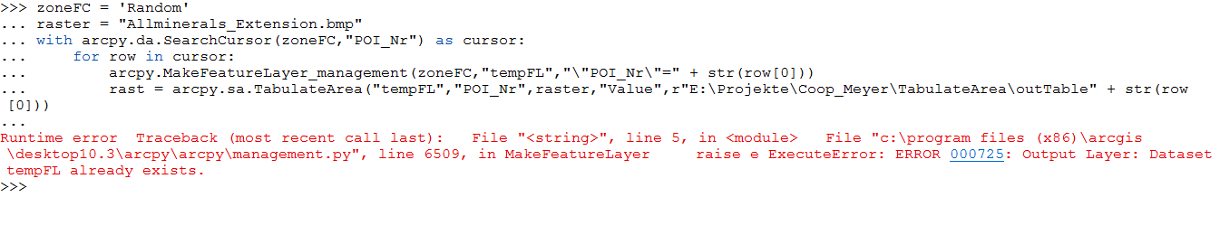
I was using a personal GDB. Now I export the data to shapefile and run the code again.
Its working at least a bit 🙂
It creates a table with one entry and then stops with a error.
- « Previous
-
- 1
- 2
- Next »
- « Previous
-
- 1
- 2
- Next »