- Home
- :
- All Communities
- :
- Products
- :
- ArcGIS Spatial Analyst
- :
- ArcGIS Spatial Analyst Questions
- :
- Assessment between two paths
- Subscribe to RSS Feed
- Mark Topic as New
- Mark Topic as Read
- Float this Topic for Current User
- Bookmark
- Subscribe
- Mute
- Printer Friendly Page
Assessment between two paths
- Mark as New
- Bookmark
- Subscribe
- Mute
- Subscribe to RSS Feed
- Permalink
Hi I wonder if there is a way to do the following.
The scenario is creating and comparing new footpaths within a state reserve.
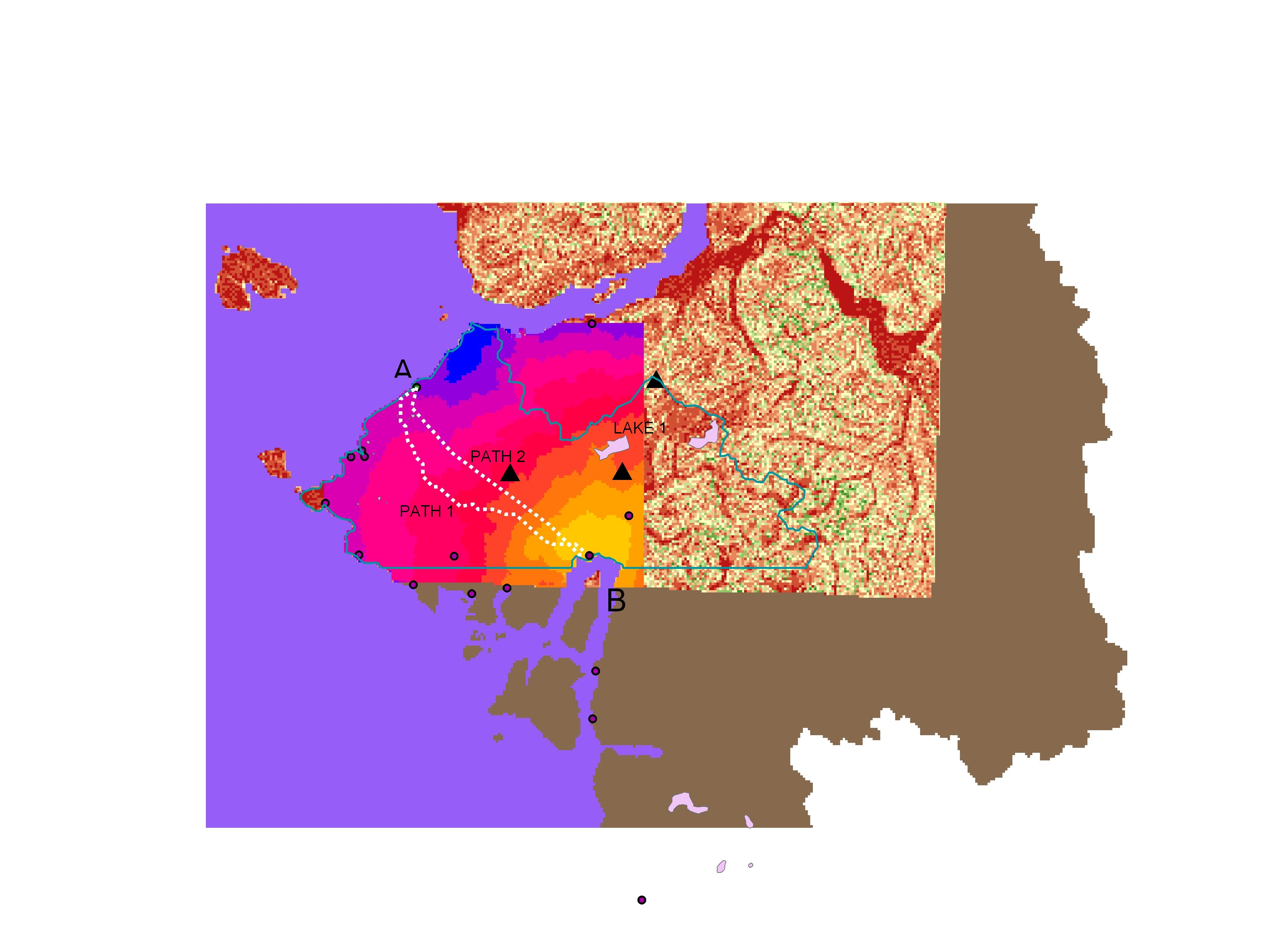
I need create a type of anaysis that would allow me to assess to choices of getting from A to B (in the picture). Path A should be the result if the only parameter taken into consideration would be the slope (effort). A path going from point A to Lake 1 and then to point B should be result if the attractiveness of the lake would be taken into consideration.
In the picture attached:
For path 1 I carried a cost distance analysis assessing the slope and using point B as the source (destination) of the analysis and setting point A as the origin.
For path 2 I created a multiple ring buffer and I weighted the output against the slope raster I used in path 1. Both rasters were reclassified before creating a new cost distance raster where the proximity to the lake have been matched with the smallest value of the slope. The result shown in the picture resembles the effect of a gravity model attracting path 1 closer to path 2.
What I need instead is reaching a breaking value where the output of the analysis would show a path connecting A-Lake 1-B as a preferable path compared to path 1, because of the attractiveness of the lake. Thank you
- Mark as New
- Bookmark
- Subscribe
- Mute
- Subscribe to RSS Feed
- Permalink
Sounds nice! To connect A to B passing by the lake, you should probably calculate path A - Lake and Lake - B separately. To enhance the analysis you could include a visibility (viewshed) analysis where the areas with visibility to the lake get a lower weight than the other pixels. This way you will force the route to have more views to the lake. If this will actually create a better path, depends strongly on the topography and landcover.
Kind regards, Xander
- Mark as New
- Bookmark
- Subscribe
- Mute
- Subscribe to RSS Feed
- Permalink
Thank you Xander, will follow your advice
Regards. Juan
- Mark as New
- Bookmark
- Subscribe
- Mute
- Subscribe to RSS Feed
- Permalink
As a followup to Xander's comments...since you are using slope, you might consider replacing costdistance with pathdistance which is similar but accounts for directionality (ie upslope versus downslope)
Also, put some tags on your thread so that the contents can be searched upon.
- Mark as New
- Bookmark
- Subscribe
- Mute
- Subscribe to RSS Feed
- Permalink
Thank you Dan.
So far I have been using cost distance and then a least cost path specifying a backlink which I understand accounts for directionality.
I will give it a try with your suggestions Dan and compare it.
Thanks
- Mark as New
- Bookmark
- Subscribe
- Mute
- Subscribe to RSS Feed
- Permalink
The backlink just returns you to the origin point...the use of costdistance vs pathdistance ultimately determines the route that the path will take