- Home
- :
- All Communities
- :
- Products
- :
- ArcGIS Solutions
- :
- ArcGIS Solutions Questions
- :
- Spatial Join
- Subscribe to RSS Feed
- Mark Topic as New
- Mark Topic as Read
- Float this Topic for Current User
- Bookmark
- Subscribe
- Mute
- Printer Friendly Page
Spatial Join
- Mark as New
- Bookmark
- Subscribe
- Mute
- Subscribe to RSS Feed
- Permalink
I have a parcel data layer with landowner information in it that I want to join land cover data to. I have clipped them so that they are exactly the same size/shape. Is there any way to get just the land cover column to join to the attribute table of the parcel data layer?
- Mark as New
- Bookmark
- Subscribe
- Mute
- Subscribe to RSS Feed
- Permalink
http://desktop.arcgis.com/en/arcmap/latest/manage-data/tables/about-joining-and-relating-tables.htm
There are attribute joins based on a common id or attribute field and there are spatial joins based on location. If your layers have a common ID value, then the conventional attribute join would work, otherwise if the locations are such that there is a one-to-one relationship, then that should work as well.
What have you tried? and if you did and the results were unexpected, can you show what the result was
- Mark as New
- Bookmark
- Subscribe
- Mute
- Subscribe to RSS Feed
- Permalink
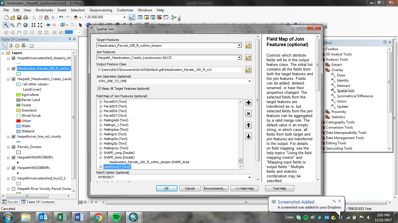
Hey Dan,
I tried using the spatial join in overlay in toolbox. There are 600 record of parcels, and over 5000 records of landcover that cover the parcel area. So when I perform the join, the target is the parcels and the join features is the LC data. I got rid of the extraneous fields in the LC that I don't need except the LandCover2 one. I did not change the match option from intersect to anything else. I wonder if this is what gave me the weird results. I want to know how GIS is calculating what ends up in the joined data. When I checked to see if the join had gone through correctly, it seemed to make some of the parcels have the wrong landcover. For example, one parcel was mostly agriculture and forest, but got recategorized after the join as urban (there is one TINY sliver of urban in the parcel). Is there a way to calculate the largest percentage of the land cover for the column for the join?
