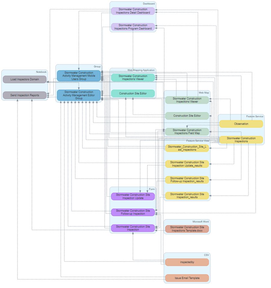
Did you deploy Stormwater Construction Activity Management and wish you had a graphical way to see how all the items are connected? Or maybe you haven't deployed it yet, but would like to understand it more?
Here is a link to the solution documentation: https://doc.arcgis.com/en/arcgis-solutions/latest/reference/introduction-to-stormwater-construction-...
Here is a link to the solution - check out the demo for more information: https://arcg.is/1n9qjb
I have attached a picture of the solution diagram too!