- Home
- :
- All Communities
- :
- Developers
- :
- Native Maps SDKs
- :
- .NET Maps SDK Questions
- :
- Re: integrating with telerik radmap for wpf
- Subscribe to RSS Feed
- Mark Topic as New
- Mark Topic as Read
- Float this Topic for Current User
- Bookmark
- Subscribe
- Mute
- Printer Friendly Page
integrating with telerik radmap for wpf
- Mark as New
- Bookmark
- Subscribe
- Mute
- Subscribe to RSS Feed
- Permalink
- Report Inappropriate Content
Can someone provide detailed information on integrating with Telerik RadMap for WPF? It is easy enough to get going in a demo mode, but I have an account I want to use so that ArcGIS doesn't lock out my app or my ip address.
- Mark as New
- Bookmark
- Subscribe
- Mute
- Subscribe to RSS Feed
- Permalink
- Report Inappropriate Content
Hi,
Please can you provide more information about what you're trying to build? (ArcGIS won't lock out your app or your IP address - but you should read Licensing and Deployment | ArcGIS for Developers to understand the development and deployment licensing requirements).
Thanks
Mike
- Mark as New
- Bookmark
- Subscribe
- Mute
- Subscribe to RSS Feed
- Permalink
- Report Inappropriate Content
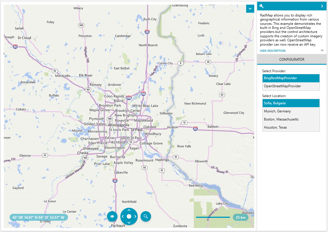
As a starting point I'd like to build something like the telerik map demo pictured here, using the telerik radmap control but also arcgis as a map data provider. I would also want it to authenticate to arcgis using a client id and client secret, as we are working on an app for widespread production use across our company.
If possible I would also like to be able to build in a vector graphic rendering mechanism so that I can have a hybrid satelite imagery/street map mode.
- Mark as New
- Bookmark
- Subscribe
- Mute
- Subscribe to RSS Feed
- Permalink
- Report Inappropriate Content
Are you asking for how to consume ArcGIS Online services in Telerik Radmap? That might be more of a question for Telerik, and it looks like they have some documentation for it: WPF Map | ArcGIS Online Map Provider | Telerik UI for WPF
Since this question is posted in the ArcGIS Runtime for .NET forum, have you considered using the ArcGIS Runtime WPF control instead, since that has native integration with ArcGIS Online Services (vector and satellite), as well as support for Bing Maps and OpenStreetmap
- Mark as New
- Bookmark
- Subscribe
- Mute
- Subscribe to RSS Feed
- Permalink
- Report Inappropriate Content
I mention Telerik for context, but my focus has more to do with how to integrate with ArcGIS through web services in a best practices fashion. I am exploring the runtime, but the case has to be made within my organization for that investment.
- Mark as New
- Bookmark
- Subscribe
- Mute
- Subscribe to RSS Feed
- Permalink
- Report Inappropriate Content
I'd suggest you start with the sample app to get an idea about the bits and pieces available in the API. You can get it from the store:https://www.microsoft.com/store/productId/9MTP5013343H
https://www.microsoft.com/store/productId/9MTP5013343H
Full source also available here: arcgis-runtime-samples-dotnet
Another good starting point is the getting started guides in the doc: