- Home
- :
- All Communities
- :
- Developers
- :
- Native Maps SDKs
- :
- Runtime SDK for iOS Questions
- :
- How to change feature order in layer
- Subscribe to RSS Feed
- Mark Topic as New
- Mark Topic as Read
- Float this Topic for Current User
- Bookmark
- Subscribe
- Mute
- Printer Friendly Page
How to change feature order in layer
- Mark as New
- Bookmark
- Subscribe
- Mute
- Subscribe to RSS Feed
- Permalink
Hi!
i have a Feature Layer witch can contain overlapping features (all the same colour).
When the user tapps on the features i'll show him a "feature chooser" to select only one feature.
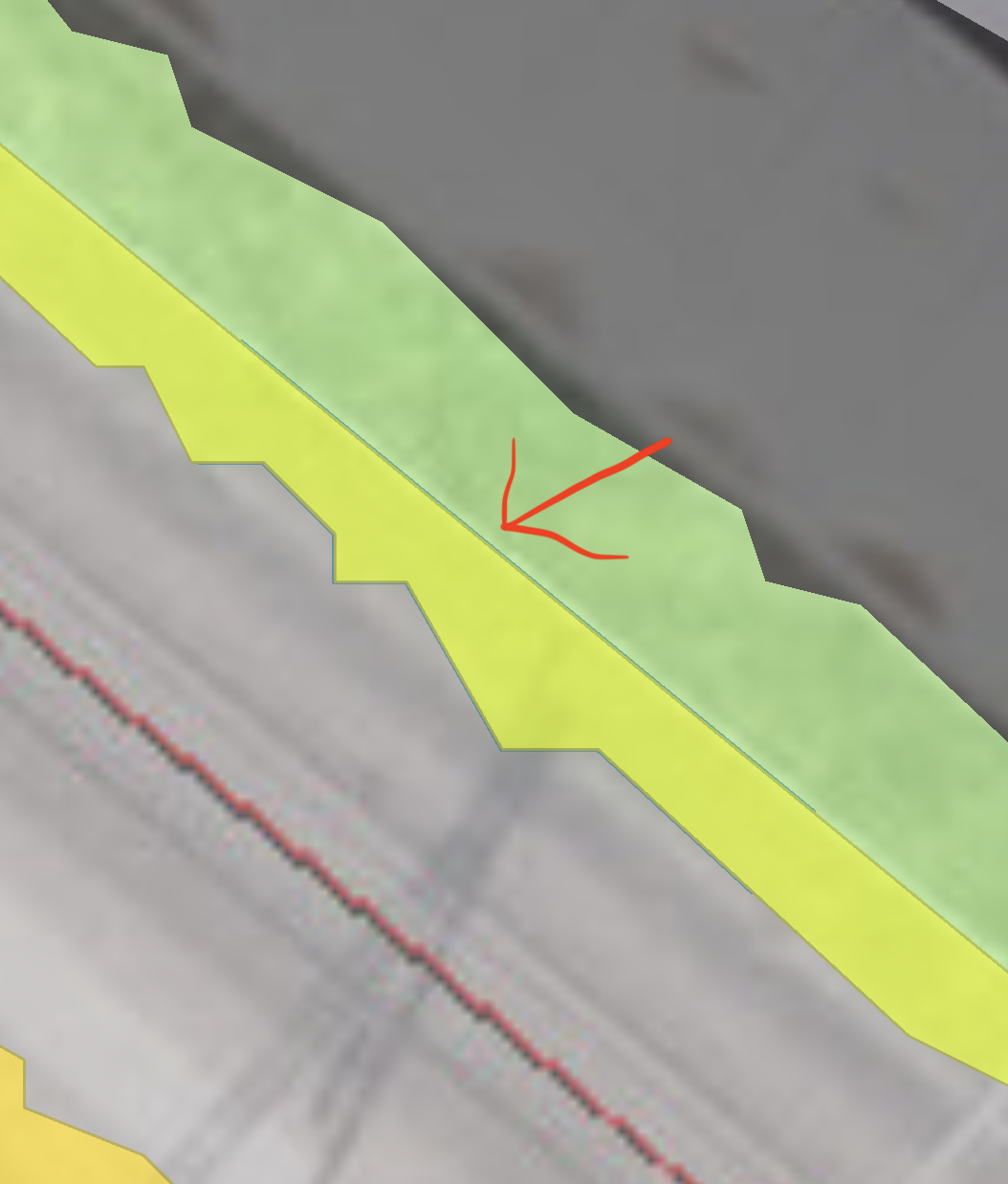
But if the selected feature is smaller than an overlapping one and is beneath the bigger feature, the user can't see the selected feature at all.
How can i lift the selected feature higher? (See "SelectedFeature.png")
Thanks for your help!
%20-%202018-10-25%20at%2009.34.08.png)
- Mark as New
- Bookmark
- Subscribe
- Mute
- Subscribe to RSS Feed
- Permalink
Hi Michael,
We have a similar scenario on a project we're working on. I'm just using an AGSGraphicLayer, rendered on top of the feature layer, to copy the selected feature into temporarily. In your case, once user has selected feature they want:
1) Create either AGSSimpleRenderer or just symbol to make the feature a different color, etc. Here are a couple examples of renderers that illustrate how to do either:
var municipalityPointRenderer: AGSSimpleRenderer {
let symbol = AGSPictureMarkerSymbol(image: imageLiteral(resourceName: "townSymbol"))
symbol.height = 10.0
symbol.width = 10.0
let renderer = AGSSimpleRenderer(symbol: symbol)
return renderer
}
var municipalityPolyRenderer: AGSSimpleRenderer {
let lineSymbol = AGSSimpleLineSymbol(style: .solid, color: UIColor(red: 51/255, green: 51/255, blue: 51/255, alpha: 0.0), width: 1)
let fillSymbol = AGSSimpleFillSymbol(style: .solid, color: UIColor.clear, outline: lineSymbol)
let renderer = AGSSimpleRenderer(symbol: fillSymbol)
return renderer
}
2) Create a new AGSGraphic from feature. Here is an example, where feature is AGSArcGISFeature from AGSIdentifyLayerResult. Note, that you could assign a symbol here if you weren't using a renderer:
let selectedFeature = AGSGraphic(geometry: feature.geometry, symbol: nil, attributes: feature.attributes as? [String : Any])
3) Create a new AGSGraphicsOverlay, add the graphic from step 2 to it, assign the renderer and add it to the mapView:
let selectedLayer = AGSGraphicsOverlay()
selectedLayer.graphics.add(selectedFeature)
selectedLayer.renderer = EsriUtil.municipalityPointRenderer
self.mapView.graphicsOverlays.add(selectedLayer)
4) Remove the overlay when user deselects, or selects another. If you have a single overlay, you can simply remove them all. You will need to adjust based on how your mapView, and overlay are referenced:
self?.mapView.graphicsOverlays.removeAllObjects()
Hope this helps. Let me know if you have any questions.
Cheers,
Jake
- Mark as New
- Bookmark
- Subscribe
- Mute
- Subscribe to RSS Feed
- Permalink
Hi Jake!
it works perfectly! thank you for your detailed answer!
Cheers,
Mike