- Home
- :
- All Communities
- :
- Developers
- :
- Native Maps SDKs
- :
- Runtime SDK for iOS Questions
- :
- Re: Error with multipart geometry in runtime geoda...
- Subscribe to RSS Feed
- Mark Topic as New
- Mark Topic as Read
- Float this Topic for Current User
- Bookmark
- Subscribe
- Mute
- Printer Friendly Page
Error with multipart geometry in runtime geodatabase
- Mark as New
- Bookmark
- Subscribe
- Mute
- Subscribe to RSS Feed
- Permalink
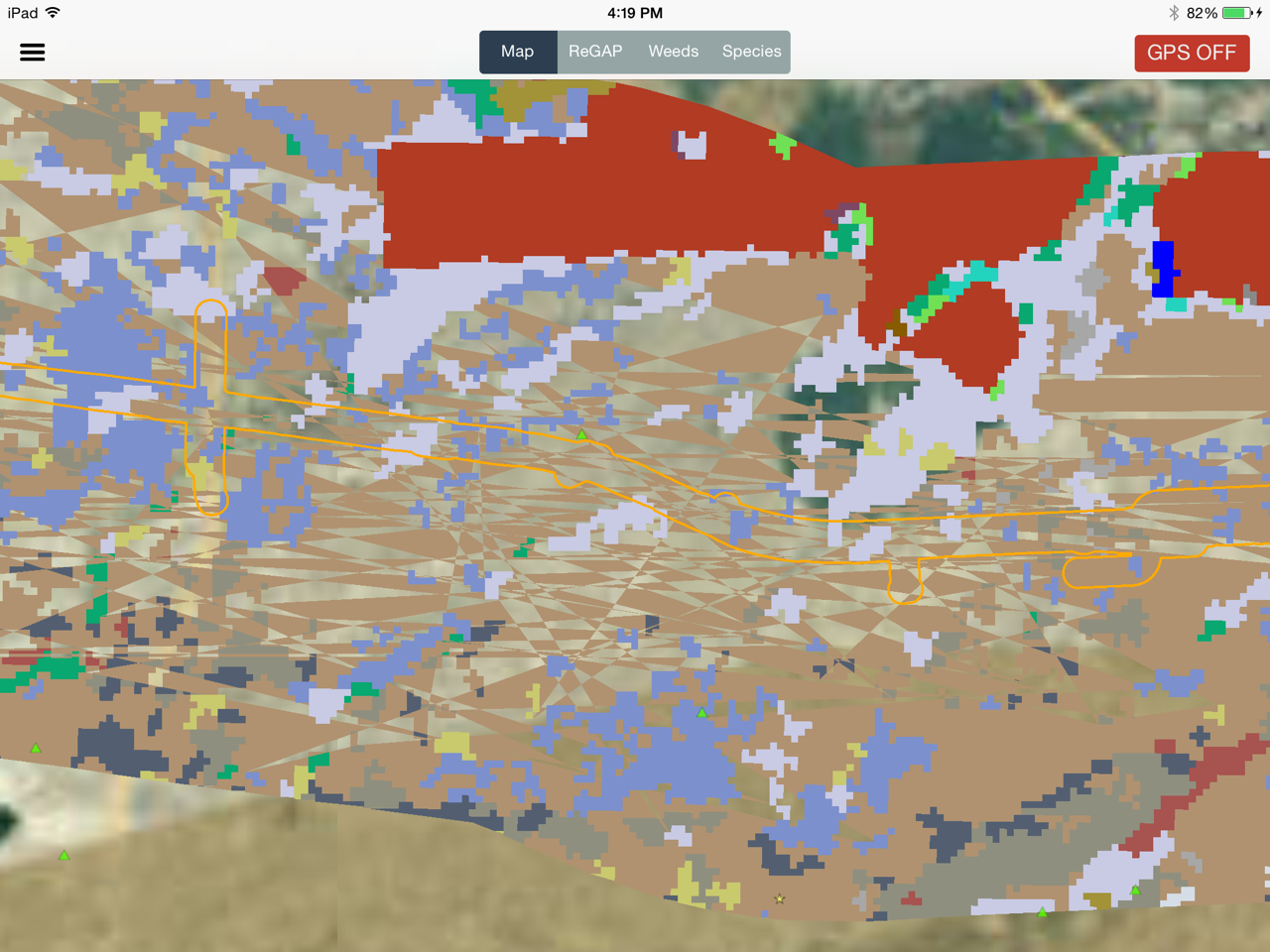
I've got an issue with a large polygon feature layer (~20,000 features). In the screenshot below you can see a landcover layer. It appears that the polygon features with multipart geometry are not drawing correctly. The area in the image with the crisscross lines should all be a single feature surrounding smaller features of different types. I've tried various repair geometry and simplify tools with no effect. If I look at the geometry in ArcMap (view sketch) it seems like everything is in the correct order. It's almost as if the breaks between the multiple parts of the geometry aren't being passed into the runtime geodatabase.
Has anyone had any experience with complex geometries in the runtime geodatabase?
- Mark as New
- Bookmark
- Subscribe
- Mute
- Subscribe to RSS Feed
- Permalink
I was able to work around this issue by creating a grid over the extent of the layer in ArcMap and using the Split Polygons tool to chop everything up. This didn't solve the problem - multipart geometry still doesn't draw correctly, but it did reduce the number and size of multipart features so they are less noticable. You could also use the dice tool to do this.
It appears that this is a bug in either the offline geodatabase or the SDK drawing routines.
- Mark as New
- Bookmark
- Subscribe
- Mute
- Subscribe to RSS Feed
- Permalink
Michael -
Did you use ArcMap to create the runtime geodatabase? What version were you using?
Would it be possible for you to privately share the gdb with us so we can investigate?
- Mark as New
- Bookmark
- Subscribe
- Mute
- Subscribe to RSS Feed
- Permalink
The geodatabase was created using the desktop workflow. Using 10.2.2
I'd be happy to share it with you - let me know how best to send it.
- Mark as New
- Bookmark
- Subscribe
- Mute
- Subscribe to RSS Feed
- Permalink
I can confirm that this is indeed an issue. We'll try to fix it in the next release.
As a workaround, you can try generalizing the geometries before exporting it to the runtime geodatabase.
- Mark as New
- Bookmark
- Subscribe
- Mute
- Subscribe to RSS Feed
- Permalink
Our workaround has generally been to do some sort of dice or gridding of the large complex geometries to break them up into smaller chunks. I doesn't fix the issue, but it reduces the size and visibility of the drawing artifacts.
Is this something that will be addressed by an SDK update (drawing issue), or is it something on the geodatabase creation side that will require an ArcMap update?
- Mark as New
- Bookmark
- Subscribe
- Mute
- Subscribe to RSS Feed
- Permalink
We're still investigating, but likely it'll need to be fixed in the SDK.