- Home
- :
- All Communities
- :
- Products
- :
- ArcGIS Pro
- :
- ArcGIS Pro Questions
- :
- XY Points Not Displaying Correctly
- Subscribe to RSS Feed
- Mark Topic as New
- Mark Topic as Read
- Float this Topic for Current User
- Bookmark
- Subscribe
- Mute
- Printer Friendly Page
XY Points Not Displaying Correctly
- Mark as New
- Bookmark
- Subscribe
- Mute
- Subscribe to RSS Feed
- Permalink
Hello,
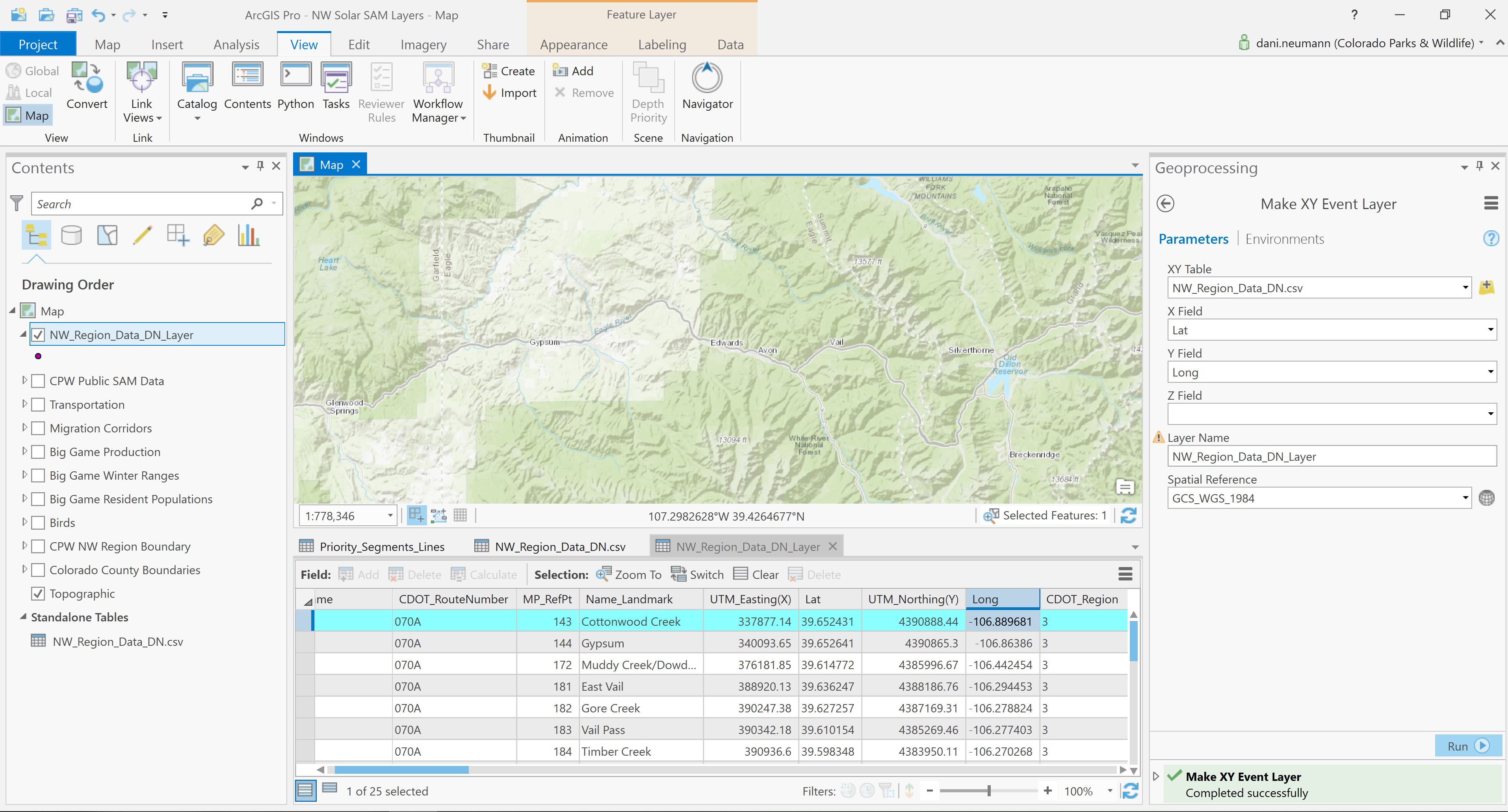
I imported a standalone table, right-clicked "Display XY Data", and set the parameters. Lat & long appear to be in the correct fields and the datum is selected. I quickly verified that the lat & longs are correct in Google Earth. However, no points are displaying in Pro. When I right-click the new point layer under in the contents pane, the attribute table is there and populated.
I'm pretty new to Pro, and aware that it's likely a simple operator error... but I don't know how to go about troubleshooting. See the screenshot!
Thank you!
Solved! Go to Solution.
Accepted Solutions
- Mark as New
- Bookmark
- Subscribe
- Mute
- Subscribe to RSS Feed
- Permalink
Seems you need to switch the two fields: long for X Field, lat for Y Field.
- Mark as New
- Bookmark
- Subscribe
- Mute
- Subscribe to RSS Feed
- Permalink
Can you post a portion of your csv file?
- Mark as New
- Bookmark
- Subscribe
- Mute
- Subscribe to RSS Feed
- Permalink
I did! I'm going cross-eyed... I'll delete this post! Probably should have slowed down and had more coffee
- Mark as New
- Bookmark
- Subscribe
- Mute
- Subscribe to RSS Feed
- Permalink
Easy mistake to make. 🙂
By the way, when you are wondering about the coordinates, you can watch the values at the bottom center of your map. In your image, it reads 107.298W and 39.426N. That should give you a clue for which values are x and y.
- Mark as New
- Bookmark
- Subscribe
- Mute
- Subscribe to RSS Feed
- Permalink
Don't delete the post! You aren't the first nor the last to make that very simple mistake. Enjoy another cup of coffee!