- Home
- :
- All Communities
- :
- Products
- :
- ArcGIS Pro
- :
- ArcGIS Pro Questions
- :
- WMS layer doesn't display in ArcGIS Pro
- Subscribe to RSS Feed
- Mark Topic as New
- Mark Topic as Read
- Float this Topic for Current User
- Bookmark
- Subscribe
- Mute
- Printer Friendly Page
WMS layer doesn't display in ArcGIS Pro
- Mark as New
- Bookmark
- Subscribe
- Mute
- Subscribe to RSS Feed
- Permalink
ArcGIS Pro 2.0.1 trial
Possible glitch with adding sublayers of a WMS manually?
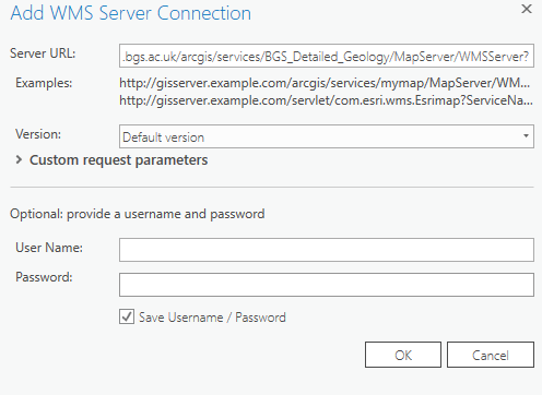
In a new project, I've followed the steps to add a new WMS layer to the map. For this example I'm using BGS 50K geology: https://map.bgs.ac.uk/arcgis/services/BGS_Detailed_Geology/MapServer/WMSServer
Insert>Connections>New WMS Server> paste the URL into the box and click ok
then, Map>Add Data>Data> browse to the WMS server layer and click ok to add to the map.
The WMS layer (and sublayers) display properly with the settings like this:
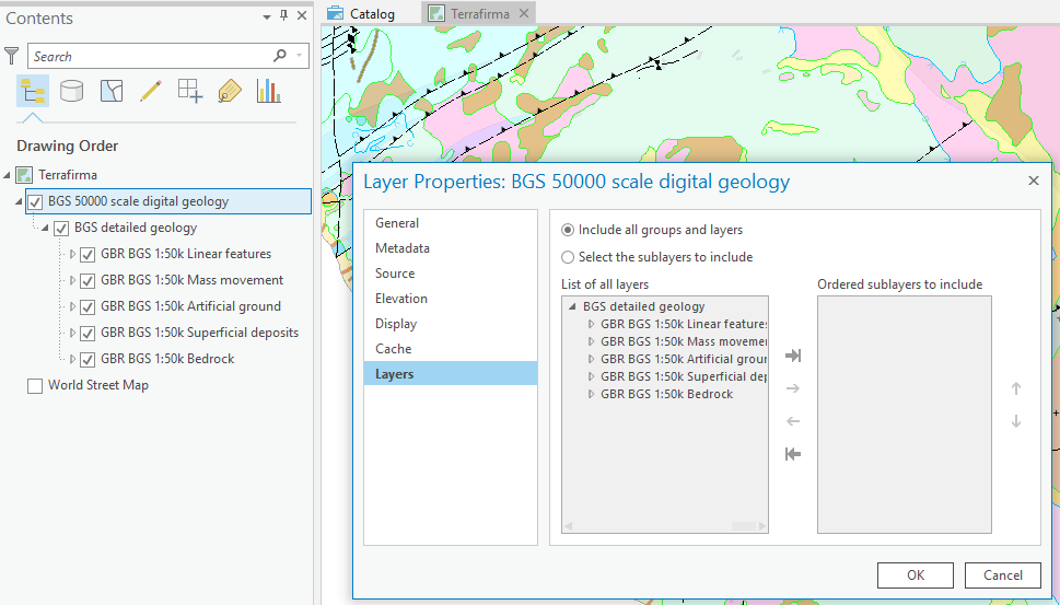
But if I change the option here to add the sublayers manually, the WMS layer doesn't display (see the white background):
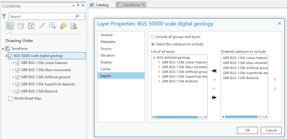
If I then try to rectify this by reverting to 'include all groups and layers', it still doesn't display and I have to add the WMS layer to the map again.
There are no display scales on the layer and I haven't moved around in the map between changing the option.
- Mark as New
- Bookmark
- Subscribe
- Mute
- Subscribe to RSS Feed
- Permalink
I had something similar occur. I'm not sure what's going on. I tried one imagery service and it didn't work. This service had multiple layers. However, I added an imagery service using a layer file that only had one layer in it and that drew fine. One other difference was the format of the service. The one that worked used a REST endpoint. The one that didn't used some other kind of configuration.
This is the one that didn't work - http://geoint.lmic.state.mn.us/cgi-bin/wms?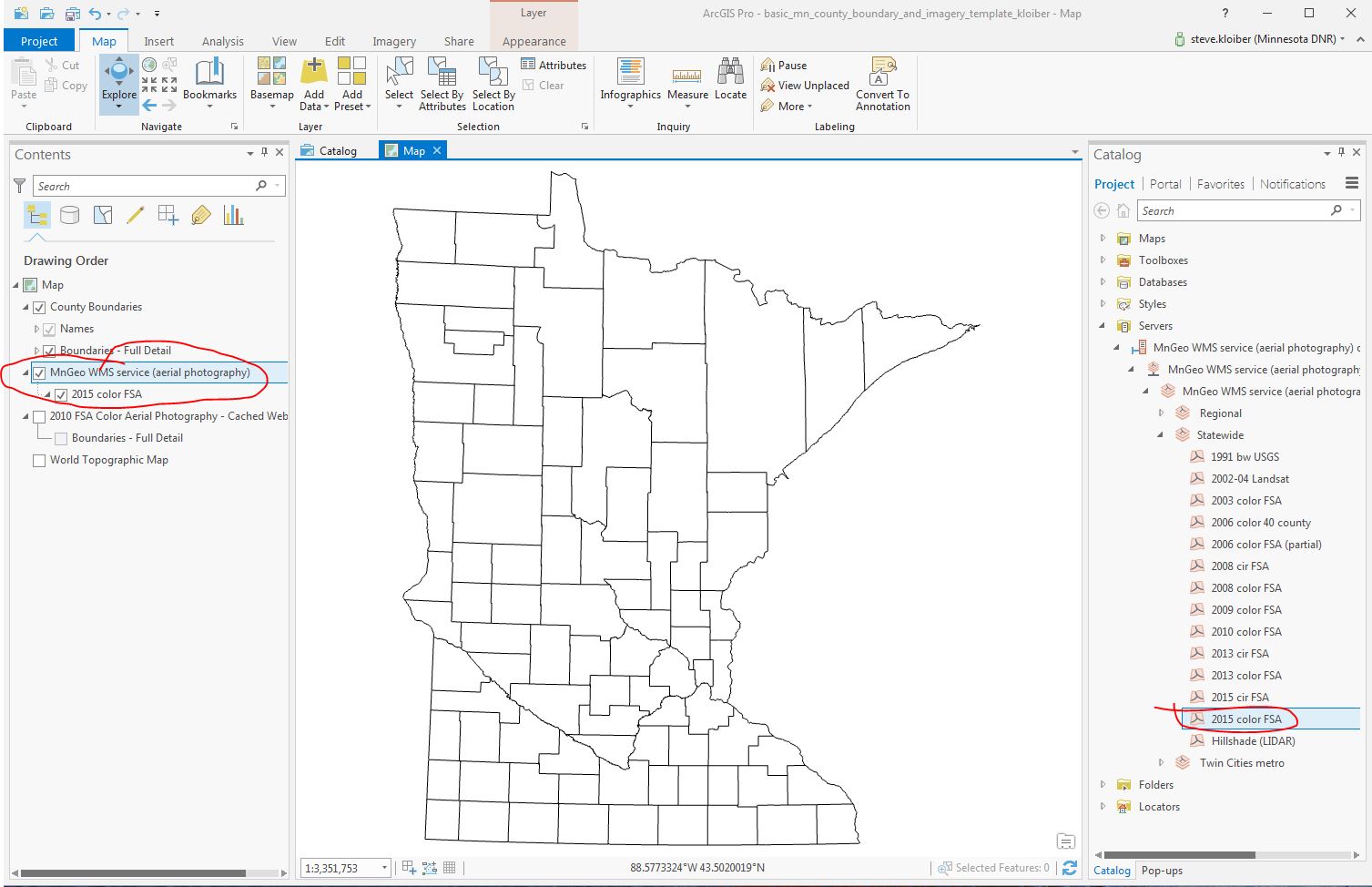
- Mark as New
- Bookmark
- Subscribe
- Mute
- Subscribe to RSS Feed
- Permalink
I did find a work around. I loaded the WMS into ArcMap (which has always rendered this service just fine). I created a layer file for the service and then added the service using this layer file. The WMS worked fine this way. But if I tried to add it directly as a WMS service in ArcGIS Pro, it won't render at all.
- Mark as New
- Bookmark
- Subscribe
- Mute
- Subscribe to RSS Feed
- Permalink
Coincidentally, I had this problem today and I tried many things to no avail. Then I restarted ArcGIS Pro and it worked just fine, I don't know why. Of course, it's also important to make sure that the WMS version is the same.
- Mark as New
- Bookmark
- Subscribe
- Mute
- Subscribe to RSS Feed
- Permalink
I was also able to solve this problem by restarting ArcGis Pro.