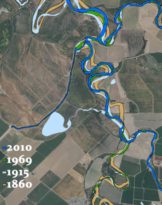
I want to create polygons from NAIP or drone images of a stream over a period of time such as shown below. I am trying to find an efficient way to trace the stream channel in an automated way rather than tracing the stream channel manually (Which becomes very tedious for a bigger area). I tried without success this Image classification tutorial, https://youtu.be/6rWKle3DrD and I will appreciate it if anyone can help.
Thank you in advance.