- Home
- :
- All Communities
- :
- Products
- :
- ArcGIS Pro
- :
- ArcGIS Pro Questions
- :
- Re: Select polygons that share an intersected poly...
- Subscribe to RSS Feed
- Mark Topic as New
- Mark Topic as Read
- Float this Topic for Current User
- Bookmark
- Subscribe
- Mute
- Printer Friendly Page
Select polygons that share an intersected polygon from a separate layer
- Mark as New
- Bookmark
- Subscribe
- Mute
- Subscribe to RSS Feed
- Permalink
So I have a feeling the simplest way to solve my problem may just be for me to manually go over the data but here it goes.
I need to select all the of parcels that have more than 1 land use zone. So for example, I have a parcel polygon that is intersected by 2 zone polygons and I have a lot of them. I need to create a layer to show only those parcels that have multiple zones. Is it even possible to automate this even if it requires some manual clean up afterwords?
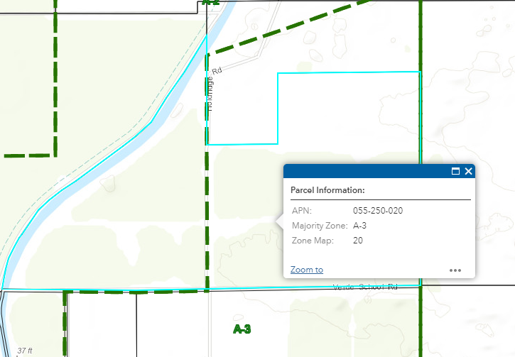
In the image above shows the selected parcel is in 2 different zones. I have an Arcade expression to show the zone with the highest percentage covering the parcel but now I need to actually select and create a new map showing all the parcels like this.
Any help or advice would be greatly appreciated.
Thank you,
Derek
- Mark as New
- Bookmark
- Subscribe
- Mute
- Subscribe to RSS Feed
- Permalink
Do you have access to ArcGIS Pro or ArcMap?
- Mark as New
- Bookmark
- Subscribe
- Mute
- Subscribe to RSS Feed
- Permalink
I have access to both.
- Mark as New
- Bookmark
- Subscribe
- Mute
- Subscribe to RSS Feed
- Permalink
In ArcGIS Pro
Run the Union tool on the Parcels and Zone
You will get an output
Then on the output run the Summarize tool on the ParcelID - using Count as the Statistic
You will get an output of Parcels that are part of more than one zone
Now you can add a join - using the ParcelID on the Polygons and use the parcel ID of the summary table
Then you can use a select by attributes or definition query to display features that cross two land use zones
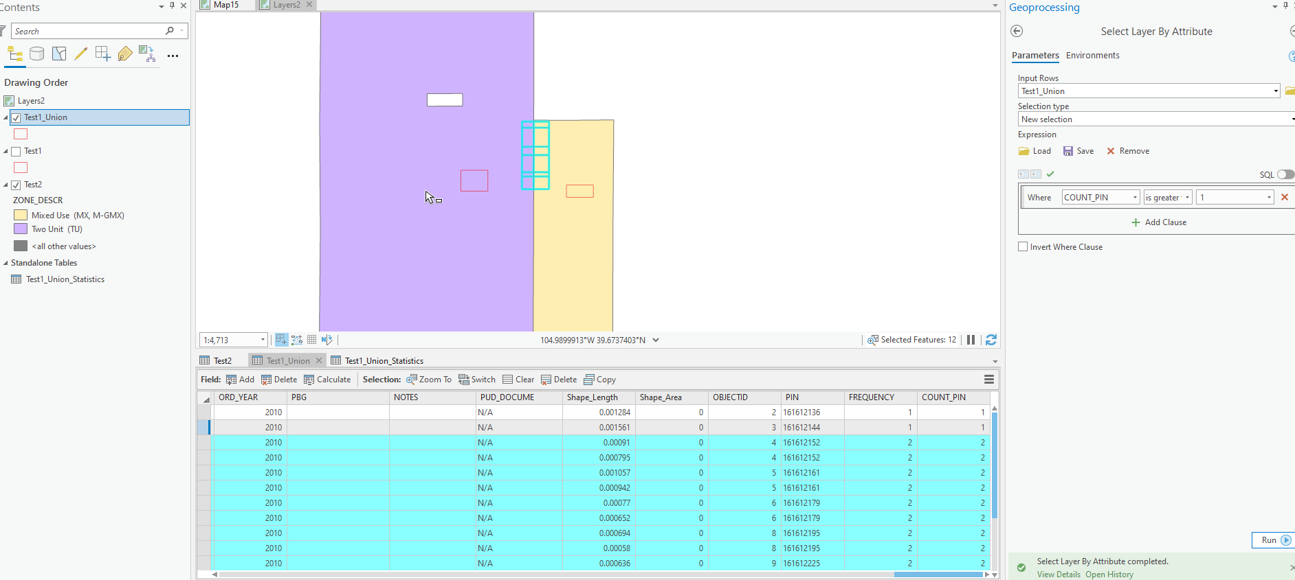
Once they are selected you could export the layer to a new Feature Class
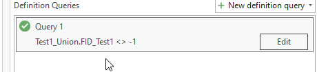
(Also I ran a definition query on the Union where Parcels was not -1) to only display parcels that were within a land use. (Otherwise empty zones would appear)
Hope that this helps