- Home
- :
- All Communities
- :
- Products
- :
- ArcGIS Pro
- :
- ArcGIS Pro Questions
- :
- Re: Reshape Edges Topology: Edge extent
- Subscribe to RSS Feed
- Mark Topic as New
- Mark Topic as Read
- Float this Topic for Current User
- Bookmark
- Subscribe
- Mute
- Printer Friendly Page
- Mark as New
- Bookmark
- Subscribe
- Mute
- Subscribe to RSS Feed
- Permalink
Hello. I am currently using topology-enabled reshape edges tool to fix some drainage basins.
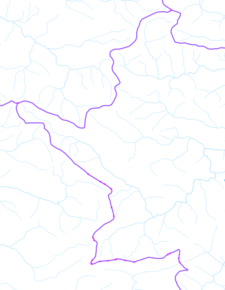
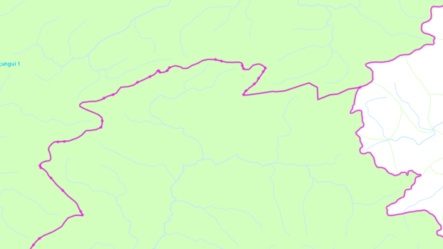
When I select the edges on my polygons, some of them are all nice and cool, the whole edge is a single edge, like the upper one on the image below. But for some reason, other edges appear completely shattered into pieces, like the lower one on the image, with all the pink dots. You can see there is no other polygon for there to be multiple intersection points.
I tried selecting multiple edges and drawing a single line, but the error occurs then. What could be causing this?
Solved! Go to Solution.
Accepted Solutions
- Mark as New
- Bookmark
- Subscribe
- Mute
- Subscribe to RSS Feed
- Permalink
Thx for the feedback! So I now wonder if there are gaps/overlaps in your polygon FC. Are you able to create a geodatabase topology and add rules "must not have gaps" and "must not have overlaps"?
- Mark as New
- Bookmark
- Subscribe
- Mute
- Subscribe to RSS Feed
- Permalink
Hmmm...this is odd. I wonder if what you're seeing are pseudonodes. According to the web - "The definition of Pseudo node is "Pseudo nodes occur where a single line connects with itself or where only two Polylines intersect." Let's try something to confirm. run the Multipart to Singlepart GP tool in ArcGIS Pro and then apply your Map Topology workflow again. Do you see the same as before?
- Mark as New
- Bookmark
- Subscribe
- Mute
- Subscribe to RSS Feed
- Permalink
Did the multipart to single part... they are still around lol
It only happens on a few specific edges, specifically between the limits of the major basins. So I guess something must've happened in the past when joining the features from different sources. My org has only recently switched from Map to Pro so there's that too.
I'm using Reshape Feature and Align Features for these cases. Thanks anyway!
- Mark as New
- Bookmark
- Subscribe
- Mute
- Subscribe to RSS Feed
- Permalink
Thx for the feedback! So I now wonder if there are gaps/overlaps in your polygon FC. Are you able to create a geodatabase topology and add rules "must not have gaps" and "must not have overlaps"?
- Mark as New
- Bookmark
- Subscribe
- Mute
- Subscribe to RSS Feed
- Permalink
Hey! I just ran "Find Overlaps" GP tool and there were a bunch of tiny thin gaps and overlaps between those features. I'm doing Reshape to fix them. Is there a tool to find all gaps and overlaps and/or to fix them automatically?
- Mark as New
- Bookmark
- Subscribe
- Mute
- Subscribe to RSS Feed
- Permalink
I bet that's what's causing your pink nodes. You could create the GDB topology in a feature dataset and use the Error Inspector to find and correct gaps/overlaps.
- Mark as New
- Bookmark
- Subscribe
- Mute
- Subscribe to RSS Feed
- Permalink
Thanks, it worked! I actually didn't know about gdb dataset topology until now, most here are still used to stacking shapefiles and I only started with pro a few months ago, no this will be very useful in the future.
- Mark as New
- Bookmark
- Subscribe
- Mute
- Subscribe to RSS Feed
- Permalink
My best guess: there are other features that participate in the geodatabase topology that are not in the map (assuming you are using one and not just a map topology)
- Mark as New
- Bookmark
- Subscribe
- Mute
- Subscribe to RSS Feed
- Permalink
To manually clean up overlaps and gaps, you could use the Align Edge tool. This tool will work with geodatabase and map topologies.
- on Edit tab, specify the Topology to use
- from Modify Features pane, choose Align Edge-> edges are displayed with magenta symbology
- Hover the mouse cursor over the edge to align--> it will display with solid yellow line and possible target edges are shown with a dashed yellow line.
- If target is correct, click the edge to move it
- Mark as New
- Bookmark
- Subscribe
- Mute
- Subscribe to RSS Feed
- Permalink
Based on your data being in shapefile format, I bet many polygons that are supposed to be adjacent were not created correctly by using the snapping, autocomplete polygon, or trace tools. I bet there are many feature classes that have gaps an overlaps between polygons that are supposed to be coincident. Instead of fixing all your "braided" digitization one overlapping segment at a time, or even searching for them using gdb topology, if you find gaps and overlaps, I would just assume that the entire feature needs alignment and use the Align Features tool.


