- Home
- :
- All Communities
- :
- Products
- :
- ArcGIS Pro
- :
- ArcGIS Pro Questions
- :
- Re: Publishing Errors 00216 and 00230
- Subscribe to RSS Feed
- Mark Topic as New
- Mark Topic as Read
- Float this Topic for Current User
- Bookmark
- Subscribe
- Mute
- Printer Friendly Page
- Mark as New
- Bookmark
- Subscribe
- Mute
- Subscribe to RSS Feed
- Permalink
When trying to publish a map I receive two errors. The first is a 00216 Map does not contain a base map. That is easy to fix and I add one but then it results in a 00230 Service layer has a different projection than the maps's projection. I can remove the base map layer as that is what is the one using a different projection but then I am back to the first error. Why do our layers have to match the WGS 1984 projection coordinate system of the basemap. Is there a way around this?
I found someone with a the same issue. coordinate system - Map Publishing Issues? ArcGIS Pro - Geographic Information Systems Stack Exchang...
Solved! Go to Solution.
Accepted Solutions
- Mark as New
- Bookmark
- Subscribe
- Mute
- Subscribe to RSS Feed
- Permalink
You could create a vector tile service in your coordinate system of choice to use as a basemap.
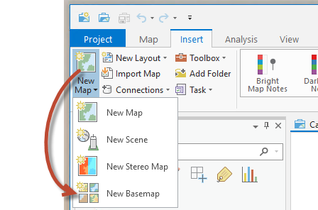
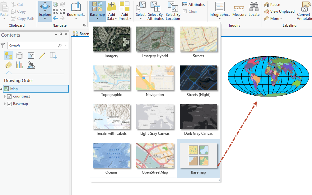
Insert a New Basemap
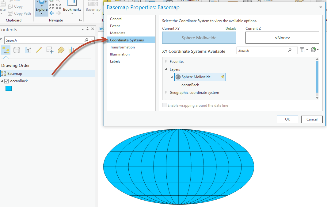
Choose data in the coordinate system you need and set the basemap coordinate system to match it.
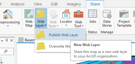
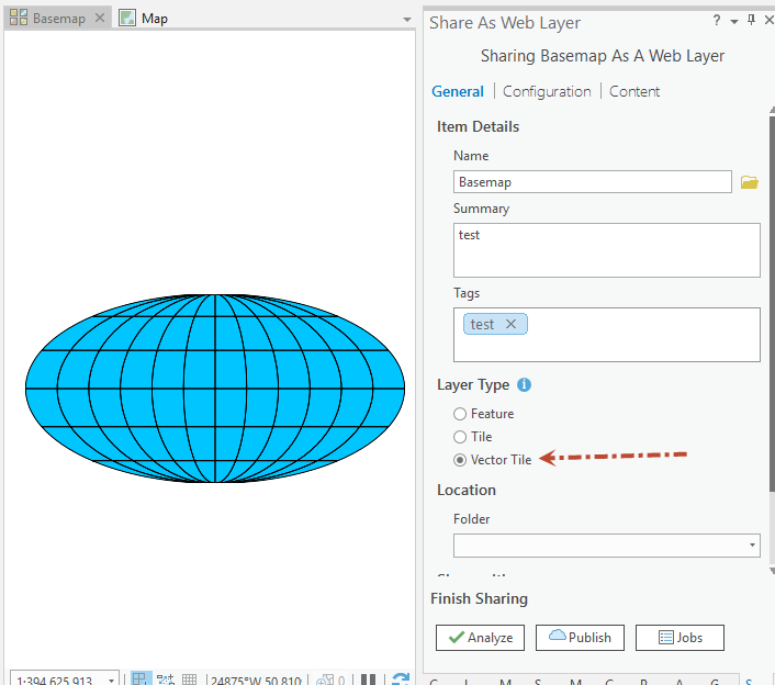
then share this layer as a web layer in the vector tile format.
Then add this service to your basemap and remove the original source data.

This will give you a basemap to use in the coordinate system you want.
Add operational layer to your MapView and select the basemap that is using the Vector Tile layer you created. Set your maps coordinate system to match the basemap.
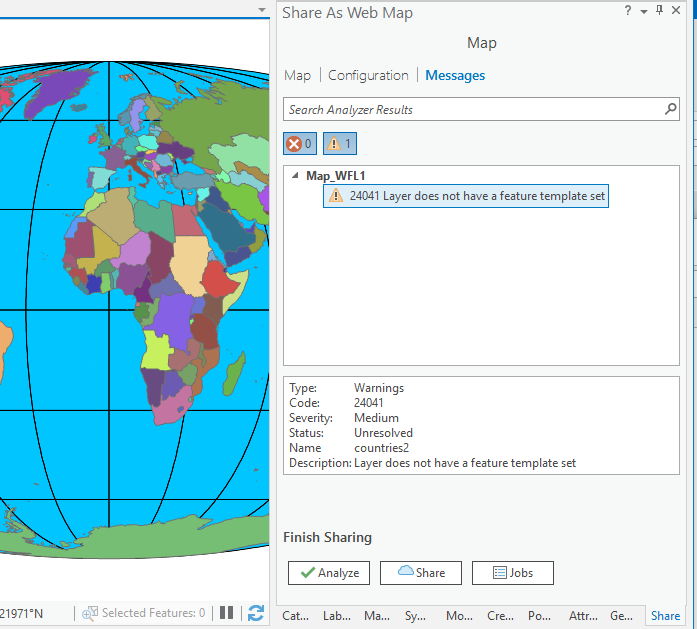
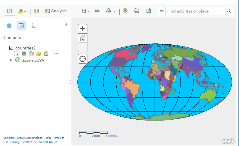
When you share this as a webmap, No errors about coordinate system or basemap.
And it looks like this on ArcGIS Online in the MapViewer
Mark
- Mark as New
- Bookmark
- Subscribe
- Mute
- Subscribe to RSS Feed
- Permalink
You could create a vector tile service in your coordinate system of choice to use as a basemap.
Insert a New Basemap
Choose data in the coordinate system you need and set the basemap coordinate system to match it.
then share this layer as a web layer in the vector tile format.
Then add this service to your basemap and remove the original source data.
This will give you a basemap to use in the coordinate system you want.
Add operational layer to your MapView and select the basemap that is using the Vector Tile layer you created. Set your maps coordinate system to match the basemap.
When you share this as a webmap, No errors about coordinate system or basemap.
And it looks like this on ArcGIS Online in the MapViewer
Mark
- Mark as New
- Bookmark
- Subscribe
- Mute
- Subscribe to RSS Feed
- Permalink
Thank you!