Turn on suggestions
Auto-suggest helps you quickly narrow down your search results by suggesting possible matches as you type.
Cancel
- Home
- :
- All Communities
- :
- Products
- :
- ArcGIS Pro
- :
- ArcGIS Pro Questions
- :
- Re: My density map being "squared off"
Options
- Subscribe to RSS Feed
- Mark Topic as New
- Mark Topic as Read
- Float this Topic for Current User
- Bookmark
- Printer Friendly Page
My density map being "squared off"
1440
4
12-10-2019 05:50 AM

12-10-2019
05:50 AM
- Mark as New
- Bookmark
- Subscribe to RSS Feed
- Permalink
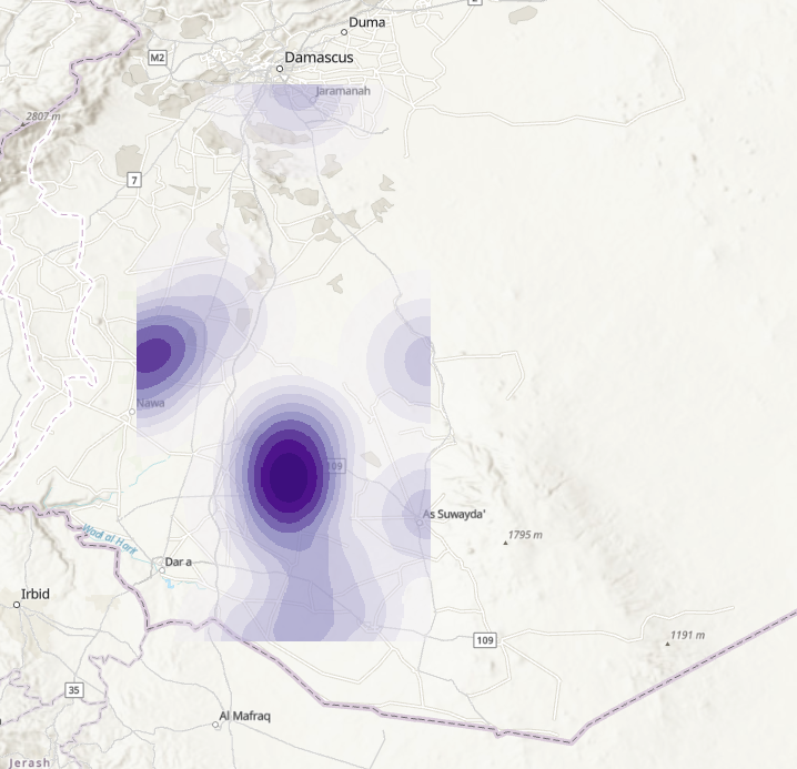
Hi Guys!
New to arcGIS and trying to find out why my density map is being "squared off" like this. I've been testing out a bunch of different settings but to no avail.
Any tips?
4 Replies


12-10-2019
06:24 AM
- Mark as New
- Bookmark
- Subscribe to RSS Feed
- Permalink
Hi Megan, thanks for replying.
Yes, sorry, it's in Pro. I use the standard settings and population field "NONE"

by
Anonymous User
Not applicable
12-10-2019
06:26 AM
- Mark as New
- Bookmark
- Subscribe to RSS Feed
- Permalink
You need to set your extents in the geoprocessing environment to be a larger extent. In Pro, it is in the tools Environments tab>Extent>Choose a layer that is larger than the dataset that you are running the tool on.
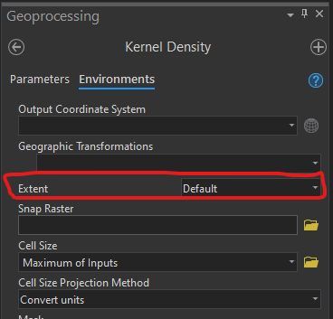
In ArcMap this is in the tools environment menu>processing extent> Extent. Choose a layer that is larger than the dataset that you are running the tool on.
12-10-2019
11:05 PM
- Mark as New
- Bookmark
- Subscribe to RSS Feed
- Permalink
That's it! Thanks a bunch