- Home
- :
- All Communities
- :
- Products
- :
- ArcGIS Pro
- :
- ArcGIS Pro Questions
- :
- merge tool arcpro
- Subscribe to RSS Feed
- Mark Topic as New
- Mark Topic as Read
- Float this Topic for Current User
- Bookmark
- Subscribe
- Mute
- Printer Friendly Page
merge tool arcpro
- Mark as New
- Bookmark
- Subscribe
- Mute
- Subscribe to RSS Feed
- Permalink
I have every municipality in my county separated and exported as different shapefiles. In the attribute table of each of these municipalities I have the Shape_Area which is calculated by the software and I have it separated by landscape type (Agricultural, urban, rural). Now, in some of the municipality shape file attribute tables there is more than one field for a type of landscape so as an example, I have two polygons for agriculture. I want to merge those into one. I use the merge tool and merge them together. I add the total shape area before hand and compare it with what I get afterwards to make sure it's correct. Sometimes this works, but I'm also running into the problem where it subtracts the shape_area amount of just gives me a totally random number? Would anyone be able to help explain why this is happening. I don't change any of the commands, it's just I use the tool for the merge for different parcels, but the type of data is the same. Thank you.
- Mark as New
- Bookmark
- Subscribe
- Mute
- Subscribe to RSS Feed
- Permalink
an example would help where this occurs. A random appearance may actually have a source, like creating holes in the geometry
- Mark as New
- Bookmark
- Subscribe
- Mute
- Subscribe to RSS Feed
- Permalink
I'll post a couple screenshots.
- Mark as New
- Bookmark
- Subscribe
- Mute
- Subscribe to RSS Feed
- Permalink
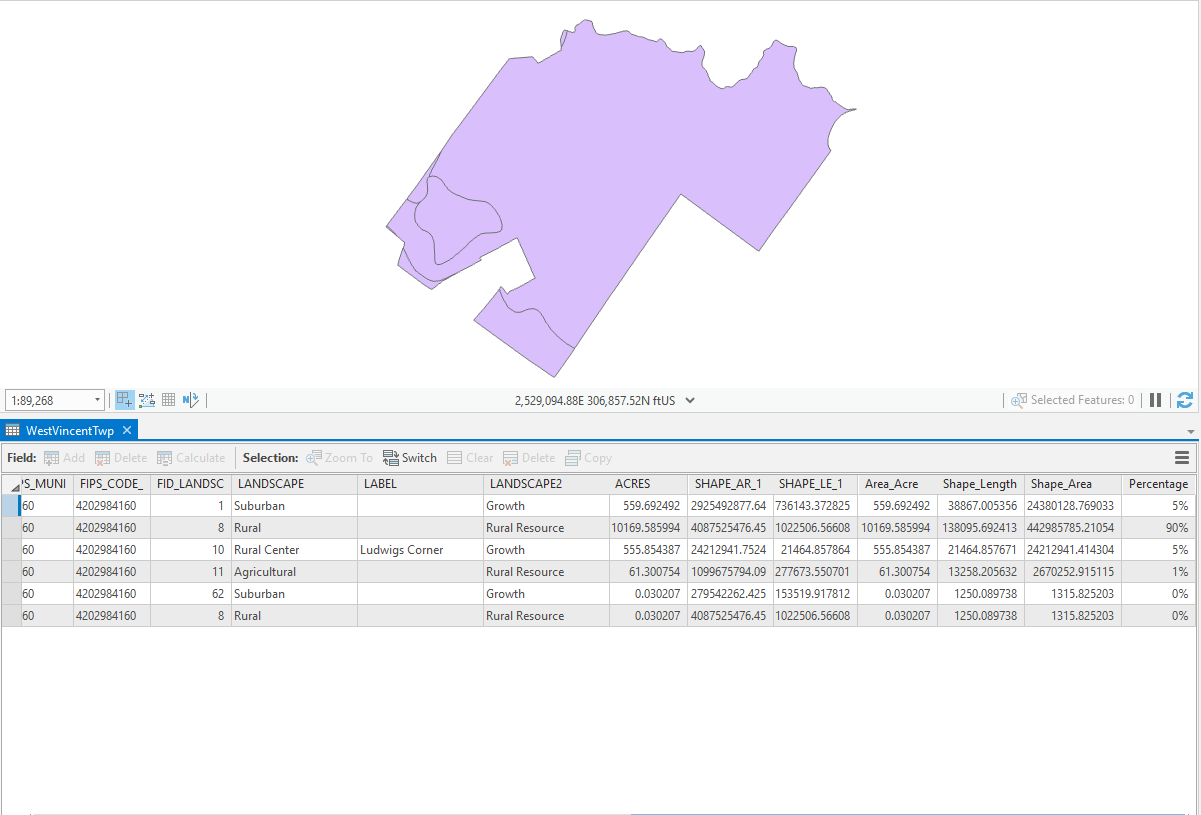 This picture is an example of what my shapefile and attribute table looks like before the merge. Notice, I have two rows for rural and those are what I want to combine. Now if we add the shape area colum for only those two polygons it should equal 44298101.04 roughly.
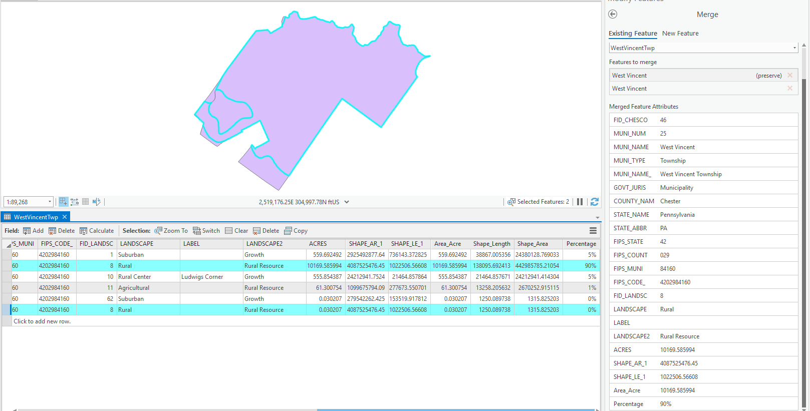 So in this next picture I selected them and used the merge tool. I picked the feature that has the most "space" to preserve although I don't know if that is important or not.
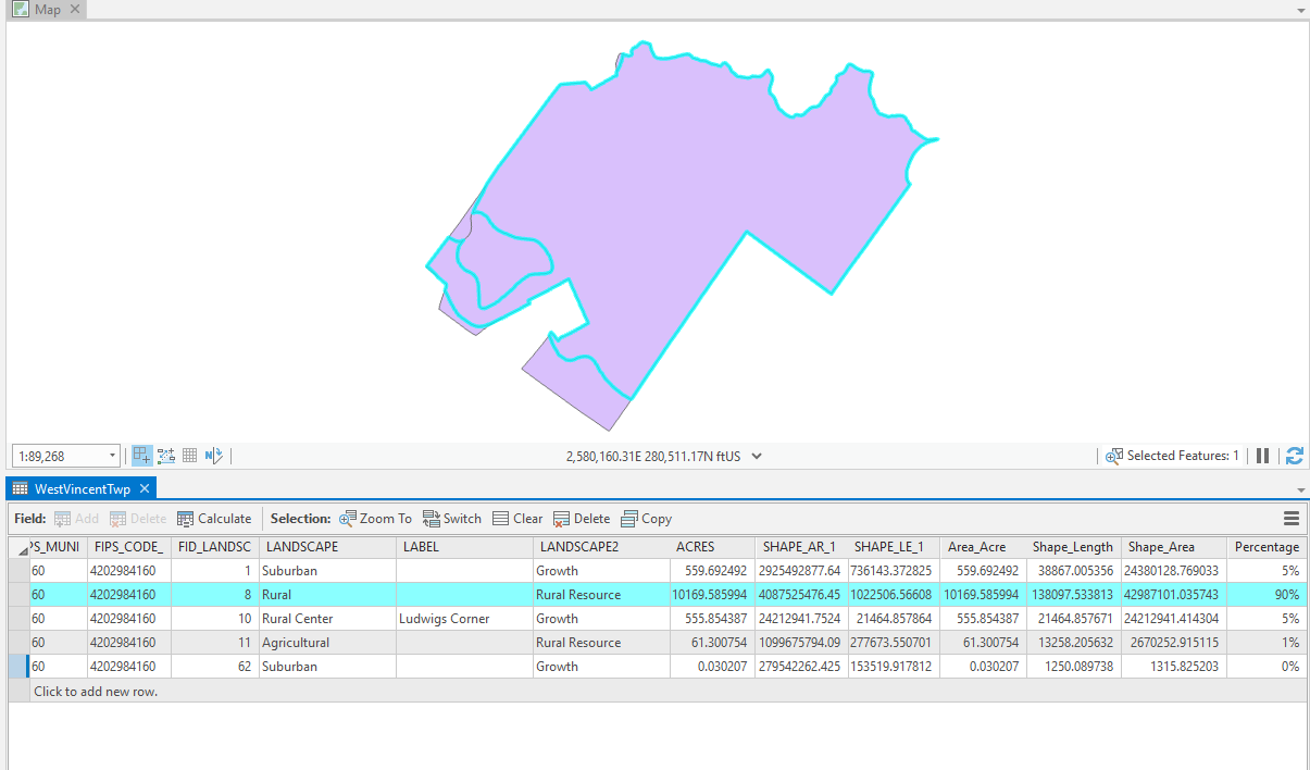 So once they are merged I get a totally different shape area, but it's less than what the combined number would be.
- Mark as New
- Bookmark
- Subscribe
- Mute
- Subscribe to RSS Feed
- Permalink
I think you want to
- Mark as New
- Bookmark
- Subscribe
- Mute
- Subscribe to RSS Feed
- Permalink
That does work nicely and gives me the dissolve for that field, however; the percentage field that you see is included in all of the attribute tables of each county (73 in total). I will recreate them if it's a must, but I was hoping to avoid that. Thank you for the response times by the way.
- Mark as New
- Bookmark
- Subscribe
- Mute
- Subscribe to RSS Feed
- Permalink
Benny:
Are you processing your data on a local drive or on a network drive?
- Mark as New
- Bookmark
- Subscribe
- Mute
- Subscribe to RSS Feed
- Permalink
Network