- Home
- :
- All Communities
- :
- Products
- :
- ArcGIS Pro
- :
- ArcGIS Pro Questions
- :
- Labeling training data for deep learning - Vehicle...
- Subscribe to RSS Feed
- Mark Topic as New
- Mark Topic as Read
- Float this Topic for Current User
- Bookmark
- Subscribe
- Mute
- Printer Friendly Page
Labeling training data for deep learning - Vehicle tracks
- Mark as New
- Bookmark
- Subscribe
- Mute
- Subscribe to RSS Feed
- Permalink
Hi everybody,
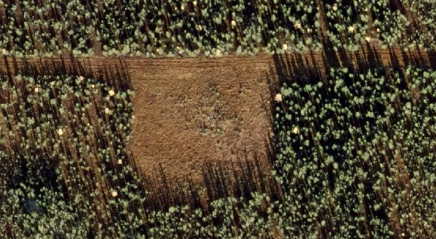
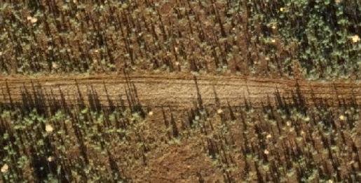
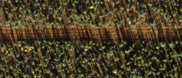
I am trying to detect vehicle tracks in forest cutlines on large rasters from airborne photography (15cm resolution) to derive information on which of those linear features are used by off-highway vehicles. I have been struggling to find satisfactory labeling methods through the "Label objects for deep learning" function in ArcGis 2.9.
So far I tried working with the MaskRCNN labeling format for object detection as well as Classified Tiles with the U-net model for semantic segmentation.
The issue is that the 'objects' I am trying to detect sometimes span along the entire raster, however, some parts are obstructed by shadows or canopy, and in some parts several tracks are visible (see attached pictures). I therefore only drew the label classes around segments where there was no obstruction and one could clearly identify two parallel lines from vehicle use.
If would appreciate if anyone could point me to similar projects or has suggestions on how to create higher quality training data.
Thank you!
- Mark as New
- Bookmark
- Subscribe
- Mute
- Subscribe to RSS Feed
- Permalink
Hi Patrick,
So, independent of the model used, I usually go for the end result. In your case, I would label the shadowed tracks as well, otherwise your AI won't be able to identify it. Think of it like you are trying to tell the AI what the end result is. If you want it identifying a single track, then you need to train it on single track, and take down the padding variable if the tracks are close to each other.
In your case, I would try to create training samples consisting of long and short segments, and single track, spanning over different lightning conditions. (Shadow / Not shadow). That way the AI should understand what to look for.
Just as a tip, Arcgis Pro 3.0 should have a new interesting model which requires less training samples.
/A