- Home
- :
- All Communities
- :
- Products
- :
- ArcGIS Pro
- :
- ArcGIS Pro Questions
- :
- Issue geocoding latitude and longitude
- Subscribe to RSS Feed
- Mark Topic as New
- Mark Topic as Read
- Float this Topic for Current User
- Bookmark
- Subscribe
- Mute
- Printer Friendly Page
Issue geocoding latitude and longitude
- Mark as New
- Bookmark
- Subscribe
- Mute
- Subscribe to RSS Feed
- Permalink
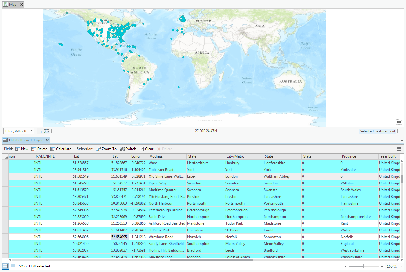
I'm trying to geocode addresses based on longitude and latitude and only about 90% of my addresses get plotted. Any idea why? I can't see any difference from the co-ordinances that get plotted and the ones that don't.
- Mark as New
- Bookmark
- Subscribe
- Mute
- Subscribe to RSS Feed
- Permalink
can't tell from the map or table, but are you suggesting that the ones that you have selected don't get geocoded and plotted because they have a positive longitude? there is some discussion and clarification in the help About finding an address—ArcGIS Pro | ArcGIS for Desktop
- Mark as New
- Bookmark
- Subscribe
- Mute
- Subscribe to RSS Feed
- Permalink
Dan, it seems that it won't plot the point if it has a positive longitude. I'm using the "Make XY Event Layer" tool. Could it be that I'm using the wrong spatial reference?
Thanks for your help!
- Mark as New
- Bookmark
- Subscribe
- Mute
- Subscribe to RSS Feed
- Permalink
You should be using a geographic coordinate system... presumably a GCS WGS-84 which is pretty standard for decimal degree coordinates, particularly on a global scale and or derived GPS data or unprojected global maps.
- Mark as New
- Bookmark
- Subscribe
- Mute
- Subscribe to RSS Feed
- Permalink
We are using this spatial reference. Are there any other troubleshooting steps to take?
- Mark as New
- Bookmark
- Subscribe
- Mute
- Subscribe to RSS Feed
- Permalink
I will have to look further. The link I posted said, however, in reference to long/lat coordinates
No specific locators are needed in the project for finding these x,y locations. ArcGIS Pro supports finding these x,y locations using the Locate pane only.