Turn on suggestions
Auto-suggest helps you quickly narrow down your search results by suggesting possible matches as you type.
Cancel
- Home
- :
- All Communities
- :
- Products
- :
- ArcGIS Pro
- :
- ArcGIS Pro Questions
- :
- Re: Is there a way to keep AGP from lowering the S...
Options
- Subscribe to RSS Feed
- Mark Topic as New
- Mark Topic as Read
- Float this Topic for Current User
- Bookmark
- Subscribe
- Mute
- Printer Friendly Page
Is there a way to keep AGP from lowering the Surface resolution when zooming out?
Subscribe
2516
1
06-07-2016 06:07 AM
06-07-2016
06:07 AM
- Mark as New
- Bookmark
- Subscribe
- Mute
- Subscribe to RSS Feed
- Permalink
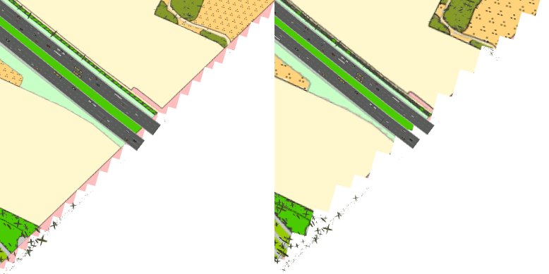
I'm using a custom elevation raster (1 meter cell size) for a polygon layer in a scene. When I zoom out, AGP lowers the surface resolution drastically, leading to cut off polygon edges - see GIF below. Can I somehow prevent this? It doesn't happen in ArcScene (which on the other hand doesn't drape the polygon over the surface as nicely as AGP).

1 Reply
06-27-2016
01:28 PM
- Mark as New
- Bookmark
- Subscribe
- Mute
- Subscribe to RSS Feed
- Permalink
Recommended solution is to use TIN, if you want to keep surface resolution constant