- Home
- :
- All Communities
- :
- Products
- :
- ArcGIS Pro
- :
- ArcGIS Pro Questions
- :
- Re: Insert individual map in mailing piece
- Subscribe to RSS Feed
- Mark Topic as New
- Mark Topic as Read
- Float this Topic for Current User
- Bookmark
- Subscribe
- Mute
- Printer Friendly Page
Insert individual map in mailing piece
- Mark as New
- Bookmark
- Subscribe
- Mute
- Subscribe to RSS Feed
- Permalink
I'm designing a brochure to individual property owners and would like to insert a personalize map on each piece based upon the location of their property, such as in the following example...
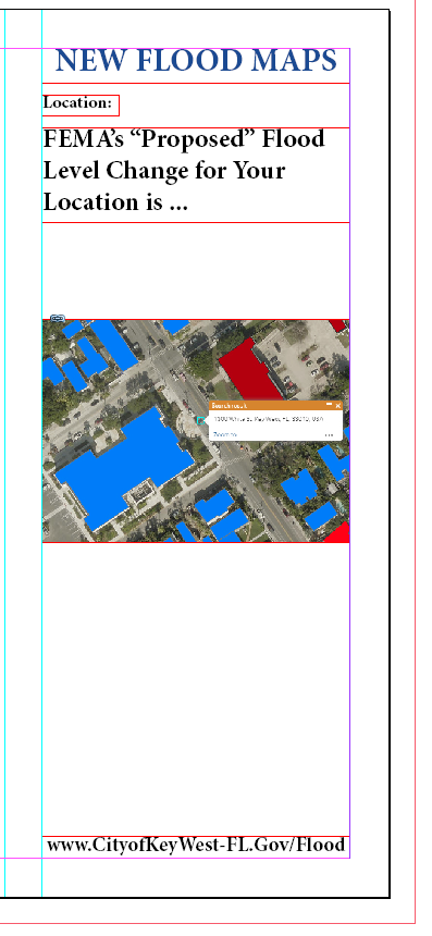
So, much like a mail-merge field, a map of their property would show on the piece.
It'd have to be automated, as there are 8k of them to be mailed.
Has such a thing been done before?
- Mark as New
- Bookmark
- Subscribe
- Mute
- Subscribe to RSS Feed
- Permalink
It sounds like you could do what you want with Map series—Layouts | ArcGIS Desktop and dynamic text pulled from attributes.
- Mark as New
- Bookmark
- Subscribe
- Mute
- Subscribe to RSS Feed
- Permalink
Hi Scott,
Along with Kory's suggestion to use Map Series, you may also want to consider automating your work using python. Here are some links to help you get started.
Introduction to arcpy.mp—ArcPy | ArcGIS Desktop
Guidelines for arcpy.mp—ArcPy | ArcGIS Desktop
MapSeries—ArcPy | ArcGIS Desktop
Hope this helps,
Tom