- Home
- :
- All Communities
- :
- Products
- :
- ArcGIS Pro
- :
- ArcGIS Pro Questions
- :
- Re: How to set a perimeter around a point using st...
- Subscribe to RSS Feed
- Mark Topic as New
- Mark Topic as Read
- Float this Topic for Current User
- Bookmark
- Subscribe
- Mute
- Printer Friendly Page
How to set a perimeter around a point using streets
- Mark as New
- Bookmark
- Subscribe
- Mute
- Subscribe to RSS Feed
- Permalink
Hi there,
I am looking for a way to set a perimeter around a point using streets.
The streets are necessary to determine the blind spots on the streets.
A buffer can't be used because a pipeline of 1200m running down a street is a totaly different thing.
Anyone know how to do this?
- Mark as New
- Bookmark
- Subscribe
- Mute
- Subscribe to RSS Feed
- Permalink
Could you describe the scenario with a graphical example (screenshot)?
Think Location
- Mark as New
- Bookmark
- Subscribe
- Mute
- Subscribe to RSS Feed
- Permalink
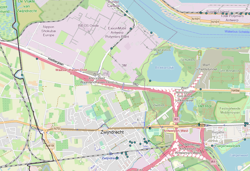
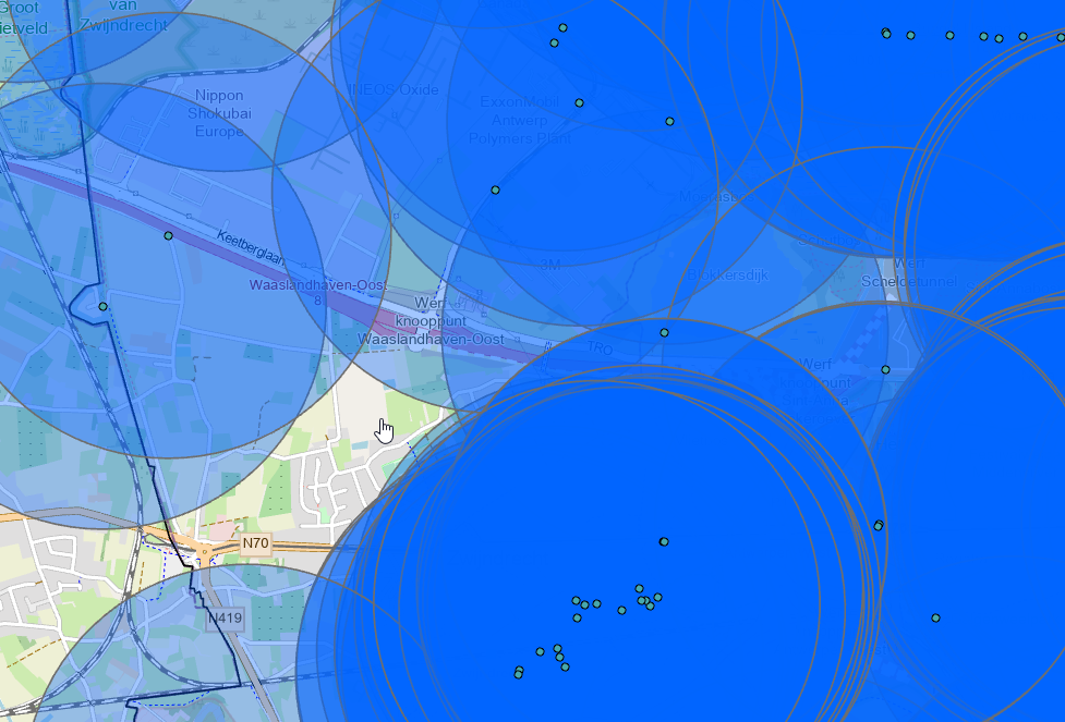
Yes, I work for a firefighter department.
When there is a big fire we use the hydrants with a bigger diameter.
Those are projected (the pointe) on the map in the atachment.
We can use them up to 1200 meters away from the fire, that is the lenght of hoses we can use.
In order to find blindspots I wanted to place a perimeter around those points.
The condition is that this perimeter uses the streets, not a circle around the point like the 'buffer'. This because our hoses don't go over buildings, only around them on the street.
You can see a map with only the hydrants and a map with the buffers on the hydrants.
- Mark as New
- Bookmark
- Subscribe
- Mute
- Subscribe to RSS Feed
- Permalink
your options would be to buffer one side or offset polyline, in either case you will have to spatially select your polylines based on their proximity to the points, also you would probably not find one simple solution since the buffer and offset options require that you know the direction that the polyline travels
... sort of retired...
- Mark as New
- Bookmark
- Subscribe
- Mute
- Subscribe to RSS Feed
- Permalink
So you want distance along the roads from a bunch of "origins"
This is a "service area" or generically a constrained spatial allocation question.
Service area can be solved using the Network Analyst extension but it can also be emulated using the Spatial Analyst extension.
... sort of retired...
- Mark as New
- Bookmark
- Subscribe
- Mute
- Subscribe to RSS Feed
- Permalink
If you have a ROW polygon feature class, you can use that for the Extent (Environment Setting) of the Buffer GP tool and have the output "clipped" to the ROW polygon as it were. The output is not a circular buffer rather just the buffered areas that fall within the ROW polygon FC extent.