- Home
- :
- All Communities
- :
- Products
- :
- ArcGIS Pro
- :
- ArcGIS Pro Questions
- :
- How can I make my layers sit together?
- Subscribe to RSS Feed
- Mark Topic as New
- Mark Topic as Read
- Float this Topic for Current User
- Bookmark
- Printer Friendly Page
How can I make my layers sit together?


- Mark as New
- Bookmark
- Subscribe to RSS Feed
- Permalink
One is in a geographic coordinate system and the other is a projected one.
Your second one seems to be an event theme, you should convert it a featureclass in a file geodatabase.
I would check that both then have a properly defined coordinate system at that point. If they do, they should project on the fly in a map. If they don't, then one of them was defined incorrectly.
I would also check the point layer's x, y values to see if they make sense
... sort of retired...



- Mark as New
- Bookmark
- Subscribe to RSS Feed
- Permalink
I believe the XY coordinates from Excel is in "WGS_1984_UTM_Zone_56S". Kindly use this coordinate system while creating the Event Layer from the Excel.
Once the data lies properly, you may reproject the coordinate system to a desired one using Project tool.
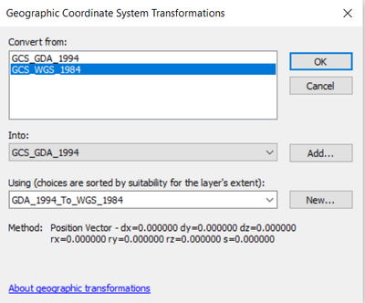
If prompted for transformation (while adding the second layer to Map), you could use the following transformation method.
Think Location
- Mark as New
- Bookmark
- Subscribe to RSS Feed
- Permalink
May I ask you, how did you determine these were the coordinates in the excel file?
Christine
- Mark as New
- Bookmark
- Subscribe to RSS Feed
- Permalink
Glad it worked. Don't forget to mark "Accept as Solution" for the reply that addressed your problem.
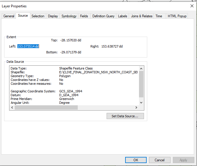
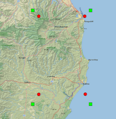
I took the coordinate values from the extent of your layer (from XY Table), and I created a CSV file with 4 values.
First I defined GDA_1994_Albers as the coordinate system (Make XY Event Layer). That didn't go as per the expected resultant.
Then I thought of using some commonly known Projected Coordinate Systems like UTM_WGS_1984 and Web Mercator (Auxiliary Sphere).
As per the extent of your shapefile, 56S is the correct UTM Zone for the area. When I defined the same coordinate system, while creating the XY Event Layer. The event layer was overlaying on top of the shapefile's extent.
Identifying an unknown coordinate system—ArcMap | Documentation (arcgis.com)
Think Location
