- Home
- :
- All Communities
- :
- Products
- :
- ArcGIS Pro
- :
- ArcGIS Pro Questions
- :
- Help - Merging Point Features
- Subscribe to RSS Feed
- Mark Topic as New
- Mark Topic as Read
- Float this Topic for Current User
- Bookmark
- Subscribe
- Mute
- Printer Friendly Page
Help - Merging Point Features
- Mark as New
- Bookmark
- Subscribe
- Mute
- Subscribe to RSS Feed
- Permalink
Hi, I'm using ArcGIS Pro for undergraduate research, and am trying to map a dataset which is in three different coordinate systems (Irish Transverse Mercator, Irish Grid, WGS). This dataset should produce a map showing point data.
As ArcGIS doesn't allow for multiple coordinate systems in one dataset, I split the csv file containing the data into three separate csv files. I input these into ArcGIS and projected them into the ITM coordinate system matching my basemap.
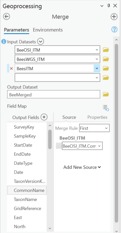
Here's where my problem comes in, when I try to merge these three sets of point data using the merge feature, half of the dataset appears to have null values. I'm not sure what I'm doing wrong. Please find attached an image of what I'm inputting into the merge function, and what is coming out.
- Mark as New
- Bookmark
- Subscribe
- Mute
- Subscribe to RSS Feed
- Permalink
Are the field names and field data type the same across the merged datasets? Otherwise obviously there would be null values from one dataset which doesn't match the same field name or type and a new field has to be added to the merged output. There's not quite enough info to go on from your current screenshots.
- Mark as New
- Bookmark
- Subscribe
- Mute
- Subscribe to RSS Feed
- Permalink
Hi David, the field names are identical across all three datasets, as they come from the same original csv file split into three. It's possible it's recognising different field data types for each dataset which I'm looking into. Thanks for your response!
- Mark as New
- Bookmark
- Subscribe
- Mute
- Subscribe to RSS Feed
- Permalink
Updating this, I think it is a field data type issue, but the issue is that the coordinate systems are completely different so it's recognising the East and North data in one dataset as double, and the other two as long. I've tried creating a new field and copying it over, as I can't edit the type directly, and it won't copy over the digits after the decimal place, which is an issue as it's longitude and latitude.
- Mark as New
- Bookmark
- Subscribe
- Mute
- Subscribe to RSS Feed
- Permalink
Can you screenshot the attribute tables and data type of each table.