- Home
- :
- All Communities
- :
- Products
- :
- ArcGIS Pro
- :
- ArcGIS Pro Questions
- :
- Having trouble trying to figure out why the altitu...
- Subscribe to RSS Feed
- Mark Topic as New
- Mark Topic as Read
- Float this Topic for Current User
- Bookmark
- Subscribe
- Mute
- Printer Friendly Page
Having trouble trying to figure out why the altitude on my DEM doesn't match the altitude on Google Earth.
- Mark as New
- Bookmark
- Subscribe
- Mute
- Subscribe to RSS Feed
- Permalink
- Report Inappropriate Content
In the realization of my master's thesis in archaeology, I aimed to perform a visibility analysis of the territory in order to understand the territorial control of these settlements before the valley/communication routes. So, I went in search of a Global Digital Model (this data comes from ASTER, more specifically - ASTGTMV003_N41W008-).
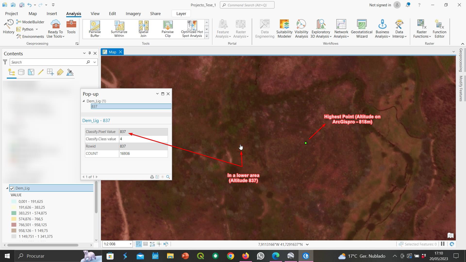
My doubt is highlighted with the following: although I know that there is always a standard deviation when it comes to altitude, I realized that this model has been criticized for having a maximum standard deviation of about 9m (in some areas). So, is there any way to correct that error? (like for instance, through the "Observer offset" field in the "Visibility" analysis) Or simply, leave it that way and explain in the thesis this issue? I must emphasize that I have already used this DEM in other analyses, so changing it for another one may modify the results previously acquired. What do you suggest me to do?
Another question that may be my fault, and maybe it is the root of all these problems. I notice that when I search for the altitude of these places (because I need to know the highest point of these settlements), that same altitude does not seem to match the place in reality. Could this be related to the simple choice of the coordinate system (i chosed the ETRS1989 Portugal TM06), the same that i used on QGIS ?
Version: ArcGisPro 3.0.1