- Home
- :
- All Communities
- :
- Products
- :
- ArcGIS Pro
- :
- ArcGIS Pro Questions
- :
- Forest-based classification and regression predict...
- Subscribe to RSS Feed
- Mark Topic as New
- Mark Topic as Read
- Float this Topic for Current User
- Bookmark
- Subscribe
- Mute
- Printer Friendly Page
Forest-based classification and regression predict to raster output empty
- Mark as New
- Bookmark
- Subscribe
- Mute
- Subscribe to RSS Feed
- Permalink
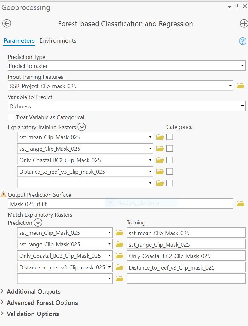
I am trying to use Forest-based classification and regression tool in ArcGIS Pro 2.4.3. My goal is to create a predicted surface using a training datatset (point feature) and explanatory training rasters. All my data is continous. The tool appears to run successfully but my output prediction surface is always empty.
Start Time: Monday, 21 December 2020 1:17:53 PM
Running script Forest...
Random Seed: 699645
Cell Size: 2.50
-------------- Model Characteristics --------------
Number of Trees 100
Leaf Size 5
Tree Depth Range 1-15
Mean Tree Depth 8
% of Training Available per Tree 100
Number of Randomly Sampled Variables 1
% of Training Data Excluded for Validation 10
------------ Model Out of Bag Errors ------------
Number of Trees 50 100
MSE 23.446 22.829
% of variation explained 45.088 46.531
----------------------- Top Variable Importance ------------------------
Variable Importance %
DISTANCE_TO_REEF_V3_CLIP_MASK_025 1871.38 29
ONLY_COASTAL_BC2_CLIP_MASK_025 1627.23 25
SST_RANGE_CLIP_MASK_025 1498.54 23
SST_MEAN_CLIP_MASK_025 1420.19 22
----- Training Data: Regression Diagnostics ------
R-Squared 0.705
p-value 0.000
Standard Error 0.029
*Predictions for the data used to train the model compared to the observed categories for those features
---- Validation Data: Regression Diagnostics -----
R-Squared 0.245
p-value 0.027
Standard Error 0.098
*Predictions for the test data (excluded from model training) compared to the observed values for those test features
--------------------------------------------- Explanatory Variable Range Diagnostics --------------------------------------------
Training Validation Prediction Training Validation Prediction
Variable Minimum Maximum Minimum Maximum Minimum Maximum Share(a) Share(b) Share(c)
SST_MEAN_CLIP_MASK_025 17.06 17.62 17.18 17.55 16.65 17.72 1.00 0.67* 1.91+
SST_RANGE_CLIP_MASK_025 6.60 6.86 6.66 6.84 6.27 7.16 1.00 0.70* 3.46+
ONLY_COASTAL_BC2_CLIP_MASK_025 1.00 3.00 1.00 3.00 1.00 3.68 1.00 1.00* 1.00+
DISTANCE_TO_REEF_V3_CLIP_MASK_025 0.00 2890.70 0.00 1355.60 0.00 3885.24 1.00 0.47* 1.34+
(a) % of overlap between the ranges of the training data and the input explanatory variable
(b) % of overlap between the ranges of the validation data and the training data
(c) % of overlap between the ranges of the training data and the prediction data
* Data ranges do not coincide. Training or validation is occurring with incomplete data.
+ Ranges of the training data and prediction data do not coincide and the tool is attempting to extrapolate.
Temporal File was not removed F:\02_ArcMap\Chpater_4\scratch\nc87172.flt
Completed script Forest-based Classification and Regression...
Succeeded at Monday, 21 December 2020 1:23:44 PM (Elapsed Time: 5 minutes 50 seconds)
Solved! Go to Solution.
Accepted Solutions
- Mark as New
- Bookmark
- Subscribe
- Mute
- Subscribe to RSS Feed
- Permalink
what are the paths to your data?
F:\02_ArcMap\Chpater_4\scratch\nc87172.flt
is a bit concerning since depending on the type of raster you are producing, folders can't begin with a number. Worth a check before you start digging too deep into the forest and check your file management
... sort of retired...
- Mark as New
- Bookmark
- Subscribe
- Mute
- Subscribe to RSS Feed
- Permalink
Thanks changing the location of my geodatabse fixed the issue.