- Home
- :
- All Communities
- :
- Products
- :
- ArcGIS Pro
- :
- ArcGIS Pro Questions
- :
- faulty 3D data display in Pro
- Subscribe to RSS Feed
- Mark Topic as New
- Mark Topic as Read
- Float this Topic for Current User
- Bookmark
- Subscribe
- Mute
- Printer Friendly Page
faulty 3D data display in Pro
- Mark as New
- Bookmark
- Subscribe
- Mute
- Subscribe to RSS Feed
- Permalink
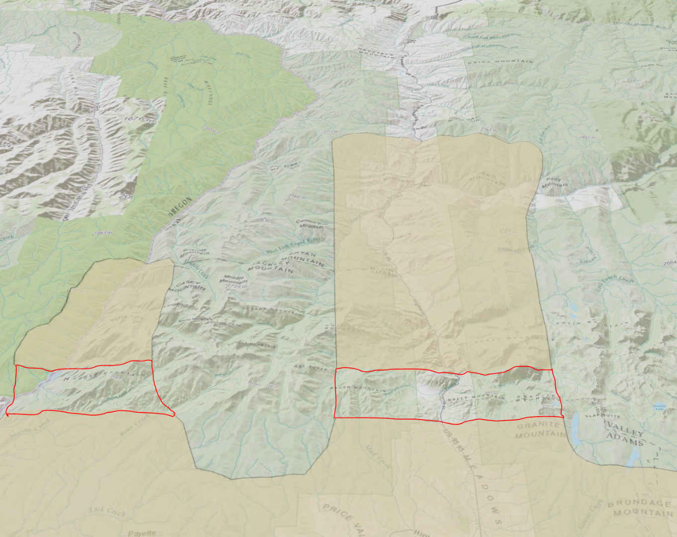
After adding a polygon GDB feature class to pro, there are certain areas of the data that show up as Slivers of no data. This is non-dependent on scale, or where I pan the data to. Only in 3D view. Anyone know why this is happening, and what solutions there may be? See snip.
Thanks - Charlie F
The area outlined in red is supposed to be part of the tan polygon, but the sliver always shows in the same spatial location across the display.
- Mark as New
- Bookmark
- Subscribe
- Mute
- Subscribe to RSS Feed
- Permalink
Is the elevation of that area negative or below the surface elevation?
- Mark as New
- Bookmark
- Subscribe
- Mute
- Subscribe to RSS Feed
- Permalink
My elevation property is set to 'Features are On the Ground'. It is not specific to one vector layer, but rather all of them. It appears my basemap is not fully caching in that area, perhaps that is leading to the display problem. I will add this to the Arc Pro Forum as well, as it doesn't seem a strictly 3D mapping issue.

- Mark as New
- Bookmark
- Subscribe
- Mute
- Subscribe to RSS Feed
- Permalink
Do you have your own DEM? It could be that your data is below the elevation in the World Elevation Surface. I experienced this same behaviour and it solved the problem for me.
- Mark as New
- Bookmark
- Subscribe
- Mute
- Subscribe to RSS Feed
- Permalink
Thanks for the reply, I can try using my own DEM. It won't have all the fancy basemap imagery though.
- Mark as New
- Bookmark
- Subscribe
- Mute
- Subscribe to RSS Feed
- Permalink
You can test out the "below the ground theory" by right clicking on the Scene in the table of contents, select Properties, then select the Elevation Surface tab. There is a check box in here to "Allow navigation below the ground"
- Mark as New
- Bookmark
- Subscribe
- Mute
- Subscribe to RSS Feed
- Permalink
I am having a similar problem. It seems to be tied to the coordinate system. If I use a projected coordinate system my 2D layers are hidden when using the Esri default surface even when all layers are set to ground and underground navigation is allowed. If I resent to a geographic coordinate system such as WGS 84 they will suddenly appear. If I use my local DEM as the ground surface with a projected coordinate system the 2D layers display as expected. None of these features have z values or elevation fields, so when set to ground I would expect them to be draped over whatever the ground surface happens to be.
I did not experience this issue with version 1.0 or 1.1 beta.
- Mark as New
- Bookmark
- Subscribe
- Mute
- Subscribe to RSS Feed
- Permalink
That seemed to work for me as well. I changed the Coord. system to WGS 84, and the data showed up.
Our organization has continually had problems with Basemap performance, the best solution so far has been using the basemap coordinate system in your map. Thanks for the replies!