- Home
- :
- All Communities
- :
- Products
- :
- ArcGIS Pro
- :
- ArcGIS Pro Questions
- :
- Re: Extract roof form tool
- Subscribe to RSS Feed
- Mark Topic as New
- Mark Topic as Read
- Float this Topic for Current User
- Bookmark
- Subscribe
- Mute
- Printer Friendly Page
Extract roof form tool
- Mark as New
- Bookmark
- Subscribe
- Mute
- Subscribe to RSS Feed
- Permalink
- Report Inappropriate Content
Hello!
I have a problem while using script for extraction roof forms in ArcGIS Pro, which was described here:
Create elevation layers—Extract Roof Forms for Municipal Development | ArcGIS
Although script works, it doesn't show true results. Less than 10% roofs are classified as hip or gable, and more than 90% are classified as flat which does not correspond to reality. I've computed mean slope for the roofs and I can see, that roof was classified as flat, although his mean slope is around 50 degrees.
When it comes to input I have very accurate LiDAR data and created elevation layers with pixel 0,25m.
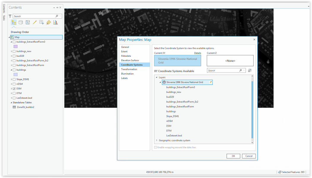
I've created completely new project and during creating LAS dataset I've set my coordinate system (EPSG 3794).
Also in map properties I've changed everything to meters, but I thing that the problem still must be with coordinate system.
Key input data in extract roof form tool:
Minimum Flat Roof Area - default 250
Minimum Slope Roof Area - default 75
Minimum Roof Height - default 8
Because all these values are in feet, I've changed them to meters according to my data.
With parameters 25/7/2,5 (in order like above) tool extracted around 60 roofs. Rest ( more than 4000) are flat
I've made an experiment and run script with values 250/75/3 (like the input data would be in feets) and the result is 400 buildings classified (3800 buildings are still flat according to analysis). It is better but still only 8% buildings were classified as gable or hip.
I have no idea where is the problem. Please help me.
- Mark as New
- Bookmark
- Subscribe
- Mute
- Subscribe to RSS Feed
- Permalink
- Report Inappropriate Content
It is odd that you would see an increase in sloped roofs classified when you increase the minimum roof plane area. This basically means that it's discarding more roof planes because they do not meet the minimum area requirement. Also, minimum areas of 250 and 75 sq meters would be quite large if your data are in meters.
It could be that the issue is due to the coordinate system of your data (changing the units in the map properties would not help in this case). For instance, if the vertical units of your elevation rasters do not match your horizontal units, that could cause such an issue. I would first go through and confirm that the source lidar's vertical and horizontal coordinate systems match those of your surface models, and that they match up with that of your building footprints.
- Mark as New
- Bookmark
- Subscribe
- Mute
- Subscribe to RSS Feed
- Permalink
- Report Inappropriate Content
hello,
Processing the 'extract roof form' tollbox ended with this problem. Does anybody have an idea, what's wrong?
thank you for helping!
regards, klemens
Startzeit: Fri Jul 07 14:00:10 2017
Skript ExtractRoofForm wird ausgeführt...
Failed script ExtractRoofForm...
Traceback (most recent call last):
File "F:\APPL\install\esri\arcgis pro\roof_form_extraction\Roof_Form_Extraction\Roof_Form_Extraction.tbx#ExtractRoofForm_RoofFormExtraction.py", line 52, in <module>
AttributeError: 'module' object has no attribute 'mp'
Fehler beim Ausführen von (ExtractRoofForm).
- Mark as New
- Bookmark
- Subscribe
- Mute
- Subscribe to RSS Feed
- Permalink
- Report Inappropriate Content
Hi Klemens,
Are you using the latest release of Pro when you get this error?
Thanks,
Dan
- Mark as New
- Bookmark
- Subscribe
- Mute
- Subscribe to RSS Feed
- Permalink
- Report Inappropriate Content
Hello Dan,
currently I am using arcgis pro 1.4, I haven't installed 2.0 yet.
klemens
- Mark as New
- Bookmark
- Subscribe
- Mute
- Subscribe to RSS Feed
- Permalink
- Report Inappropriate Content
Hello Dan,
sorry I made a mistake and used the tool with arcmap, that's why I got the error.
klemens
- Mark as New
- Bookmark
- Subscribe
- Mute
- Subscribe to RSS Feed
- Permalink
- Report Inappropriate Content
Hello guys
I’m trying to extract the roof top forms of the centre of Amsterdam. To do this I want to use the roof form extract tool of ERSI. I followed all the steps that were given by the tutorial. As input I use building data of Amsterdam. With the help of the tutorial I created a DSM, DTM, nDSM by using lidar data. After running the RoofFormExtraction tool, I constantly getting an 000072 error after an hour. See the screen dump below. 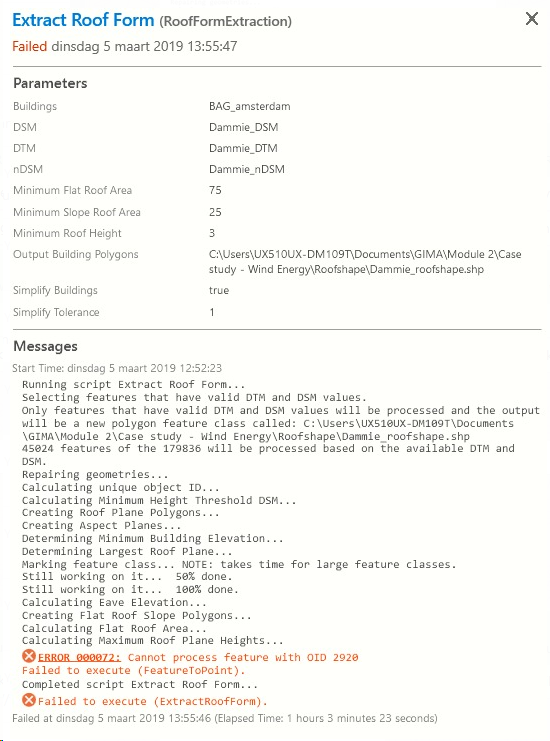
I am working with a very large dataset (including all buildings of the city of amsterdam). I dont know if this might be of influence.
Greetings rens
- Mark as New
- Bookmark
- Subscribe
- Mute
- Subscribe to RSS Feed
- Permalink
- Report Inappropriate Content
Do google search on the error: you'll find https://pro.arcgis.com/en/pro-app/tool-reference/tool-errors-and-warnings/001001-010000/tool-errors-...
Sometimes the error messages really do mean something!
- Mark as New
- Bookmark
- Subscribe
- Mute
- Subscribe to RSS Feed
- Permalink
- Report Inappropriate Content
Dear Joe,
Unfortunately I already tried this and it still came back with the same error. Moreover, the tool already incorporates the Geometry Repair tool. When running the dataset which is provided by esri the tool works fine. Thus, there is probably something with the dataset I am using like some specific polygon misallignment or something.
Best,
rens
- Mark as New
- Bookmark
- Subscribe
- Mute
- Subscribe to RSS Feed
- Permalink
- Report Inappropriate Content