- Home
- :
- All Communities
- :
- Products
- :
- ArcGIS Pro
- :
- ArcGIS Pro Questions
- :
- Exploratory Analysis Interactive Cut Fill not func...
- Subscribe to RSS Feed
- Mark Topic as New
- Mark Topic as Read
- Float this Topic for Current User
- Bookmark
- Subscribe
- Mute
- Printer Friendly Page
Exploratory Analysis Interactive Cut Fill not functioning as expected
- Mark as New
- Bookmark
- Subscribe
- Mute
- Subscribe to RSS Feed
- Permalink
I am attempting to calculate the elevation at which the cut and fill volume would be equal using the Interactive Cut and Fill tool from the Exploratory 3D Analysis tools. I'm using a 2D layer for the analysis. And while I am able to get a visual of what's being cut and filled (see attached screen shot), the calculated volume isn't populating, and the z value is about 3X higher than the elevation from the raster. The ground should be closer to 100 ft amsl but the value is showing as 300 ft. The raster that I'm using for ground has no value above 97, and I've defined the vertical projection. Is there some set-up piece I'm missing here to get the tool to do the calculation? I'm completely at a loss as to why this won't work. Based on the documentation I've read, it should. Any thoughts or guidance is appreciated!
- Mark as New
- Bookmark
- Subscribe
- Mute
- Subscribe to RSS Feed
- Permalink
from the help topic
The units of the analytical results are derived from the elevation units set for the map.
and a 3X factor suggests a feet/meters possibility. Are all your data inputs in one or the other?
... sort of retired...
- Mark as New
- Bookmark
- Subscribe
- Mute
- Subscribe to RSS Feed
- Permalink
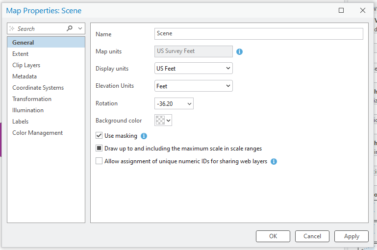
I was pretty excited about this because the one place I didn't check was in the General tab of the Scene properties. But that's all in feet, so that wasn't the issue. There are no meters anywhere here! I've set the coordinate system in the map, the raster that's used for the elevation surface and the layer to state plane feet. What's weird is that the elevation profile tool works just fine on that surface. Well, I appreciate the feedback. I've attached all my settings here in case someone can see something I'm missing.