- Home
- :
- All Communities
- :
- Products
- :
- ArcGIS Pro
- :
- ArcGIS Pro Questions
- :
- Re: Does anyone else have any issues with snapping...
- Subscribe to RSS Feed
- Mark Topic as New
- Mark Topic as Read
- Float this Topic for Current User
- Bookmark
- Subscribe
- Mute
- Printer Friendly Page
Does anyone else have any issues with snapping?
- Mark as New
- Bookmark
- Subscribe
- Mute
- Subscribe to RSS Feed
- Permalink
I've been editing the vertices of some polygon layers to snap them to a point layer. I turned on snapping, select the vertex of the polygon I want to move, click and move it towards the point and my cursor does "snap" to the point feature. The vertex does move close to the point feature, but if I zoom in closer I can see that the vertex and the point are not actually coincident. It seems I have to zoom in to a 1:1 scale to get the vertex snapped appropriately. Has anyone else experienced this issue?
- Mark as New
- Bookmark
- Subscribe
- Mute
- Subscribe to RSS Feed
- Permalink
You need to create topology and add rules to topology. Check this link http://resources.arcgis.com/en/help/main/10.2/index.html#/An_overview_of_the_Topology_toolset/001700...
An overview of topology in ArcGIS ArcGIS Help (10.2, 10.2.1, and 10.2.2)
let me know if you cannot figure it out I can make you print screen of tools and icons you need to use.
- Mark as New
- Bookmark
- Subscribe
- Mute
- Subscribe to RSS Feed
- Permalink
I believe you're thinking of the Snapping geoprocessing tool - that's not what I'm using here. I mean the actual snapping tool on the editing toolbar.
I tested this again with a brand new dataset and it seems that the snapping tool (on the editing toolbar) is a bit unpredictable. Try it yourself: Create a point file and a polygon file. Add some points to the point file, and then using snapping create a polygon file using those points as vertices. When I did this, the polygon's vertices lined up with the points perfectly. Now, select the polygon and edit its vertices. Drag one of the vertices away from the point, then back again using snapping. In some cases, the vertex will snap perfectly back to the point; in others, it will snap close to it relative to your current scale. I tried this once zoomed out to a scale of 1:1,000,000 and the vertex was offset from the point by about a half mile which is completely unacceptable.
I wasn't able to figure out why sometimes it snapped back perfectly and sometimes it only snapped close to the point. I tried having snapping only enabled on the point feature, and only Point Snapping enabled and the problem would still happen. I never had any issues with snapping in ArcMap - I can't imagine it was by design in ArcPro that snapping only gets you to the general area.
- Mark as New
- Bookmark
- Subscribe
- Mute
- Subscribe to RSS Feed
- Permalink
Brett,
Can you zip up your data and attach or message me, I'll take a look.
Thanks
- Mark as New
- Bookmark
- Subscribe
- Mute
- Subscribe to RSS Feed
- Permalink
Hi Sean,
See the attached. I was able to duplicate this issue (although not 100% of the time) creating a brand new dataset, too. When you look at the shapefiles, the polygon will already more or less match up with the points around the perimeter. Drag one of the vertices of the polygon away from a point, then back to it with snapping from a small-ish scale; then zoom in and see how close you are to the point. In my case, more often than not the vertex does not actually match up with the point.
- Mark as New
- Bookmark
- Subscribe
- Mute
- Subscribe to RSS Feed
- Permalink
Sean - were you able to duplicate my issue with my dataset?
- Mark as New
- Bookmark
- Subscribe
- Mute
- Subscribe to RSS Feed
- Permalink
Hey Brett,
Yes, I was able to reproduce the problem on your dataset and have entered a bug. I wasn't able to reproduce it on any other existing or new data with the current Pro build here so we'll wait to see what comes out of the bug report.
- Mark as New
- Bookmark
- Subscribe
- Mute
- Subscribe to RSS Feed
- Permalink
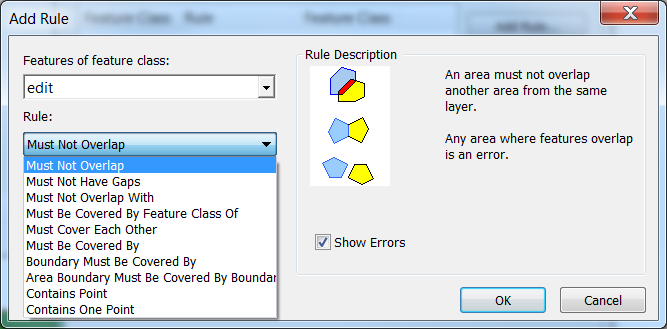
I forgot to mention, to be able to create topology rules you need to work on in geodatabase and inside that create a dataset and your data that you are editing should be under this dataset
Go to catalog and right click to your dataset that you put your editing feature classes , then go to new and press topology and on the way it will ask which feature classes will be contributing topology then when you keep going next you will be finding the page you can add rules

depending on your feature class it will give you choices for rules and you can add those
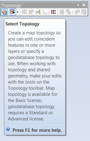
To activate topology tool. Start editing for your feature class under dataset and activate the topology tool as below

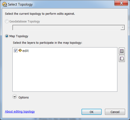
Then in topology click first icon
it will ask layers that participate in rules
- Mark as New
- Bookmark
- Subscribe
- Mute
- Subscribe to RSS Feed
- Permalink
Thanks Naime - but I want to remind you I'm using ArcGIS Pro, not ArcMap  I've never had issues with snapping in ArcMap (even without using Topology). Something's fishy in ArcGIS Pro.
- Mark as New
- Bookmark
- Subscribe
- Mute
- Subscribe to RSS Feed
- Permalink
OK Sorry for misunderstanding