- Home
- :
- All Communities
- :
- Products
- :
- ArcGIS Pro
- :
- ArcGIS Pro Questions
- :
- Create catchment area for stores
- Subscribe to RSS Feed
- Mark Topic as New
- Mark Topic as Read
- Float this Topic for Current User
- Bookmark
- Subscribe
- Mute
- Printer Friendly Page
Create catchment area for stores
- Mark as New
- Bookmark
- Subscribe
- Mute
- Subscribe to RSS Feed
- Permalink
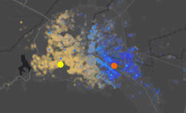
I need to create a polygon showing where my customers live (several million) for each of the locations of my stores (150)
Visually, it is very simple to see where they are:
The problem arises when I need to create a polygon in order to run some additional analysis down the road like demographics and such...
Any ideas? I tried running HotSpot Analysis, but it is very very slow even when doing it for only two stores and 100k customers as a trial...
cheerrs and thanks!
- Mark as New
- Bookmark
- Subscribe
- Mute
- Subscribe to RSS Feed
- Permalink
Have you tried this:
How To: Convert a point feature class to a polygon feature class
- Mark as New
- Bookmark
- Subscribe
- Mute
- Subscribe to RSS Feed
- Permalink
Many thanks but I think this marks the extent of the whole points:
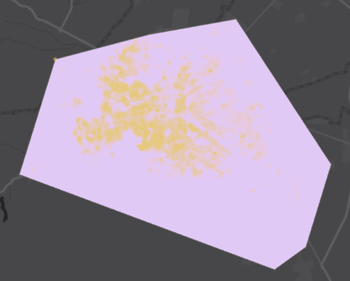
Whereas I would need something like the following (drawn by hand, apologies) where the density is greater
Rickey Fite Any ideas on how to achieve it?
- Mark as New
- Bookmark
- Subscribe
- Mute
- Subscribe to RSS Feed
- Permalink
that is approximating a convex hull and for that many points would be difficult to do.
You could approxiate the bounds in raster, by converting points to raster for each class which will effectively fill in the interveneing space without having to do buffers (which would fail). The result could then be converted back to vector.
The issue would be the appropriate selection of cell size and extent
- Mark as New
- Bookmark
- Subscribe
- Mute
- Subscribe to RSS Feed
- Permalink
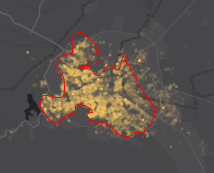
well, I thought I had replied yesterday but I did not click POST... dumb of me....
Thanks for your suggestion. I tried converting to raster and back, but the polygons were too "ugly and non-descript"

so, I kept looking around and found the toolbox AGGREGATE POINTS which seem to do the trick.

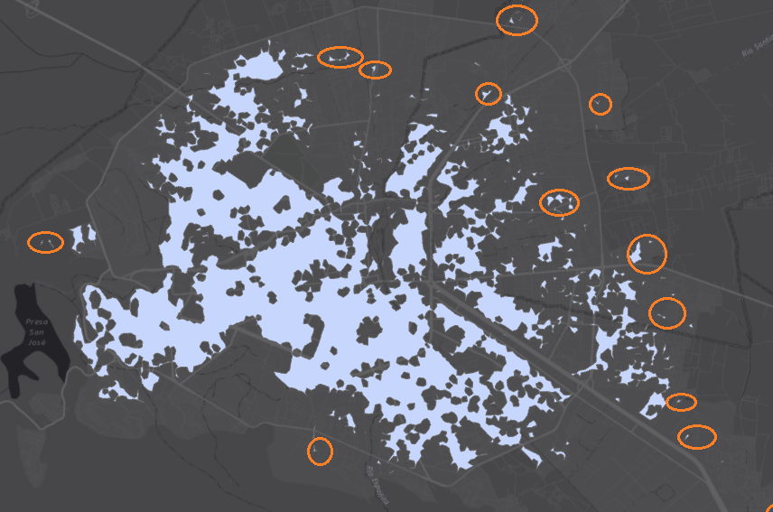
Now the question is: Is there a way to remove the small "islands"? (marked in orange circles)
- Mark as New
- Bookmark
- Subscribe
- Mute
- Subscribe to RSS Feed
- Permalink
To quote me... using an appropriate cell size and extent.... I guess you used the default cell size which is pretty crummy since it defaults to 1/250th of the extent on the long axis... you could have tried a smaller cell size.
As for removing small areas, then you can perform a Regiongroup Region Group—Help | ArcGIS for Desktop
then do a query keeping only those areas greater than a certain threshold (you can also use Con if you want to do stuff with the areas smaller, like set them to 0 or some other value or nodata. ie. what do you want to do with the fiddly bits besides remove them
PS filtering is a possibility, but it will impact the other areas, whereas the regiongroup won't. But it could be an option if you only want to produce a visual of general conditions.
- Mark as New
- Bookmark
- Subscribe
- Mute
- Subscribe to RSS Feed
- Permalink
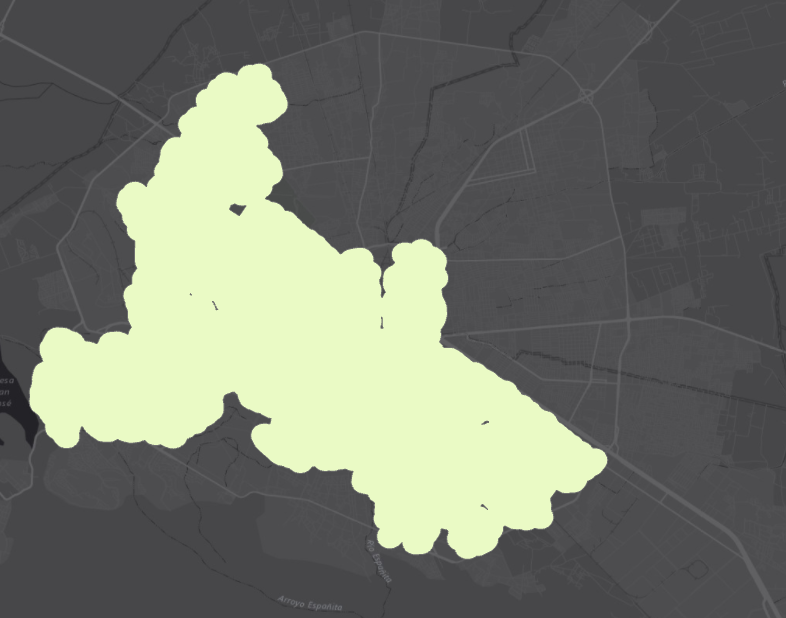
Well, many thanks!
It looks like we are getting there....
I managed to delete the "islands" and kept the larger masses.
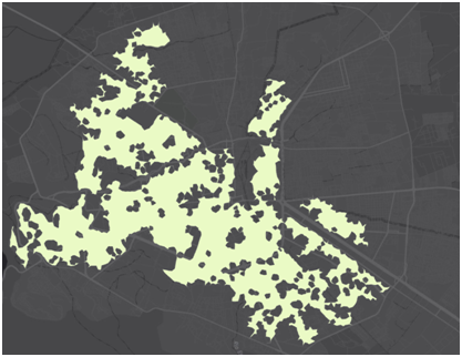
Now... how can I fill the holes? as I need a large mass?
Thanks for your kind help!
PS. I'm working with vector as I can't convert this layer to raster.
- Mark as New
- Bookmark
- Subscribe
- Mute
- Subscribe to RSS Feed
- Permalink
A quick and dirty method is a buffer outward by some amount dissolving buffers...call this buff1.
then take buff1 and buffer it inwards by the same amount...
in a perfect world and a brilliant selection of buffer size and spatial geometry, all the holes should be removed.
For fun give it a try while I ruffle through non-programming approaches to remove the interior rings
- Mark as New
- Bookmark
- Subscribe
- Mute
- Subscribe to RSS Feed
- Permalink
Sounds like a plan. Let me run it and let you know how it goes....
- Mark as New
- Bookmark
- Subscribe
- Mute
- Subscribe to RSS Feed
- Permalink
well, it's rough but it helps... I can do with it...