- Home
- :
- All Communities
- :
- Products
- :
- ArcGIS Pro
- :
- ArcGIS Pro Questions
- :
- Create catchment area for stores
- Subscribe to RSS Feed
- Mark Topic as New
- Mark Topic as Read
- Float this Topic for Current User
- Bookmark
- Subscribe
- Mute
- Printer Friendly Page
Create catchment area for stores
- Mark as New
- Bookmark
- Subscribe
- Mute
- Subscribe to RSS Feed
- Permalink
I need to create a polygon showing where my customers live (several million) for each of the locations of my stores (150)
Visually, it is very simple to see where they are:
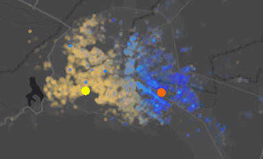
The problem arises when I need to create a polygon in order to run some additional analysis down the road like demographics and such...
Any ideas? I tried running HotSpot Analysis, but it is very very slow even when doing it for only two stores and 100k customers as a trial...
cheerrs and thanks!
- Mark as New
- Bookmark
- Subscribe
- Mute
- Subscribe to RSS Feed
- Permalink
now to step it up with a graduated fill pattern... all the cool mappers are doing it 
- Mark as New
- Bookmark
- Subscribe
- Mute
- Subscribe to RSS Feed
- Permalink
this will come quite handy for the resulting analysis. thanks!
- Mark as New
- Bookmark
- Subscribe
- Mute
- Subscribe to RSS Feed
- Permalink
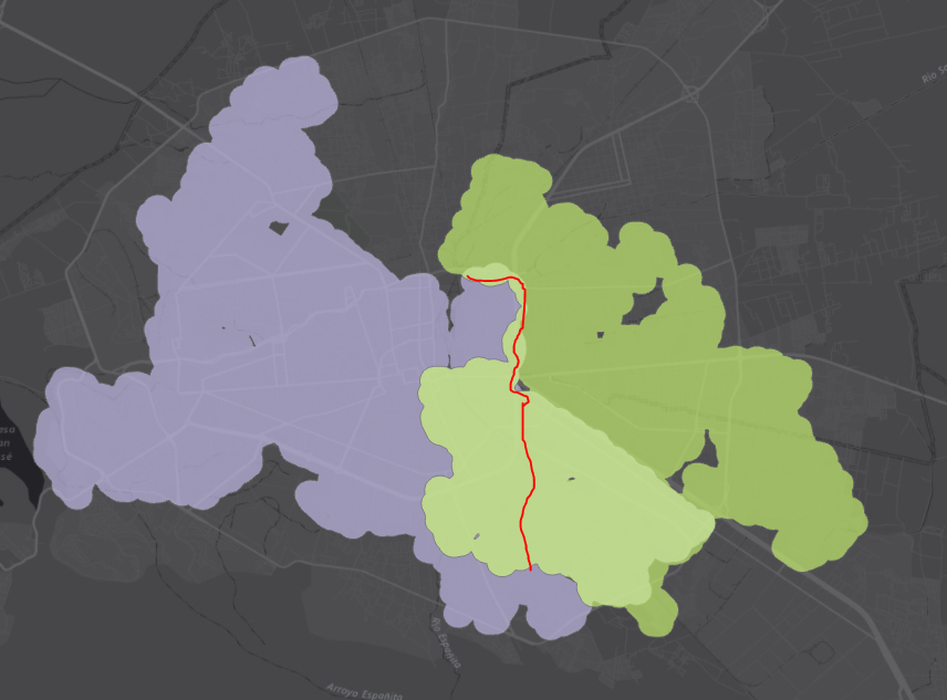
Last, but not least...
how can I remove half of the overlapping area between 2 catchment areas we defined using the abobe process?
I tried Intersection but then I end up with only one area in the midlle...
The resulting polygons should not overlap...
- Mark as New
- Bookmark
- Subscribe
- Mute
- Subscribe to RSS Feed
- Permalink
check out the other Analysis, Overlay tools... probably Union would do, or update depending on what you want but you may have to split the result and fiddle with the parts in an edit session to join parts together if needed
- Mark as New
- Bookmark
- Subscribe
- Mute
- Subscribe to RSS Feed
- Permalink
Tried that already... I need the Inverse Union, or a scissor that cuts the overlapping area in 2 so I get 2 distinct areas that do not overlap.
Something like the Create Thiessen Polygons—Help | ArcGIS for Desktop but that works only for points...
Maybe the Split—Help | ArcGIS for Desktop may work, but I don't have a Split feature. The split feature would be half of the intersection between both catchment areas...
- Mark as New
- Bookmark
- Subscribe
- Mute
- Subscribe to RSS Feed
- Permalink
a quick edit would do it since your splitting feature isn't one of the polygon boundaries, but a polyline.
- Mark as New
- Bookmark
- Subscribe
- Mute
- Subscribe to RSS Feed
- Permalink
Dirty but it dos the trick. Super help, many thanks!
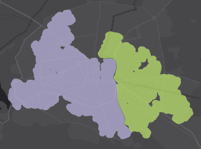
Now I need to do this for 100 locations 
- Mark as New
- Bookmark
- Subscribe
- Mute
- Subscribe to RSS Feed
- Permalink
at least you have a plan, which you could automate in modelbuilder or python, but sometimes manual is faster based on my views seeing others implementating modelbuilder workflows for anything other than the simplest operations
- Mark as New
- Bookmark
- Subscribe
- Mute
- Subscribe to RSS Feed
- Permalink
indeed.
I might try ModelBuilder to create the polygons then delete overlapping areas manually
Cheers and thanks for the pointers!
- « Previous
-
- 1
- 2
- Next »
- « Previous
-
- 1
- 2
- Next »