- Home
- :
- All Communities
- :
- Products
- :
- ArcGIS Pro
- :
- ArcGIS Pro Questions
- :
- Clip Tool (Analysis Tools) including one point fro...
- Subscribe to RSS Feed
- Mark Topic as New
- Mark Topic as Read
- Float this Topic for Current User
- Bookmark
- Subscribe
- Mute
- Printer Friendly Page
Clip Tool (Analysis Tools) including one point from outside boundary area.
- Mark as New
- Bookmark
- Subscribe
- Mute
- Subscribe to RSS Feed
- Permalink
Hello, I am wondering if anyone else has had an issue with the Clip Tool including JUST ONE point from outside their clip boundary area? (I am using ArcPro 2.6.1) I clipped some point features with a shapefile, and out of the 1,549 points that were produced, one is about 1.5 km away from the boundary edge of the shapefile I used to clip the points.
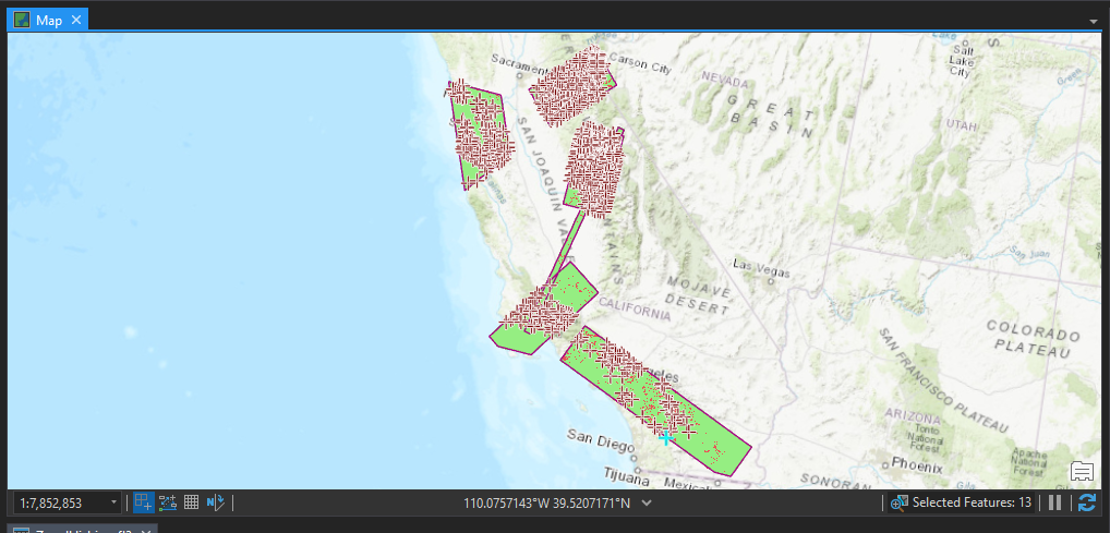
Here is a view of my shapefile and the 1,579 points I clipped:
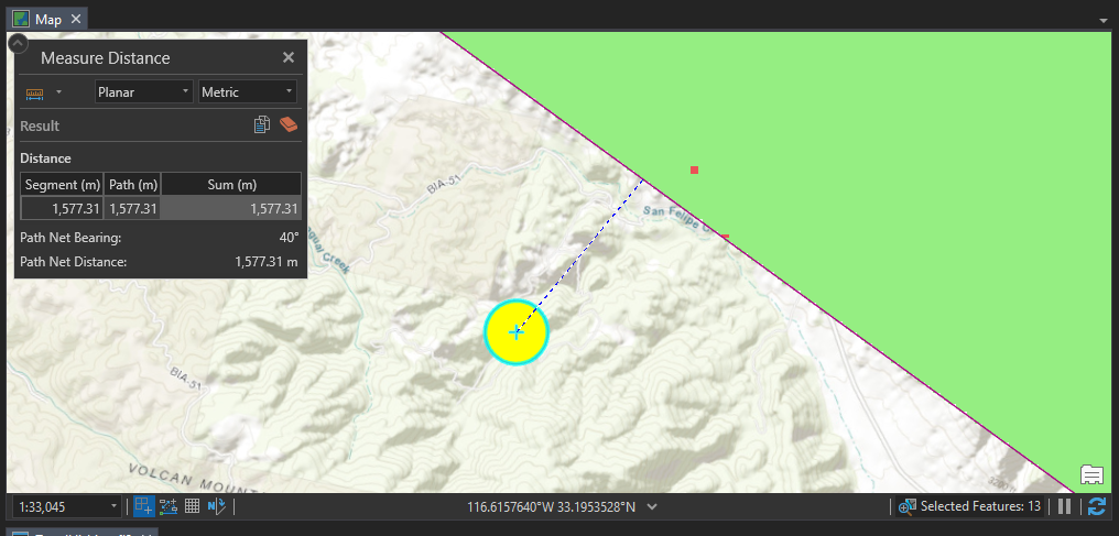
Here is a view of the ONE POINT that is outside of the clip boundary:
Appreciate any help with this.
- Mark as New
- Bookmark
- Subscribe
- Mute
- Subscribe to RSS Feed
- Permalink
Were the coordinates of your bounding rectangle(ish) used for clipping in decimal degrees or in a projected coordinate system? If the former, you might try a geodesic densification on it prior to using it for clipping.
What is the projection of your map frame?
Why do you think that point should be within the bounding rectangle?
... sort of retired...
- Mark as New
- Bookmark
- Subscribe
- Mute
- Subscribe to RSS Feed
- Permalink
The bounding rectangle(ish) and the points both have a GCS of WGS 1984. The map frame's Coordinate System is set to Albers Conical Equal Area, should I set it to WGS 1984 before I run the clip? Or do I transform the rectangles and points to Albers Equal Conical Area since my raster data set is AECA?
- Mark as New
- Bookmark
- Subscribe
- Mute
- Subscribe to RSS Feed
- Permalink
densify the geographic coordinates of the bounding rectangle using a geodesic densify and rerun to see if that point is really in the bounding areas of your selector featureclass
Geodetic Densify (Data Management)—ArcGIS Pro | Documentation
... sort of retired...
- Mark as New
- Bookmark
- Subscribe
- Mute
- Subscribe to RSS Feed
- Permalink
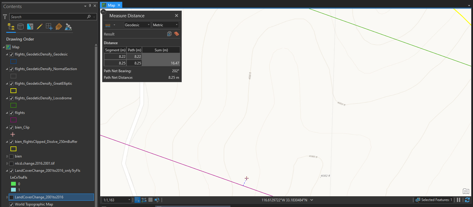
I ran the Geodetic Densify (I'm not very versed in the differences between the different Geodetic Types), but It looks like non of the Geodetic Densify results (GreatElliptic, Loxodrome, Normal Selection, Geodesic) had that point within them. Only the original bounding rectangle has that one point in it:
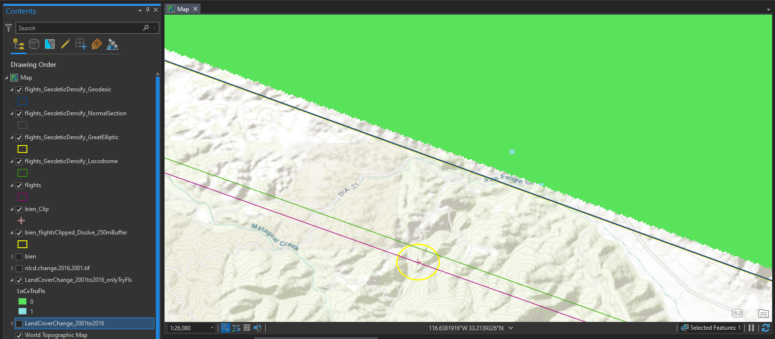
A closer view of the point in comparison to the "flights" and "flights_GeodeticDensify_Loxodrome" boundary lines, with "flights" being the outermost bounding rectangle: