- Home
- :
- All Communities
- :
- Products
- :
- ArcGIS Pro
- :
- ArcGIS Pro Questions
- :
- Clip layers not honored when printing or exporting
- Subscribe to RSS Feed
- Mark Topic as New
- Mark Topic as Read
- Float this Topic for Current User
- Bookmark
- Subscribe
- Mute
- Printer Friendly Page
Clip layers not honored when printing or exporting
- Mark as New
- Bookmark
- Subscribe
- Mute
- Subscribe to RSS Feed
- Permalink
When using clip layers to clip to the outline of a feature in ArcGIS Pro 2.4 the layout and map tabs show results as expected screen grab below. 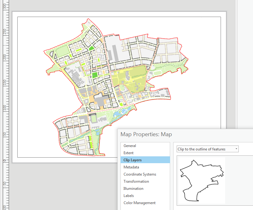
But when printing or exporting the map the clipping layer is not honored is there a setting I am missing or is this expected behavior.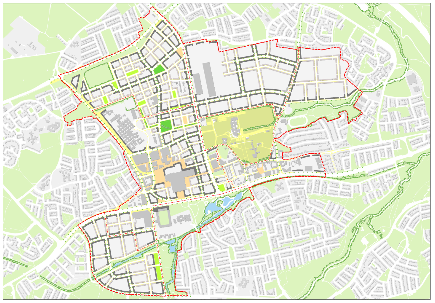
- Mark as New
- Bookmark
- Subscribe
- Mute
- Subscribe to RSS Feed
- Permalink
Hi Larry,
I'm unaware of any known issue that would result in clipped layers not drawing in the layout (as expected), but drawing in the printed map or the exported file.
There may be something specific about your map, layout rendering, export options, etc... that results in the clip being ignored. Can you contact Esri Support? They are better equipped to handle troubleshooting steps and gather bug data. They can be contacted at https://support.esri.com/en/contact-tech-support.
Thanks,
Tom
- Mark as New
- Bookmark
- Subscribe
- Mute
- Subscribe to RSS Feed
- Permalink
Tested! Clip Layers option works correctly just on the screen - not on the exported/printed maps!
- Mark as New
- Bookmark
- Subscribe
- Mute
- Subscribe to RSS Feed
- Permalink
When I export from map or layout, the clipping remains. You'll need more details that are specific to your workflow (exact steps to reproduce), which you'll need if this goes to tech support (likely outcome). In addition, what kind of video card are you running? Is that a vector tile layer that is being clipped?
- Mark as New
- Bookmark
- Subscribe
- Mute
- Subscribe to RSS Feed
- Permalink
Life is to short for ESRI tech support, my issue seems to be linked to the fact that the map was using old enterprise geo-databases (for some of the layers) which have yet to be upgraded two fixes came to mind duplicate the data out to a current file geodatabase or use donut buffers with a white fill. Went with the second option as I find that having a single source of data is always preferable when you come back to it in a couple of years
- Mark as New
- Bookmark
- Subscribe
- Mute
- Subscribe to RSS Feed
- Permalink
Larry:
Would you be able to provide more details on the old enterprise geodatabases that you felt were the cause of the problem such as GIS version installed (e.g. SDE 10.2, 10.3, etc.) and database type (e.g. SQL Server 2012, Oracle 10g, etc.)?
- Mark as New
- Bookmark
- Subscribe
- Mute
- Subscribe to RSS Feed
- Permalink
Michael,
we have both 10.0 and 10.2.2 geodatabase's sitting on SQL Server 2008 (10.0.6241.0)
- Mark as New
- Bookmark
- Subscribe
- Mute
- Subscribe to RSS Feed
- Permalink
You might be running into https://pro.arcgis.com/en/pro-app/help/data/databases/database-requirements-sqlserver.htm.
- Mark as New
- Bookmark
- Subscribe
- Mute
- Subscribe to RSS Feed
- Permalink
It would be interesting to actually get details on when this doesn't work. I just tried as well and my export to png works just fine.