- Home
- :
- All Communities
- :
- Products
- :
- ArcGIS Pro
- :
- ArcGIS Pro Questions
- :
- Bearing distance to Line Tool ignores Lat/Long
- Subscribe to RSS Feed
- Mark Topic as New
- Mark Topic as Read
- Float this Topic for Current User
- Bookmark
- Subscribe
- Mute
- Printer Friendly Page
Bearing distance to Line Tool ignores Lat/Long
- Mark as New
- Bookmark
- Subscribe
- Mute
- Subscribe to RSS Feed
- Permalink
- Report Inappropriate Content
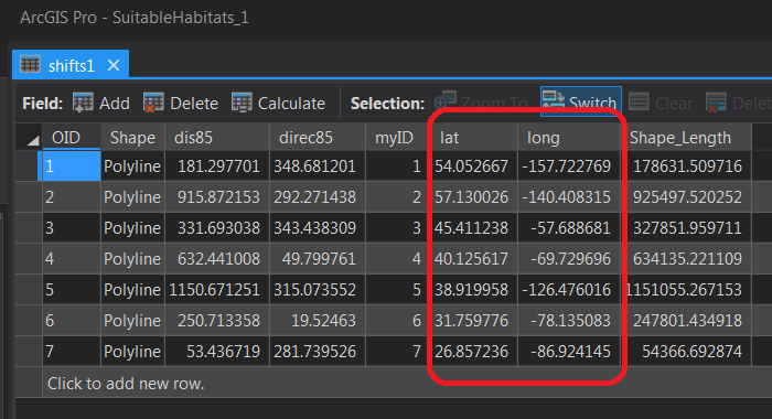
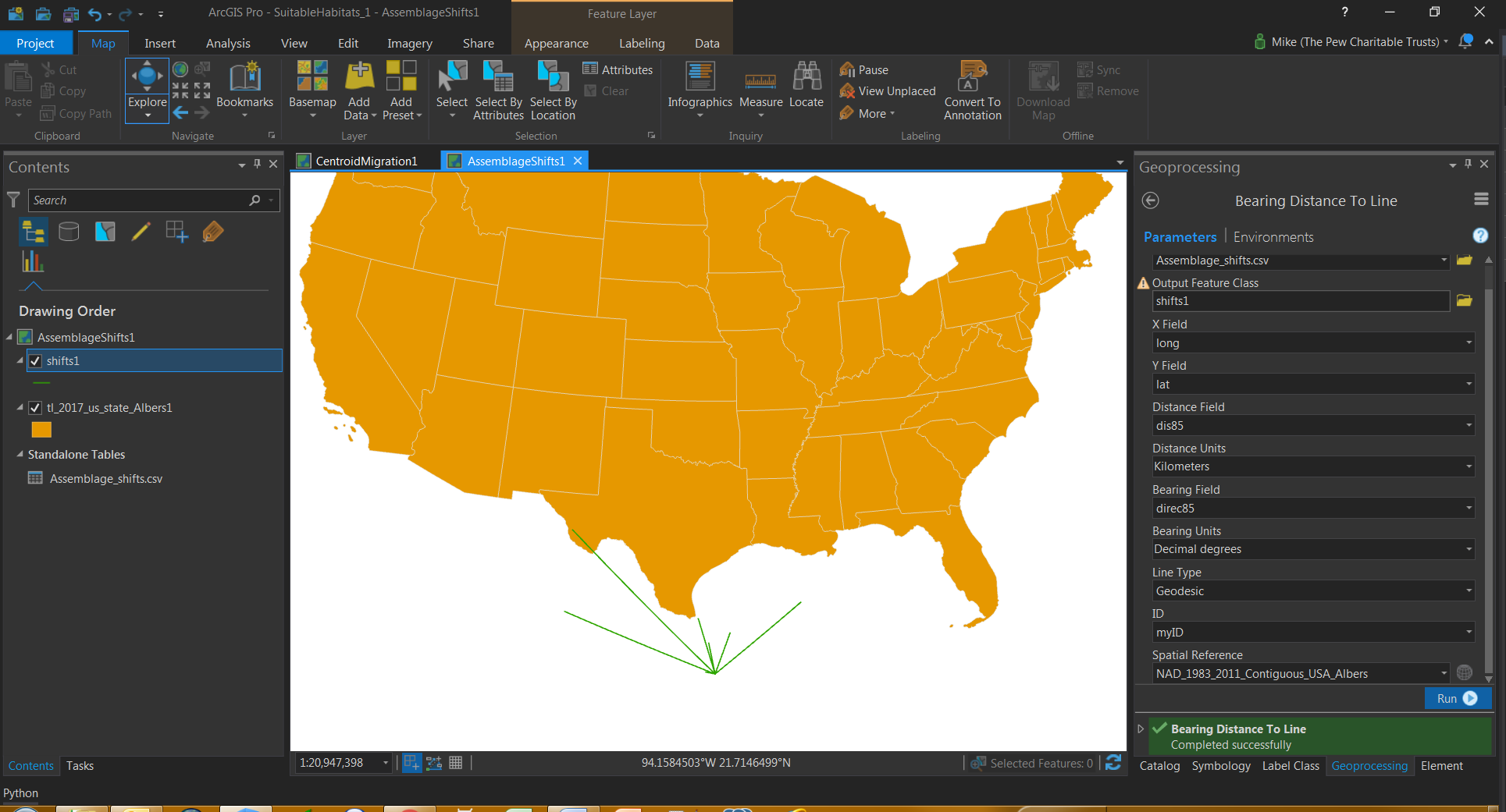
I'm using the Bearing Distance to Line tool in ArcPro 2.1 with a small dataset of 7 observations. The Lat/Long data is from 7 different points around marine areas surrounding the U.S. but despite the data showing different Lat/Long locations, the output has all lines originating from a single point. Also, the lines' origin is not even one of the Lat/Long points in the table. Anyone know what's wrong here?
- Mark as New
- Bookmark
- Subscribe
- Mute
- Subscribe to RSS Feed
- Permalink
- Report Inappropriate Content
Perhaps the *.csv file's coordinate system are unknown. I would suggest that you make a featureclass in a gdb, and try that . The angles look familiar and the distances might be scaled relative to the distance recorded in the table to those of a US albers
- Mark as New
- Bookmark
- Subscribe
- Mute
- Subscribe to RSS Feed
- Permalink
- Report Inappropriate Content
Since you are using lat/lon, try "WGS 1984" as your spatial reference instead of "NAD 1983 2011 Contiguous US Albers".