- Home
- :
- All Communities
- :
- Products
- :
- ArcGIS Pro
- :
- ArcGIS Pro Questions
- :
- ArcGISPro MultiPatch Stretching
- Subscribe to RSS Feed
- Mark Topic as New
- Mark Topic as Read
- Float this Topic for Current User
- Bookmark
- Subscribe
- Mute
- Printer Friendly Page
ArcGISPro MultiPatch Stretching
- Mark as New
- Bookmark
- Subscribe
- Mute
- Subscribe to RSS Feed
- Permalink
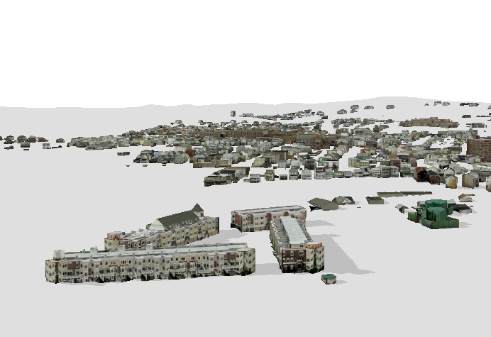
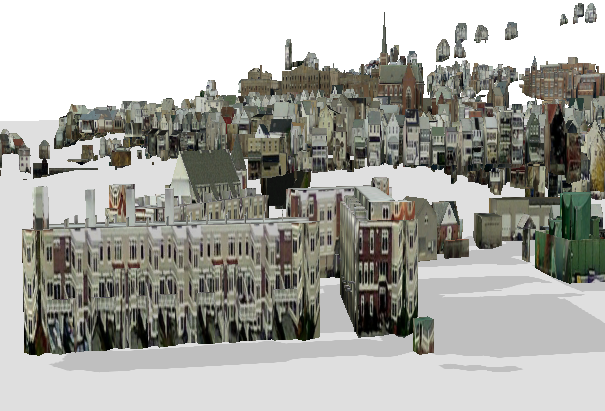
Once in a while when converting multi-patch data to a new coordinate system I get a stretched effect. I think the z height value is dropped or ignored. See below:
 >
> >
> 
original model Project tool stretched result
Anyone else encountered this? If so, do you know what caused the error? how did you fix it?
Thanks again,
-nick ![]()
- Mark as New
- Bookmark
- Subscribe
- Mute
- Subscribe to RSS Feed
- Permalink
Before reprojecting the data, were the Z values in feet or meters?
- Mark as New
- Bookmark
- Subscribe
- Mute
- Subscribe to RSS Feed
- Permalink
I think it would be in the wrong units. But when I re-project it's not changing the z value, I don't see options to change the Z scale. So I go from feet to meters in the re-project. X and Y changes not the Z I'm assuming.
Hmmm, is there a tool that converts the z values. I'm new to GIS.
Gabriel, thanks again for your response.
- Mark as New
- Bookmark
- Subscribe
- Mute
- Subscribe to RSS Feed
- Permalink
To my knowledge, ArcGIS does not project/transform Z values, which is why I asked. You can usually find a way to do it manually though. I would start with trying the Adjust 3D Z tool using the From Units and To Units parameters. Keep in mind that this tool modifies the input data (I.e., it does not produce a new copy of the data) so be sure to create a backup copy of your data before running the tool. Here is the help doc: Adjust 3D Z—Data Management toolbox | ArcGIS for Desktop
- Mark as New
- Bookmark
- Subscribe
- Mute
- Subscribe to RSS Feed
- Permalink
Wow thanks a lot Gabriel . I'll give it a shot and see what result I get.
-nick
- Mark as New
- Bookmark
- Subscribe
- Mute
- Subscribe to RSS Feed
- Permalink
I have never had need for it so .... please .... try this on a copy of your file ...
https://pro.arcgis.com/en/pro-app/tool-reference/data-management/adjust-3d-z.htm
- Mark as New
- Bookmark
- Subscribe
- Mute
- Subscribe to RSS Feed
- Permalink
Thanks Dan, will do.