- Home
- :
- All Communities
- :
- Products
- :
- ArcGIS Pro
- :
- ArcGIS Pro Questions
- :
- Re: ArcGIS standard deviation classification
- Subscribe to RSS Feed
- Mark Topic as New
- Mark Topic as Read
- Float this Topic for Current User
- Bookmark
- Subscribe
- Mute
- Printer Friendly Page
ArcGIS standard deviation classification
- Mark as New
- Bookmark
- Subscribe
- Mute
- Subscribe to RSS Feed
- Permalink
I want to use standard deviation classification method for my map in ArcGIS, but the default class are -0.5 st dev - +0.5 st dev; 0.5 st dev-1.5 st dev; etc. I wonder if there's a way to use 0-1 st dev, 1-2 st dev, etc. Thanks.
- Mark as New
- Bookmark
- Subscribe
- Mute
- Subscribe to RSS Feed
- Permalink
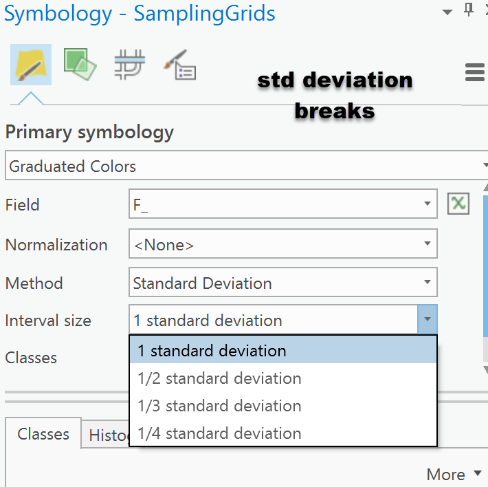
yes

Then modify your breaks from there once you get the range values, should you want to consolidate those below the mean
- Mark as New
- Bookmark
- Subscribe
- Mute
- Subscribe to RSS Feed
- Permalink
Hi Dan,
Thanks for the answer. I know how to choose the interval size. My question was how to set the cut off values to be from 0-1 st dev instead of -0.5-0.5 st dev, see the resulted default classes from standard deviation classification method on Classifying numerical fields for graduated symbology—Help | ArcGIS for Desktop . I know i could calculate the mean first and set the limits manually. I wonder if there's an option in ArcGIS to do it more easily. Thanks.
- Mark as New
- Bookmark
- Subscribe
- Mute
- Subscribe to RSS Feed
- Permalink
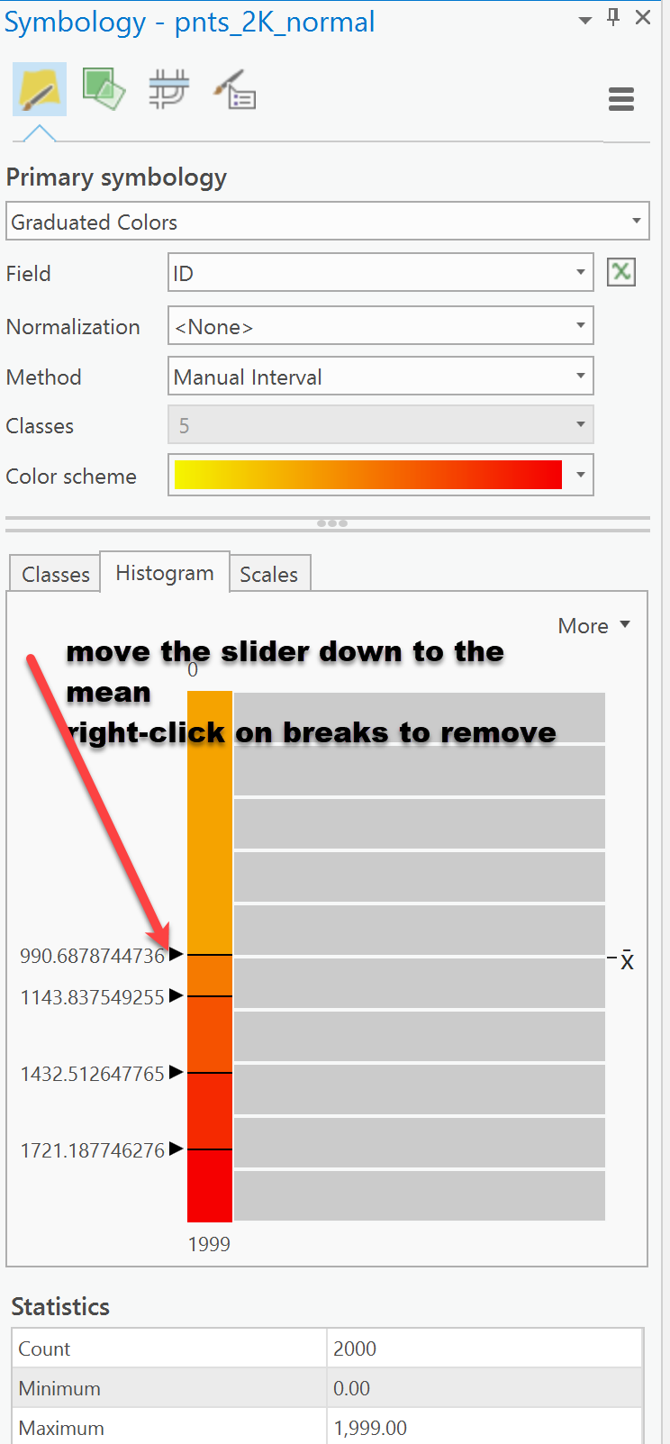
Don't see one, I switch to manual after (jot down the breaks, just in case, most people don't want to calculate the mean or std dev first)
- Mark as New
- Bookmark
- Subscribe
- Mute
- Subscribe to RSS Feed
- Permalink
like so... took about 30 seconds to move the slider to the mean, then right-click and remove the negative breaks
