- Home
- :
- All Communities
- :
- Products
- :
- ArcGIS Pro
- :
- ArcGIS Pro Questions
- :
- ArcGIS Pro crashes after running Project Raster to...
- Subscribe to RSS Feed
- Mark Topic as New
- Mark Topic as Read
- Float this Topic for Current User
- Bookmark
- Subscribe
- Mute
- Printer Friendly Page
ArcGIS Pro crashes after running Project Raster tool
- Mark as New
- Bookmark
- Subscribe
- Mute
- Subscribe to RSS Feed
- Permalink
This may be a bug but I don't know. I have a simple raster image in jp2 format. I attempt to run the Project Raster tool. Here is a screenshot of my parameters:
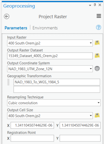
I am choosing the coordinate system and a geographic transformation, and putting the output raster in .jp2 format as well. In "environments" I am not building pyramids.
When I run the tool, it runs for about 5 seconds and gives me an error:
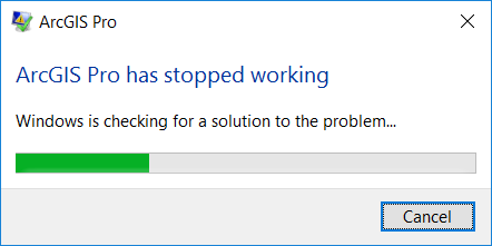
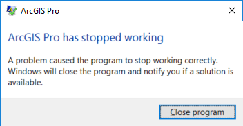
I have no error report and not sure what is happening. Could this be a bug? I have tried this numerous times and yes, I have restarted my computer!  I am running ArcGIS Pro 2.0.1.
Is there a way to find a bug report and send to esri?
Solved! Go to Solution.
Accepted Solutions
- Mark as New
- Bookmark
- Subscribe
- Mute
- Subscribe to RSS Feed
- Permalink
The output cell sizes are really, really small for projected data. What happens if you make them more appropriate?
- Mark as New
- Bookmark
- Subscribe
- Mute
- Subscribe to RSS Feed
- Permalink
...Well, I have a workaround that works for my purposes. If I use the "Mosaic to New Raster" tool, I can get the outcome I need.
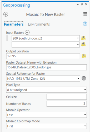
But I still would like to know why I keep getting a crash with Project Raster...
- Mark as New
- Bookmark
- Subscribe
- Mute
- Subscribe to RSS Feed
- Permalink
The output cell sizes are really, really small for projected data. What happens if you make them more appropriate?
- Mark as New
- Bookmark
- Subscribe
- Mute
- Subscribe to RSS Feed
- Permalink
Melita,
I was wondering about that. The cell size did seem extremely small. I am wondering why that is.
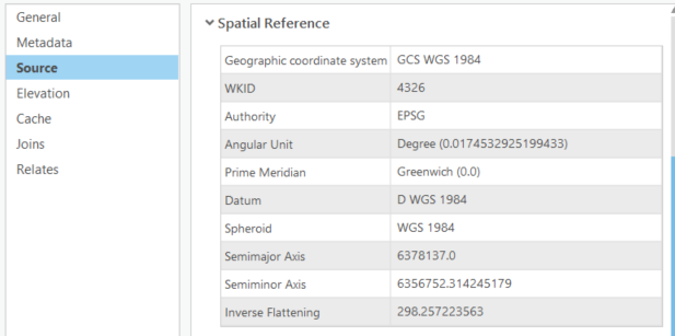
Here is some info:
original file is a jp2 image natively in WGS84 and sits at around 12.3 MB in my folder:
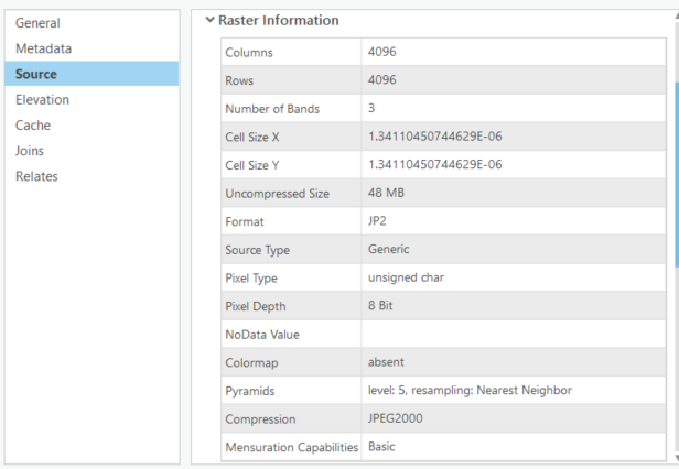
and
Looking at this data, the cell size IS really small but I am wondering if that is represented in decimal degrees and not what my map is in (which is meters). If I change the cell size to this:
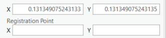
which is what the cell size is in meters (for my map's system of NAD83 UTM Zone 12N)
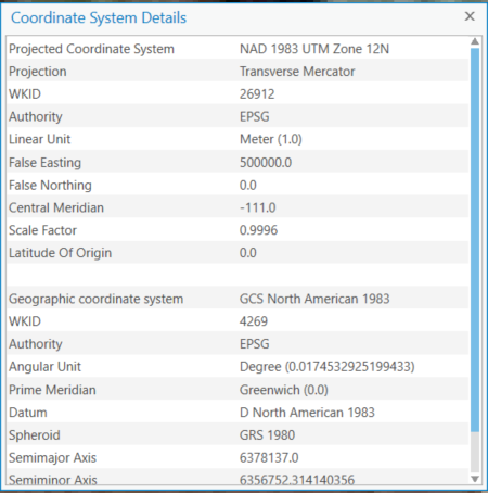
Then, it runs just fine and produces the file as expected. The new file is around 25.9 MB in my folder - same jp2 extension.
Out of curiosity, I tried to run the same process with the original default values in a WGS84 map with degrees as the map units (and the super small cell size). It crashed on me again. I wish there were an error message at least!
Thanks for pointing out the cell size issue!
- Mark as New
- Bookmark
- Subscribe
- Mute
- Subscribe to RSS Feed
- Permalink
That's correct about the input data. The cell size is always in the same units as the coordinate system, so they're in degrees.
- Mark as New
- Bookmark
- Subscribe
- Mute
- Subscribe to RSS Feed
- Permalink
Strange... your output cell size is based on your input cell size which is in decimal degrees. As Melita points out... you need to make a conscious decision as to the planar cell size that you want