- Home
- :
- All Communities
- :
- Products
- :
- ArcGIS Pro
- :
- ArcGIS Pro Questions
- :
- Arcgis Pro backsight angle
- Subscribe to RSS Feed
- Mark Topic as New
- Mark Topic as Read
- Float this Topic for Current User
- Bookmark
- Subscribe
- Mute
- Printer Friendly Page
Arcgis Pro backsight angle
- Mark as New
- Bookmark
- Subscribe
- Mute
- Subscribe to RSS Feed
- Permalink
Is it possible to draw a line segment by entering a backsight angle as with the angle-distance COGO course in ArcMap?
I need to draw a line with the second segment at a backsight angle to the first segment-ie. a straight line would be 180 degrees. This is easy using COGO tools in ArcMap, but I can't find any similar option in Pro...
see: About creating a line with the Traverse window—Help | Documentation Angle-Distance Course.
- Mark as New
- Bookmark
- Subscribe
- Mute
- Subscribe to RSS Feed
- Permalink
Maybe somebody in the ArcGIS Parcel Fabric space can answer...
- Mark as New
- Bookmark
- Subscribe
- Mute
- Subscribe to RSS Feed
- Permalink
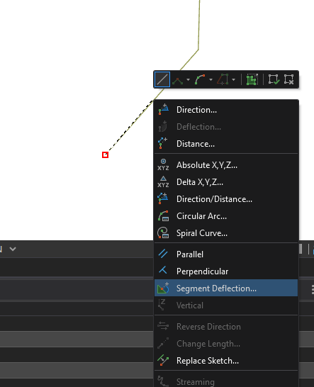
While I do wish there were a more direct way of entering these sorts of angles, this is possible using the Segment Deflection tool, found in the context menu during a sketch operation. Because a traverse creates individual two-point line features, the standard Deflection tool is unavailable.
When you reach a call in your legal which has a backsight angle, simply right-click the previous line.
The following dialog will prompt you for the value of the deflection. Positive values for clockwise deflection, negative for counter-clockwise. Once entered, your sketch will now be constrained to the entered deflection value. Note that this can be used for a deflection "looking back" or "looking forward", so make sure you have your cursor in the appropriate direction before continuing. For this reason, always define the deflection prior to the distance, to ensure that your segment is created as intended.
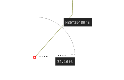 +45 degree deflection from the previous call.
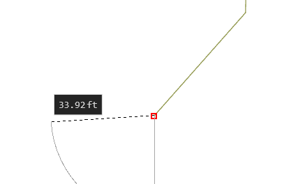
+45 degree deflection from the prolongation of the previous call.
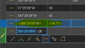
Once your deflection is defined, right-click and select distance, or press D on your keyboard to enter the distance of the call. Once the direction and distance are both constrained, the feature will be automatically created. As with all manually digitized calls in the Traverse tool, this new feature will have generated dimensions, meaning that the COGO values will not be stored in the feature attributes, if applicable. See the Create a Traverse Pro documentation for more on that.
Hopefully this helps you deal with those pesky backsight angles.
Kendall County GIS
- Mark as New
- Bookmark
- Subscribe
- Mute
- Subscribe to RSS Feed
- Permalink
Thanks Josh, very helpful!