- Home
- :
- All Communities
- :
- Products
- :
- ArcGIS Pro
- :
- ArcGIS Pro Questions
- :
- Re: ArcGIS Pro: 3D cartesian coordinate system
- Subscribe to RSS Feed
- Mark Topic as New
- Mark Topic as Read
- Float this Topic for Current User
- Bookmark
- Subscribe
- Mute
- Printer Friendly Page
ArcGIS Pro: 3D cartesian coordinate system
- Mark as New
- Bookmark
- Subscribe
- Mute
- Subscribe to RSS Feed
- Permalink
Hello Geodesists,
I am receiving data from custom 3D cartesian coordinate system I would like to define in ArcGIS Pro.
I computed the seven parameters to a 3D national system and there are equations to go from 3D cartesian to geographic that I believe ArcGIS Pro knows ?
It seems like I can define seven parameters method tranformation in ArcMap:
Equation-based methods—ArcMap | Documentation
But I can't find a way to define a coordinate system as 3D cartesian.
Did I miss anything ?
Thanks
- Mark as New
- Bookmark
- Subscribe
- Mute
- Subscribe to RSS Feed
- Permalink
Haven't tried it yet but
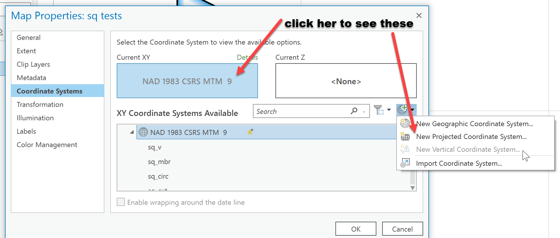
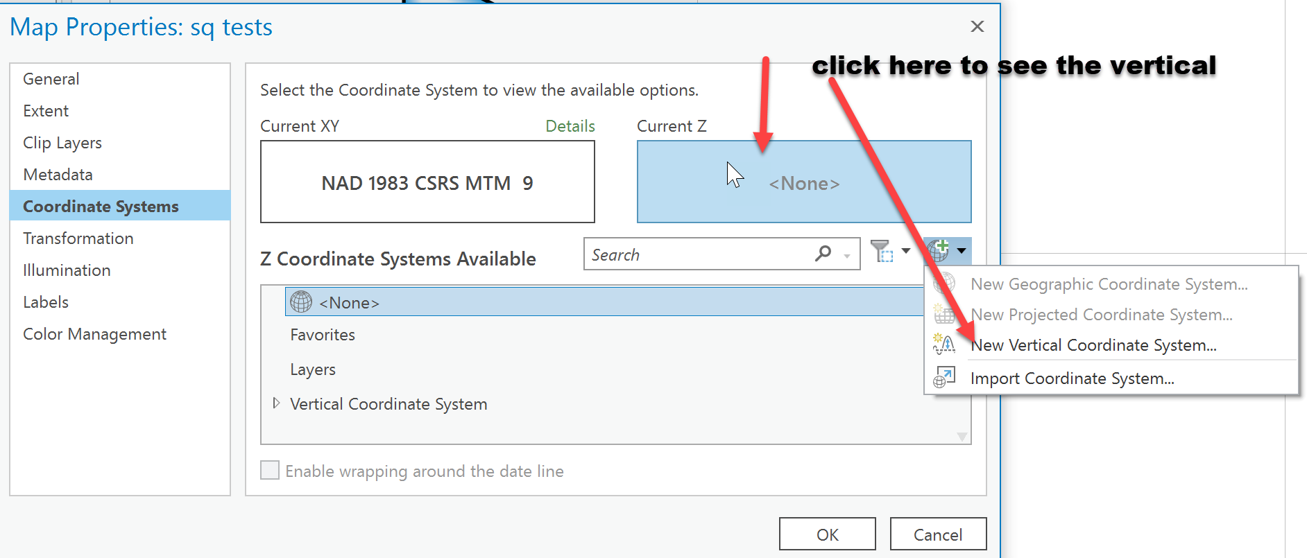
Specify a coordinate system—ArcGIS Pro | Documentation
shows how to define your own horizonal and vertical coordinate systems...
... sort of retired...
- Mark as New
- Bookmark
- Subscribe
- Mute
- Subscribe to RSS Feed
- Permalink
Thanks for your reply.
That is not exactly what I am looking for. I am looking for X, Y, Z 3D coordinate (without ellipsoid definition).
Then you can directly compute lat, lon, and H when an ellipsoid is defined and easily work with well-known geodesic datum.
Maybe Melita Kennedy will have an idea ?
- Mark as New
- Bookmark
- Subscribe
- Mute
- Subscribe to RSS Feed
- Permalink
We don't support 3D Cartesian in ArcGIS yet. It is in the Esri projection engine, but not exposed in the software using the library. I'm sorry!
Melita
- Mark as New
- Bookmark
- Subscribe
- Mute
- Subscribe to RSS Feed
- Permalink
Thanks for your reply.
I am not sure to understand: can it be somehow extended using Esri projection engine ?
Thanks !
- Mark as New
- Bookmark
- Subscribe
- Mute
- Subscribe to RSS Feed
- Permalink
Hello @MelitaKennedy,
Just wanted to tell that it is disappointing that it is not available in the softwares as it would be really helpful to manipulate CAD and BIM data using generally a random 3D coordinate system.
Is it something planned or not at all ?
Thank