- Home
- :
- All Communities
- :
- Products
- :
- ArcGIS Pro
- :
- ArcGIS Pro Questions
- :
- ArcGIS Pro 2.5: What does the “angular unit” repre...
- Subscribe to RSS Feed
- Mark Topic as New
- Mark Topic as Read
- Float this Topic for Current User
- Bookmark
- Subscribe
- Mute
- Printer Friendly Page
ArcGIS Pro 2.5: What does the “angular unit” represent in the geographic coordinate system?
- Mark as New
- Bookmark
- Subscribe
- Mute
- Subscribe to RSS Feed
- Permalink
ArcGIS Pro 2.5: What does the “angular unit” represent in the geographic coordinate system?
I couldn’t figure out what does the “angular unit” represent in the Geographic coordinate system

Jamal Numan
Geomolg Geoportal for Spatial Information
Ramallah, West Bank, Palestine
- Mark as New
- Bookmark
- Subscribe
- Mute
- Subscribe to RSS Feed
- Permalink
in general, angular units can be in degrees (or its variants like DMS), radians, grads or gons .
It is a property of a GCS and important in raster projection amongst other things.
Unit options—ArcGIS Pro | Documentation
Direction units for editing—ArcGIS Pro | Documentation
How the Cell Size Projection Method environment setting works—Geoprocessing | Documentation
... sort of retired...
- Mark as New
- Bookmark
- Subscribe
- Mute
- Subscribe to RSS Feed
- Permalink
Right, but it’s not clear what does it represent.
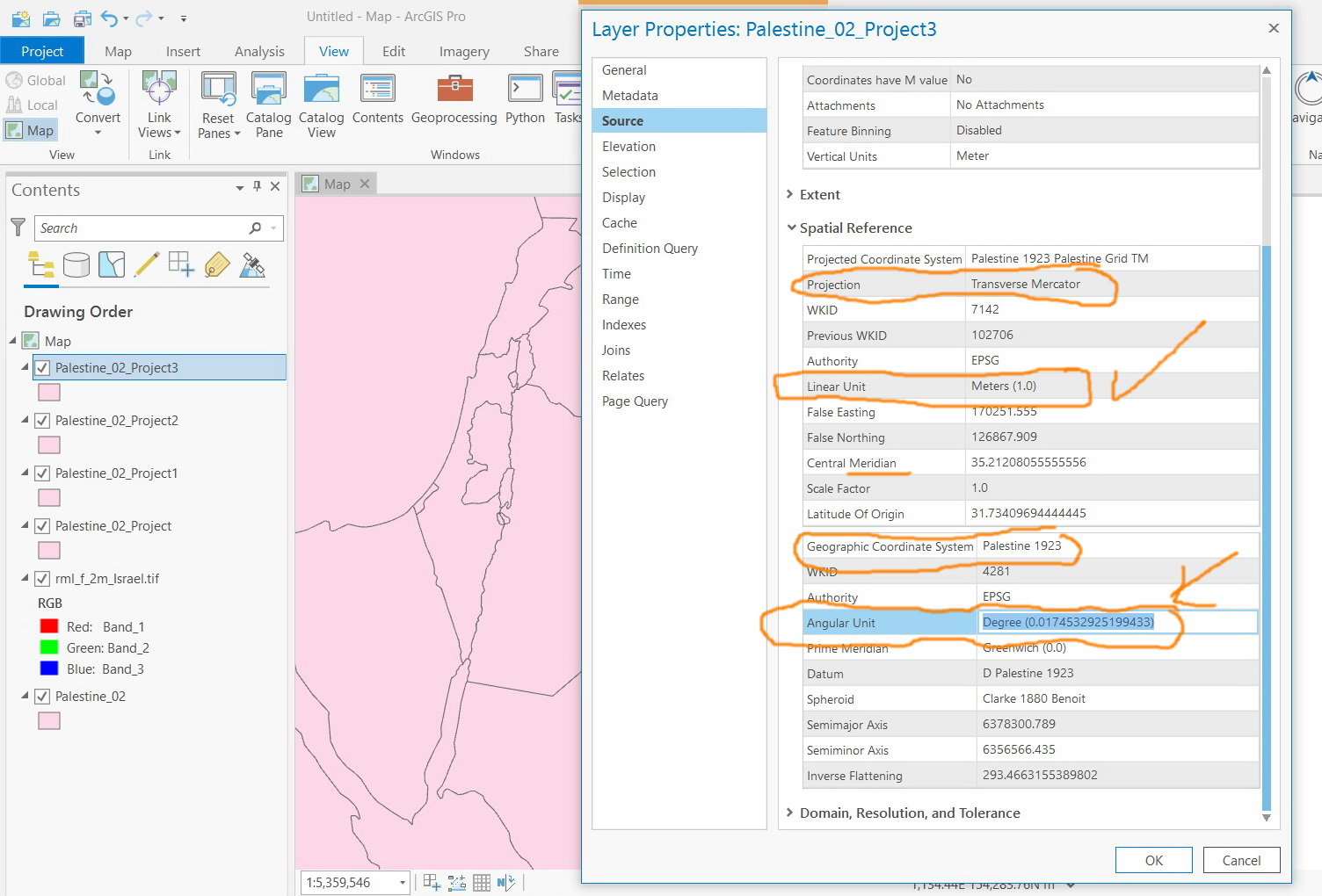
For example, for the “Clarke 1880 Benoit” spheroid and “D Palestine 1923” Datum, the angular unit is 0.0174532925199433.
What does this value represent? What does it indicate for in terms of geometry?
Jamal Numan
Geomolg Geoportal for Spatial Information
Ramallah, West Bank, Palestine
- Mark as New
- Bookmark
- Subscribe
- Mute
- Subscribe to RSS Feed
- Permalink
Geographic coordinate systems require an angular unit, but the value of the angular unit is really about geometry and not geography. Since radians are the international unit for measuring angles, a geographic coordinate system that wants to use degrees or some other angular unit of measure must provide a conversion factor. Since there are 2*pi radians in 360 degrees, 1 degree equals 0.0174532925199432.... radians.
- Mark as New
- Bookmark
- Subscribe
- Mute
- Subscribe to RSS Feed
- Permalink
Many thanks guys for the help.
It could be less confusing if the word radian follows the number
Angular Unit = Degree (0.0174532925199433 Radians)
I could see that the linear unit conforms with same logic
Linear unit: meter (1.0)
Jamal Numan
Geomolg Geoportal for Spatial Information
Ramallah, West Bank, Palestine
- Mark as New
- Bookmark
- Subscribe
- Mute
- Subscribe to RSS Feed
- Permalink
I think it also shows the ground/real measurement of the location. Hence the angular unit indicates the geometry of the area